
Nîmes-le-Vieux
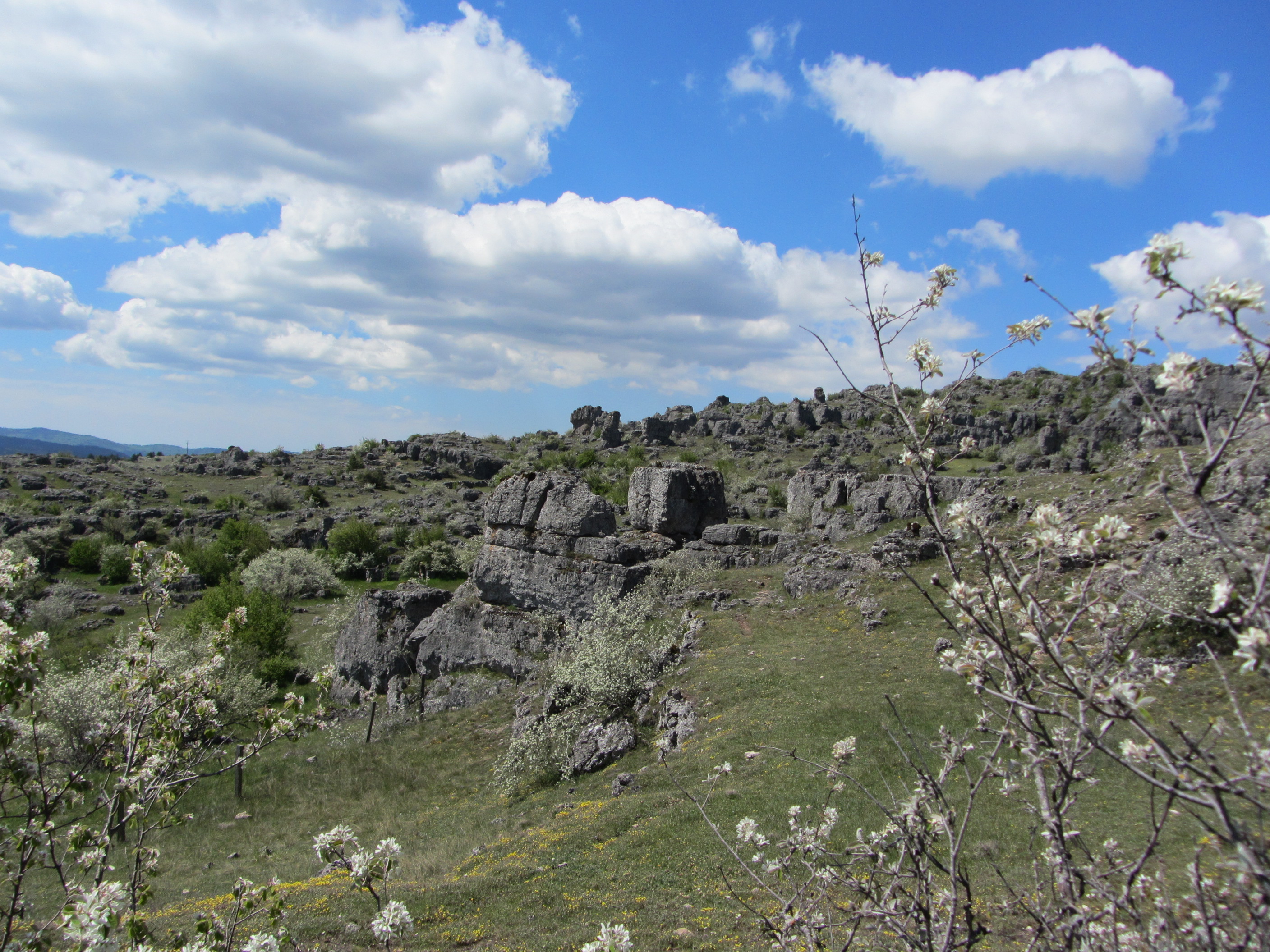
The Nîmes-le-Vieux Trail showcases a variety of typical Causse Méjean landscapes: stony arid hillocks; a few hollows of deep soil overlaid with winding plough lines; steep promontories looming rampart-like; and vast stretches of craggy rocks, whose shapes fire your imagination and captivate you.
8 points of interest
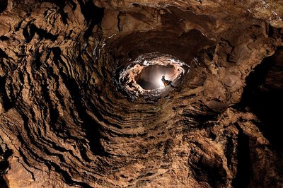
Aven de la Barelle - © Philippe Crochet  Landscape
Nîmes-le-Vieux: a trail to the very core of dolomite rock
The block field of Nîmes-le-Vieux was given its name in 1908 by its “discoverer” Paul Arnal, the Protestant pastor of Vébron. In 1910, the journal Causses and Cévennes published an article about the site by the famous geographer E.A. Martel: “Unlike Montpellier-le-Vieux, it is not a collection of enclosed spaces 100 m deep and grouped around a central rocky range, but a cliff front, a projection of the Causse Méjean surface that presents a long stretch of semi-circles all bristling with hundreds of carved, sculpted Dolomite rocks full of holes…”
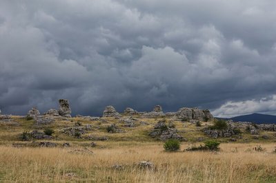
Causse Méjean - © Caroline Devevey  Geology
Haut plateau ouvert au soleil : le causse
Un causse est un plateau calcaire caractérisé par son relief plat ou légèrement vallonné, souvent entaillé par des gorges et sans rivière à la surface. Le causse Méjean est l’un des plus grands plateaux calcaires de la région !
Au toucher, la roche paraît rugueuse. C’est de la dolomie, une roche sédimentaire cousine du calcaire, faite de carbonate de calcium et de magnésium. Ces composants se sont formés par un climat très chaud au fond d’une mer aujourd’hui disparue.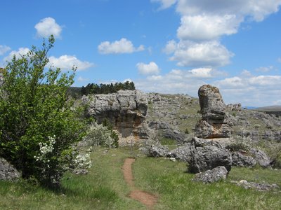
Nîmes-le-Vieux - © Eddie Balaye GeologyImps of shrubs and rocks
Le paysage karstique se caractérise par des formations géologiques remarquables produites par l’érosion de l’eau, telles que les grottes et les gouffres. En s’infiltrant, l’eau dissout le calcaire, ou la dolomie, creusant un vaste réseau souterrain avec des galeries qui peuvent s’étendre sur des kilomètres.
Ce phénomène, qui prend ici la forme de rochers fantomatiques, est désigné sous le nom de « karst sous couverture ». Ce processus a débuté il y a 100 millions d’années, avant même que les gorges du Tarn, du Tarnon et de la Jonte ne se creusent.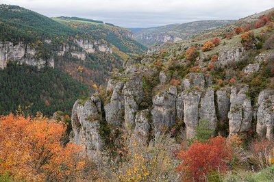
Bordure du causse Méjean - © Caroline Devevey GeologyA drop, time and an abyss
L’eau façonne le karst et donc le paysage du causse. Son écoulement souterrain est invisible, pourtant en surface des indices trahissent son action en profondeur. Avec le Tarn et la Jonte, le Tarnon est l’une des rivières qui ceinturent le causse Méjean. D’ici, on ne voit pas l’eau du Tarnon car il se trouve plus bas dans la vallée. On peut néanmoins apprécier son œuvre : une profonde entaille dans le plateau calcaire. Cette incision a eu pour effet de faire descendre toujours plus bas le niveau de l’eau du sous-sol. Une pente plus forte qui a accéléré l’érosion par l’eau.
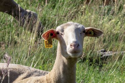
Brebis sur le causse - © Yannick Manche AgricultureLe Causse nourricier
Les grandes taches de verdure à la surface du causse sont des dolines. L’érosion par infiltration d’eau de pluie crée une dépression en forme de cuvette. Comme dans un entonnoir, le sol descend vers le fond de la cuvette qui se remplit d’argiles stockant l’eau.
Les territoires qui vous entourent, bien que naturels, ne sont pas tout à fait sauvages. Depuis des milliers d’années, les humains façonnent les causses en pratiquant l’agropastoralisme, une association entre le pâturage sur de grands espaces et l’agriculture, qui produit le fourrage et les céréales.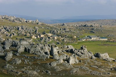
Le Veygalier - © Bruno Descaves 
A l’abri au milieu du chaos
Niché à l’abri du vent parmi le lapiaz, le hameau du Veygalier. Les habitations traditionnelles du causse sont très bien adaptées à un environnement où le bois est rare. L’architecture repose sur l’utilisation de la pierre calcaire, abondante et facile à façonner. Avec l’absence de bois d’œuvre, la charpente est remplacée par la voûte.
Autrefois, seule la pluie répondait aux besoins des humains et des animaux. Aujourd’hui, les fermes caussenardes reçoivent l’eau potable du réseau. Mais face à la diminution de la ressource en eau, les collectivités impulsent la construction de citernes de récupération au pied des bâtiments agricoles pour l’abreuvement des troupeaux.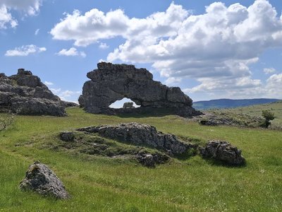
Nîmes-le-Vieux - © Natacha Maltaverne GeologyUne arche
Le relief ruiniforme résulte de la dissolution de la roche, laissant en place les parties les plus résistantes et leur donnant les formes les plus variées. Les parties actuellement en creux ont subi la dissolution la plus intense créant par endroits de véritables arches, des voûtes, et parfois de petites gorges.
Etude hydrogéologique - © Philippe Crochet  Water
WaterLa maison mystérieuse
Pour faire face aux besoins en eau de qualité et gérer durablement la ressource, des études ont été menées de 2017 à 2020 dans un partenariat entre le Parc national, le BRGM (Bureau de recherches géologiques et minières) et les spéléologues. Elles ont permis de suivre le cheminement des eaux souterraines sous le causse Méjean, de mieux connaître la structure du karst, ainsi que le débit et la qualité des eaux souterraines.
Pour suivre le trajet de l’eau à travers le karst, l’expérience consiste à injecter un traceur coloré et de voir par où il ressortira. Le produit est inoffensif pour la santé et pour le milieu naturel.
Description
From the car park, walk about 150 m through the hamlet, then turn left after the agricultural buildings.
- Departure : L'Hom ou Le Veygalier
- Arrival : L'Hom ou Le Veygalier
- Towns crossed : Fraissinet-de-Fourques and Vebron
Forecast
Altimetric profile
Recommandations
Horse-riding or mountain-biking are not allowed on or adapted to discovery trails.
Information desks

Tourism'house and national Parc at Florac
Place de l'ancienne gare, N106, 48400 Florac-trois-rivières
This office is part of the National Park's associated tourist-information network, whose mission is to provide information on, and raise awareness of, the sites and events as well as the rules that must be observed in the National Park's central zone.
On site: exhibitions, video projections, events and shop Open year-round
Access and parking
Col du Perjuret, on the D 996 from Florac or Meyrueis, or on the D 18 from Mont Aigoual. At the Col du Perjuret, head towards L'Hom, where the walk starts.
It is not possible to start this walk from Galy.
Parking :
Calculateur d'itinéraire Lio
Utilisez le calculateur liO pour organiser votre trajet en région Occitanie.
Autres régions
Calculez votre itinéraire en Auvergne Rhône Alpes sur Oùra
Source

Report a problem or an error
If you have found an error on this page or if you have noticed any problems during your hike, please report them to us here: