
The Hérault waterfalls - short
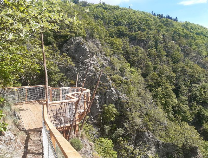
From the dividing line between the Atlantic and the Mediterranean (Serreyrède pass), this path winds through the forest on the steep southern slopes of Mont Aigoual. Dotted with varied texts on fauna, flora and forest management, referred to in the leaflet, it makes its way to a spectacular viewpoint over the Hérault waterfalls.
3 points of interest
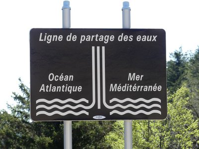
Ligne de partage des eaux - nathalie.thomas  Geology
The watershed
The current relief creates a frontier between the Atlantic and the Mediterranean: depending on the slope, water runs towards either the Ocean or the Sea. This is due to the uplift of the Cevenol sill, brought about by geological activity along the Cévennes fault, which borders draw the northern limit of the Languedoc region. This natural sill marks the geographical border between the northwest slope – verdant, not too steep – and the southeast slope, which falls away abruptly in the Languedoc and continues to be subject to powerful erosion.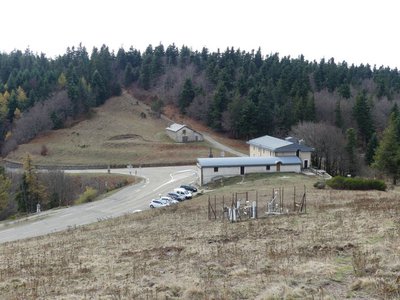
La Serreyrède - nathalie.thomas  Water
WaterClimate frontier
The pass is also a climate frontier. The Atlantic side is predominantly exposed to the west wind and receives rainfall that is fairly regularly spread over the year. The Mediterranean side, however, is drier and hotter and constitutes a massive barrier to the occasional southeast wind (the marin), thus forcing its humid air to rise suddenly. This makes the clouds’ water content condense, which can give rise to so-called Cevenol episodes: heavy rainfall (600 mm in 24 hrs) causing catastrophic floods. The Aigoual, Mount Aigualis the rainy (A. Bernard), is well-named! After Savoie, it is the rainiest place in France.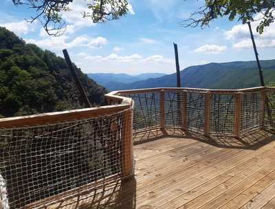
© R. Descamps WaterTwo waterfalls... Find the Hérault!
Faced with these two threads of rivers, geographers hesitated between flow rate and length, and finally designated the waterway below you the Hérault while the waterfall opposite you was named the Dauphine. Two remarkable plants can be seen here: orpine (Hylotelephium telephium) with its succulent leaves, a food source for the larvae of a butterfly that is in strong decline all over the Massif central: the Apollo (which may be seen from mid-July to mid-August); and Prost saxifrage, which forms regular cushions that are easy to recognise. They enable it better to store what little water is available. It is a plant endemic to the Cévennes.
Description
Une variante, plus longue, est possible depuis la station de Prat Peyrot.
- Departure : Maison de l'Aigoual
- Arrival : Maison de l'Aigoual
- Towns crossed : Val-d'Aigoual
Forecast
Altimetric profile
Recommandations
Narrow and craggy path – firm shoes are essential.
Do not leave the path as this environment is unstable and very delicate. Horse-riding or mountain-biking are not allowed on or adapted to discovery trails.
Information desks

Tourism & national parc'house
Col de la Serreyrède, 30570 Val d'Aigoual
The Maison de l'Aigoual houses the tourism office Mont Aigoual Causses Cévennes and the Maison du Parc national. This visitor centre provides information on and raises awareness of the Cévennes National Park, its sites and events as well as the rules that must be observed in the National Park's central zone.
On site: changing exhibitions, video projections, Festival Nature events and shop Open year-round
Transport
LiO is the regional public transport service of the Occitanie/ Pyrénées – Méditerranée region. It facilitates everyone’s movements by prioritising public transport. For more information, go to www.lio.laregion.fr
Access and parking
Col de la Serreyrède, on the D 986 Camprieu - Valleraugue or on the D 48 from Le Vigan.
Parking :
Calculateur d'itinéraire Lio
Utilisez le calculateur liO pour organiser votre trajet en région Occitanie.
Autres régions
Calculez votre itinéraire en Auvergne Rhône Alpes sur Oùra
Biodiversité autour de l'itinéraire
Source


Report a problem or an error
If you have found an error on this page or if you have noticed any problems during your hike, please report them to us here:
