
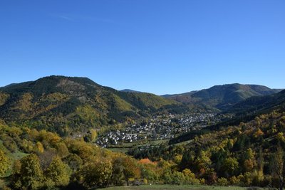
The Tour du Lempezou (by mountain-bike)
6 points of interest
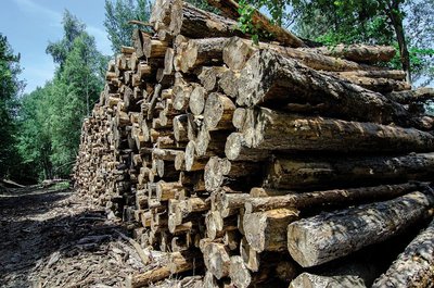
coupe de bois - © Olivier Prohin  Know-how
Fages Sawmill
Upstream from Bédouès, you will see a sawmill, which mainly produces wood to make crates and pallets. It also produces some timber. Today, local forestry companies utilise wood in a number of ways: for energy, paper pulp, timber, crate-making and construction.
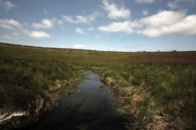
Source du Tarn - © Yannick Manche  Water
WaterThe river Tarn
The Tarn has its spring at an altitude of 1,550 m under the ridge of Mont Lozère. Having carved its way into the granite bedrock, it separates the Bougès massif from Mont Lozère. After Bédouès, it meets the river Tarnon and slowly enters the limestone region, in which its bed is increasingly deep. At its confluence with the Jonte, at Le Rozier, the Tarn leaves the department of the Lozère.
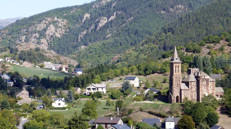
Vue sur le Lempezou et Florac - © CC Florac Sud Lozère  Landscape
Summit of Mont Lempézou
Mont Lempézou is the mountain overlooking Florac and the Tarnon valley. From the Col (pass) of the same name, you can take a path to the summit. Panoramic views over the three valleys (Tarn, Tarnon, Mimente) will give you a better idea of the local hydrography.
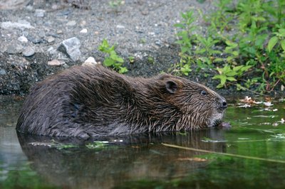
Castor au réfectoire - © Bruno Descaves  Fauna
FaunaThe European beaver (Castor fiber)
The calm deep stretches of the Tarn are good areas to settle for the European beaver, which lives in a lodge dug into the river bank. An essentially vegetarian animal, it bases its diet on cellulose. It eats young shoots, bark, aquatic plants, and foliage that is abundant in the riparian forest. It is thus useful in regulating the woody vegetation of river banks, facilitating the development of riverside fauna and flora. Through its activities, it prevents the potentially dangerous accumulation of dead wood during floods. It does not build dams.
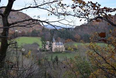
Château d'Arigès - © com com Florac Sud Lozère  History
Château d’Arigès
This can be seen on your left, in a gap in the forest. It was only a share-cropping farm, whose buildings were in ruins, when the Lord of Issenges bought it in 1658. He lived in it from 1688. This Château, which is no doubt more comfortable than the « maison carrée » (“square house”), was built in a river bend of the Tarn and is surrounded by fertile soils well-suited for crop-growing.
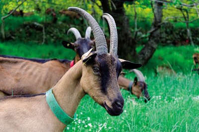
Chèvre de race alpine - © Olivier Prohin AgricultureThe Gautier goat farm
Yolande and Christian run a small farm where they make farmhouse goat's cheese, a typically Cévenol product. Their herd consists of 60 Alpine dairy goats, and all their milk is processed on-site into farmhouse cheese. From late November to late April, the nanny goats have a break so their little ones can feed!
Description
Mountain-bike route # 10. Exit right from the car park onto the D 998. After a few metres, turn right towards La Baume. Immediately after the bridge turn right and cycle along the Tarn to the campsite and the D 998. Turn right onto the bridge, then take the first left, which is a smooth track that runs alongside the Tarn before going uphill to the Col de Perpau. Just after this pass – the route's highest point (971 m) – begin the descent towards Bédouès. After the Col du Lempézou, take the single-track path leading to the D 998. Turn left onto the road, then turn right onto the bridge over the Tarn, just after the campsite. Go past the holiday village (village de vacances), then take the track on the right bank of the Tarn to return to Bédouès (N.B.: bikes are travelling in both directions on this section).
- Departure : Bédouès
- Arrival : Bédouès
- Towns crossed : Bédouès-Cocurès and Florac Trois Rivières
Forecast
Altimetric profile
Recommandations
No cycling off-track. You are strongly advised to wear a helmet. Do not forget your repair kit and a small set of tools. Please shut all gates and barriers after yourself. Slow down in farms and hamlets.
Transport
Bus line 258 “Florac – Sainte-Enimie – Le Rozier”, every day in July and August
Bus line 261 “Florac – Le Pont de Montvert – Mont Lozère”, every day in July and August
https://lio.laregion.fr/
Access and parking
From Florac, take the D 998 towards Le Pont-de-Montvert
Parking :
Calculateur d'itinéraire Lio
Utilisez le calculateur liO pour organiser votre trajet en région Occitanie.
Autres régions
Calculez votre itinéraire en Auvergne Rhône Alpes sur Oùra
Biodiversité autour de l'itinéraire
Source


Report a problem or an error
If you have found an error on this page or if you have noticed any problems during your hike, please report them to us here: