
Roc Troué
4 points of interest
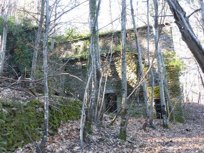
Les ruines du Flaquier - © Nathalie Thomas  Architecture
Le Flaquier
(Private property) You enter the ruins via a staircase chiselled into the rock. All the buildings - sheepfold, bread oven, clède (building for drying chestnuts) – are built on the bare rock. Long ago, a spring above them was tapped and fixed for the hamlet's needs. The large water retention basin carved into the rock has since dried out. (B. Mathieu)
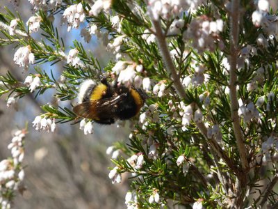
Bruyère arborescente (Erica arboréa) - © Nathalie Thomas  Flora
FloraMaquis
This is a scrubland of tree heaths, evergreen (mock) privets, sage-leaved rock roses and strawberry trees, between which frolic two-tailed pashas. This butterfly can be identified by its tan and brown colour, its underside which is ocellated black and white, and by the two tails it has at the bottom of its wings. It can only be found where there are strawberry trees, and for a good reason: they are the only plants that host its eggs, nourish its larvae and provide twigs for its chrysalis to hang from. The pasha likes to feed on ripe fruit as well as fermented and even alcoholic matter! It is also known as the foxy emperor. (B. Mathieu)
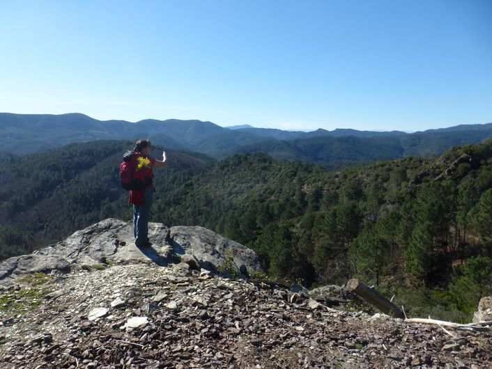
Le roc troué - © Nathalie Thomas  History
Roc Troué
The repeated passage of flocks of sheep over the millennia – first wild, then domesticated – has dragged a path to this summit. Under the impetus of the monks of Cendras, humans enlarged the path by hand to make it easier to use by convoys of saddled mules and by sheep. In 1689, the King's Intendant in Languedoc, Monsieur de Basville, implemented a royal order to organise the road network in the Cevennes in such a way that canons could be pulled along it and enable troops to hunt down Protestant rebels more easily. […] The dry-stone retaining walls and especially the giant breach cut into the rock that gives it its name – Roc Troué or Notched Rock – showcase the colossal efforts of our ancestors. The track is now in such a bad state that it is hard to imagine it was ever suitable for carts! (B. Mathieu)
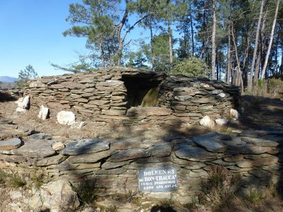
Dolmen du Roc troué - © Nathalie Thomas  Archaeology
The Roc Troué dolmen
Complexes of dolmens were built 4,000 years ago; the ones that collapsed were re-used up to the 6th century BC to deposit the ashes of the deceased and a few last offerings [dolmens furent bâtis il y a 4 000 ans puis effondrés et re-employés DONC, on les a effondres expres avant de les re-utiliser? Un peu bizarre comme formulation/idee ? Revoir la V.O.)]. Some seem to have been more elaborate, such as this one: a round base supports a dolmen built like a small house with a rock table for a “roof”. In fact, it is not certain that, in the Cevennes, prehistoric tombs were covered in this way. Archaeological excavations have uncovered pottery shards, bronze bracelets, hewn flints, a few cremation deposits or, in some cases, nothing at all! (B. Mathieu)
Description
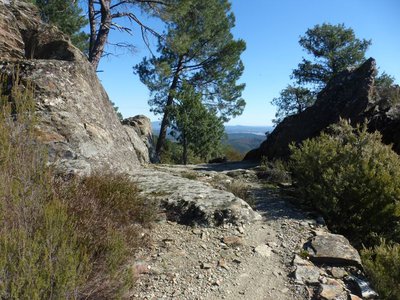
From the car park, go downhill on the road. A few metres after the first bend, turn left and go downhill on a path to reach the road to Peyraube. At the reservoir, go downhill on the road and take the track on the left before entering Peyraube. Continue on this track and pass in front of Les Pièces. Before Les Combes, at the sign for Le Flaquier, take the path on the left towards Les Cabassettes. Go uphill into the chestnut grove, walk in front of Le Flaquier to the second ruin and continue on the path to join up with a track. Turn left onto this track to reach the D 632 road. Turn left onto the road and continue to its crossroads with the D 32. Turn right onto the D 32 for 400 m, then take the path on the left to climb to the Col des Cabassettes pass. At the pass, take the path on the left that leads you through the Roc Troué (notched rock), past the dolmen of the same name and to the D 32. Take the lane towards Peyraube to return to the car park.
- Departure : Peyraube Tombs site
- Arrival : Peyraube Tombs site
- Towns crossed : Soustelle, Lamelouze, and Les Salles-du-Gardon
Forecast
Altimetric profile
Recommandations
Make sure your equipment is appropriate for the day's weather conditions. Remember that the weather changes quickly in the mountains. Take enough water, wear solid shoes and put on a hat. Please close all gates and barriers after yourself.
Information desks

Tourism office Cévennes Tourism, La Grand-Combe
Maison du mineur, rue Victor Fumat, 30110 La Grand-Combe
This office is part of the National Park's associated tourist-information network, whose mission is to provide information on, and raise awareness of, the sites and events as well as the rules that must be observed in the National Park's central zone.
Open year-round
Access and parking
From La Grand-Combe to Les Salles du Gardon, then take the D 283 to La Croix des Vents, Le Sollier and towards Peyraube. Park before the hamlet of Peyraube, in the car park for the Peyraube Tombs.
Parking :
Calculateur d'itinéraire Lio
Utilisez le calculateur liO pour organiser votre trajet en région Occitanie.
Autres régions
Calculez votre itinéraire en Auvergne Rhône Alpes sur Oùra
Source


Report a problem or an error
If you have found an error on this page or if you have noticed any problems during your hike, please report them to us here: