
The Aigoual forest
Rousses Yellow waymarks
The Aigoual forest
Medium
4h30
11,7km
+497m
-498m
Loop
Embed this item to access it offline
From Cabrillac, you take the grande draille d'Aubrac (Aubrac drovers’ road) to Le Plo de la Couaille, where you have the option (an additional 2 hrs, on the GR60) to reach the summit of Mont Aigoual and enjoy the stunning views (on a clear day). This hike with its crooked trees is full of charm. On the way, you may surprise a fox or a wild sow with its young. The forest, though planted, seems wild!
3 points of interest
Draille de Cabrillac - nathalie.thomas AgricultureThe Aubrac drovers’ road
From Cabrillac, we follow the Aubrac drovers’ road, which started near Ganges (Hérault) to lead flocks onto the Aubrac pastures, a distance of 110 km. If you climb to the top of Mont Aigoual (2 hrs), you can visit the meteorological observatory and meet transhumant flocks. Be careful of the patous (livestock guardians).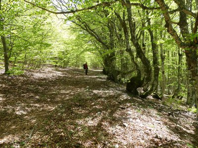
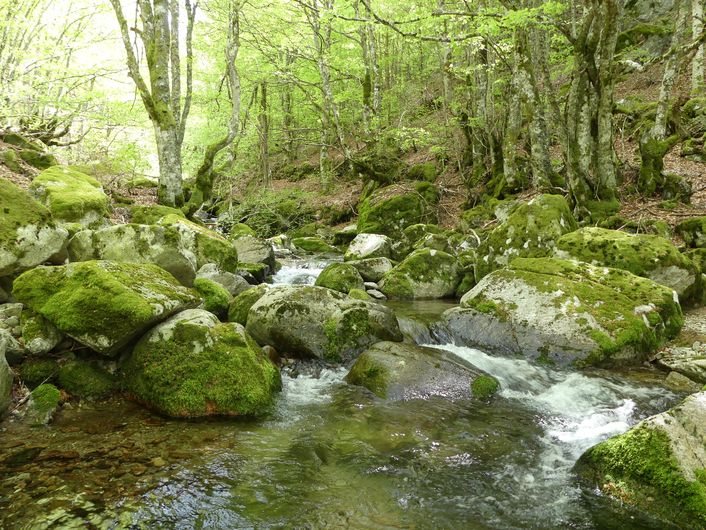
Forêt au Plo du Four - nathalie.thomas  Natural environment
A planted forest
From the 19th century onwards, people became conscious of the fact that the forest was receding due to the combined impact of exploitation for industrial firewood (glass, metals) and overgrazing linked to increasing sheep and goat farming. Departmental forestry engineer Georges Fabre claimed that the gully erosion due to deforestation was the cause of the silting-up of the port of Bordeaux. Afforestation was needed. By 1908, 10,000 hectares had been reforested.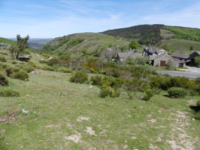
Cabrillac - nathalie.thomas  History
Cabrillac
Cabrillac was located at the crossroads of the grande draille d'Aubrac (Aubrac drovers’ road) and the road from Meyrueis to Florac and St Jean du Gard. The village had about a hundred inhabitants in the 20th century and was an important and inevitable place of transit. Two fairs were held every year: one during the migration to the summer pastures in May; the other in September, during the return. For some shepherds, this was the occasion to sell the lambs that had spent the summer on the Aubrac plateau.
Description
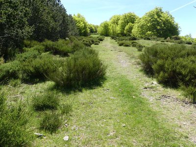
As you leave Cabrillac, in the direction of Mont Aigoual (GR®60), cross the D18, go through a fence and begin the climb amidst broom and juniper bushes.
1 – Near the top of the hill, the path widens and enters the beech forest until it reaches first the crest, then the level area of Le Plo du Four.
2 – From Le Plo du Four, the path starts to climb again; it follows the D18. At first it remains under cover of the trees, before emerging onto the short-grass prairie. Well before the ladder near the road, fork right onto the path (by a pile of stones)that leads towards the road.
3 – Cross the road and take the path, which turns into a track and crosses a heath. Having gone through an open fence, the track enters a beech forest and weaves through the trees. At first, it follows a fence, then runs along the ridge that separates the Brèze valley to the west from the Jonte valley to the east.
4 – At the first fork, at Le Plo de l’Homme-mort, leave the ridge on a track to the right that skirts it. After 500m, at the crossroads, turn right alongside an reforested area. After a slight climb, the track goes sharply downhill. Ignore the paths on the right that enter it. Where you cross the path from les Oubrets, turn right. After 250 m, you come out onto a large forestry track at le Col del Bès pass.
5 – From the pass, go right and descend towards the Jonte River, ignoring a track on the right. Cross the river and climb back up to Cabrillac (GR®66).
- Departure : Cabrillac
- Arrival : Cabrillac
- Towns crossed : Rousses, Gatuzières, Bassurels, and Meyrueis
Forecast
Altimetric profile
Recommandations
Make sure your equipment is appropriate for the day’s weather conditions. Remember that the weather changes quickly in the mountains. Take enough water, wear sturdy shoes and put on a hat. Please close all gates and barriers behind you.
Is in the midst of the park
The national park is an unrestricted natural area but subjected to regulations which must be known by all visitors.
Information desks

Tourism'house and national Parc at Florac
Place de l'ancienne gare, N106, 48400 Florac-trois-rivières
This office is part of the National Park's associated tourist-information network, whose mission is to provide information on, and raise awareness of, the sites and events as well as the rules that must be observed in the National Park's central zone.
On site: exhibitions, video projections, events and shop Open year-round
Access and parking
From Meyrueis on the D996 to Col de Perjuret, then the D18 (direction Mont Aigoual) to Cabrillac
Parking :
At the southern end of Cabrillac
Calculateur d'itinéraire Lio
Utilisez le calculateur liO pour organiser votre trajet en région Occitanie.
Autres régions
Calculez votre itinéraire en Auvergne Rhône Alpes sur Oùra
Biodiversité autour de l'itinéraire
Source

Agence d'Attractivité Touristique Gorges Causses Cévenneshttp://www.cevennes-gorges-du-tarn.com

Parc national des Cévenneshttp://www.cevennes-parcnational.fr/
Report a problem or an error
If you have found an error on this page or if you have noticed any problems during your hike, please report them to us here: