
The ramparts of Dieusse
3 points of interest
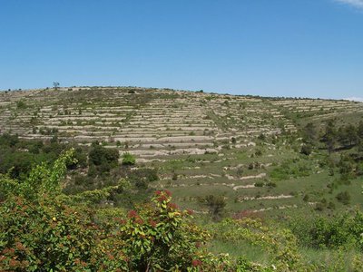
Les terrasses - © O.Pagès AgricultureThe terraces of Saint-Brès
The terraces used to be planted with grapevines, but the vines did not survive an invasion in 1880 by the phylloxera bug, which had arrived in France at the same time as new American grape varieties. The only way to rebuild the vineyards was to graft local varieties onto American ones, which were the only resistant ones. That is how the Clinton, Jaquez and Isabelle varieties appeared, which were all three originally from the US. Vinification of these was later forbidden by law in favour of varieties with a lower ethyl and especially methyl alcohol content. Many farmers were so discouraged that they abandoned grapevines altogether.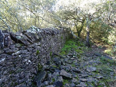
Les remparts - © JF. Raulet  History
The King’s Roads
King’s Roads have a prestigious name, but they were built in fear and pain. By order of King Louis XIV dated 29 December 1689, they had to be improved or created “so as to allow troops to march in and disperse [Protestant] assemblies and keep the wayward population at heel”. A network of 24 King’s Roads and a great number of side roads, including this one, was therefore built to establish a grid over the region. For 10 years, the inhabitants of the Cévennes were forced under duress to construct these side roads. The ten wealthiest families of each parish had to provide the funds, and the less well-off inhabitants were made to provide the labour. Those who refused were sent to the galleys!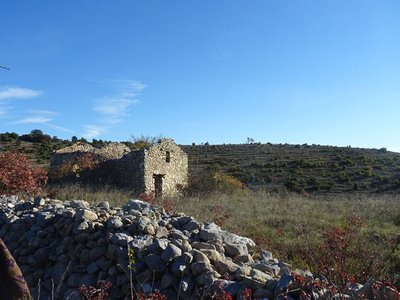
Le Mazet - © JF.Raulet AgricultureA mazet (typical one-room southern house)
This rustic little house with its single room was of unexpected social importance. The mazet appeared in the mid-19th century and corresponded to the city labourer’s deeply felt attachment to his ancestors’ land, where he would come to work in the vineyards and olive groves or to cut wood. He might keep a few rabbits at the mazet, or some fowl, and store some firewood or his tools there. The mazet was his great family project, his dream, his return to the original land, and the means of forgetting his lowly labourer’s circumstances. These buildings multiplied in the 1930s. After the war, many were extended and made more comfortable so as to become a place of rest and relaxation as a family or among friends.
Description
Starting from "SAINT-BRÈS", head towards "VILLAGE" and then "DIEUSSE", via "Coste de Bonne". Continue on "Chemin Royal" till you reach "LES REMPARTS DE DIEUSSE", then continue via "Mas de la Pommière", "La Croisée" and "La Digue" to "SERRE DE GAJAC". Admire the views from here to "La Rochette". Return to "SAINT- BRÈS" via "Bassargues".
This hike is taken from the guidebook Cévennes Haute vallée de la Cèze, published by the communauté de communes Cèze-Cévennes as part of the collection Espaces naturels Gardois and the label Gard Pleine Nature.
- Departure : Saint-Brès: at the mairie (town hall)
- Arrival : Saint-Brès: at the mairie (town hall)
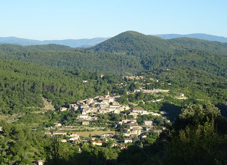
- Towns crossed : Saint-Brès and Saint-Ambroix
Forecast
Altimetric profile
Recommandations
Information desks

Tourism office CezeCévennes, Bessèges
14 rue de la République, 30160 Bessèges
This office is part of the National Park's associated tourist-information network, whose mission is to provide information on, and raise awareness of, the sites and events as well as the rules that must be observed in the National Park's central zone.
Open year-round
Tourism office Cèze-Cévennes Saint-Ambroix
Place de l'ancien Temple, 30500 Saint-Ambroix
This office is part of the National Park's associated tourist-information network, whose mission is to provide information on, and raise awareness of, the sites and events as well as the rules that must be observed in the National Park's central zone.
Open year-round
Transport
liO is the regional public transport service of the Occitanie/ Pyrénées – Méditerranée region. It facilitates everyone’s movements by prioritising public transport. For more information, call 08 10 33 42 73 or go to www.laregion.fr
Access and parking
Parking :
Calculateur d'itinéraire Lio
Utilisez le calculateur liO pour organiser votre trajet en région Occitanie.
Autres régions
Calculez votre itinéraire en Auvergne Rhône Alpes sur Oùra
Biodiversité autour de l'itinéraire
Source

Report a problem or an error
If you have found an error on this page or if you have noticed any problems during your hike, please report them to us here: