
The Rocks of Galta
3 points of interest
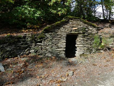
Cabane du cantonnier - nathalie.thomas  History
The King’s road
You walk past a little building that used to house the roadmender’s tools. The path you take is the former King’s road between St-Germain-de-Calberte and Barre-des-Cévennes, which was rebuilt in the early 17th century on the orders of the Intendant of Languedoc, tasked with repressing the Camisard uprising. The King’s roads allowed royal troops to penetrate into areas where movement was very difficult. This road is built on supporting walls and, in some sections, carved into the rock.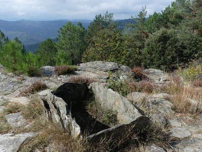
Sépulture à coffre - nathalie.thomas  Archaeology
Menhir (standing stone)
At the pass is a standing stone or menhir, a schist slab 1 ½ m high and 80 cm wide, which has circular depressions known as cup marks and carved rods. Many vestiges attest to the presence of humans in the schist valleys of the Cevennes as of 3,000 BC: tombs, menhirs, carved marks. Some 15 menhirs have been inventoried in the Gardon valleys. They are not grouped together but located on ridges or at passes. Their meaning remains very unclear: landmarks for orientation, symbols linked to worship, territorial markers, etc.?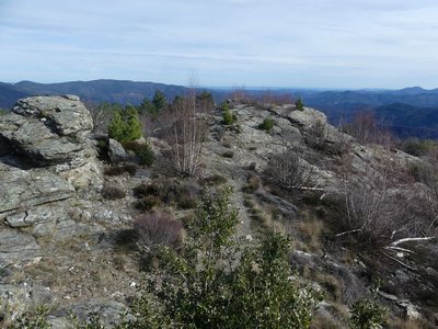
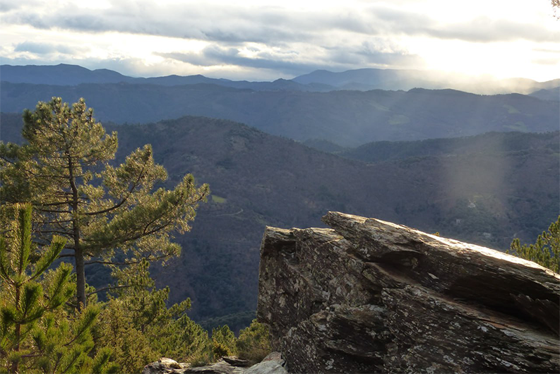
Rocs de Galta - Nathalie Thomas  Geology
Galta
The name Galta is believed to come from the Indo-European root Kar, gal, meaning rock, stone. Schists are former sediments stemming from the erosion of mountains. In the Cevennes, these sediments are about 500 million years old and were probably deposited on the edges of a former ocean that separated the north and south of what is now France. About 350 million years ago, these sediments were buried at depth and subjected to high pressure and temperatures of around 500° C. This turned them into schists, made up of new minerals: feldspaths, micas and quartz. This transformation is associated with deformation and called metamorphism. Water has run off the impermeable schist bedrock and carved out deep furrows, creating one of France’s most rugged regions. The ridges are orientated along a northwest-southeast axis.
Description
From the car park at the holiday village:
1) take the path that goes uphill into the chestnut forest;
2) at the fork, follow the large track (the former King’s road) which goes to the right;
3) at the Col de la Pierre Plantée pass, take the track on the left that is parallel to the King’s road;
4) follow the path on the right that runs along the ridge;
5) go downhill below the ridge to return to your starting-point.
- Departure : Holiday village "Lou Serre de la Can"
- Arrival : Holiday village "Lou Serre de la Can"
- Towns crossed : Saint-Germain-de-Calberte
Forecast
Altimetric profile
Recommandations
Caution: the rocky ridge is slippery underfoot when wet. Make sure your equipment is appropriate for the day’s weather conditions. Remember that the weather changes quickly in the mountains. Take enough water, wear sturdy shoes and put on a hat. Please close all gates and barriers behind you.
Information desks

Tourism'house and national Parc at Florac
Place de l'ancienne gare, N106, 48400 Florac-trois-rivières
This office is part of the National Park's associated tourist-information network, whose mission is to provide information on, and raise awareness of, the sites and events as well as the rules that must be observed in the National Park's central zone.
On site: exhibitions, video projections, events and shop Open year-round

Office de tourisme Des Cévennes au mont Lozère
le Quai, 48220 Le Pont de Montvert sud mont-Lozère

Tourism office Des Cévennes au mont-Lozère, Saint-Germain-de-Calberte
Village, 48370 Saint-Germain-de-Calberte
This office is part of the National Park's associated tourist-information network, whose mission is to provide information on, and raise awareness of, the sites and events as well as the rules that must be observed in the National Park's central zone.
Open year-round, except for 2 weeks at Christmas
Access and parking
From St-Germain-de-Calberte, take the road that goes uphill opposite the church towards Le Serre de La Can (“village vacances”)
Parking :
Calculateur d'itinéraire Lio
Utilisez le calculateur liO pour organiser votre trajet en région Occitanie.
Autres régions
Calculez votre itinéraire en Auvergne Rhône Alpes sur Oùra
Biodiversité autour de l'itinéraire
Source


Report a problem or an error
If you have found an error on this page or if you have noticed any problems during your hike, please report them to us here: