MTB 12 - The ridges of the Vallée Borgne – graded red
9 points of interest
Observatoire de l'Aigoual - nathalie.thomas  History
The meteorological observatory
Inaugurated in 1824, the meteorological observatory was built on the initiative of Georges Fabre, one of the pioneers of the reforestation of Mont Aigoual. His work with the botanist Charles Flahault enabled the creation of the arboretum of L’Hort de Dieu. The first meteorological data were gathered by agents from the French National Water and Forestry Commission. Since 1943, the observatory has been managed by the National Meteorological Office. It is France’s last mountain weather station that is inhabited year-round.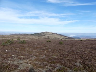
Le Portalet - nathalie.thomas  Flora
FloraShort-grass prairies and heath on the summit of Mont Aigoual
Here, only species with a short reproductive cycle can settle due to the frequently glacial climate. The heath has been invaded by heather and mountain pine. This zone is barely wooded due to the violent winds and is comparable to subalpine vegetation, consisting of short-grass prairies and heather and blueberry moor. It is sometimes called pseudo-alpine.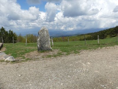
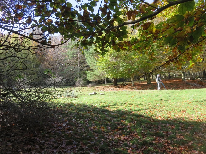
Vue depuis Font de Trépaloup - nathalie.thomas FloraThe evolution of plant life
At the pass stands a schist menhir (standing stone). To the north, in Trépaloup ravine, hewn flint implements bear witness to a human presence in the region since prehistoric times. Palynological analyses (studies of pollen fossilised in peatbogs) have allowed scientists to piece together the plant life on Mont Aigoual from 8,000 to 5,000 BC. Pine predominated, accompanied by birch and hazelnut. Then pine populations gradually diminished. The damp climate warmed up, favouring the spread of oak and hazelnut. Finally, the increased damp and cloud cover at altitude allowed fir and beech to develop. From the end of the first century BC, the substantial percentage of grasses shows that forest had receded in favour of pasture and prairies. This was the start of the great deforestation.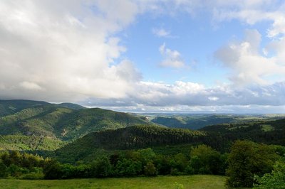
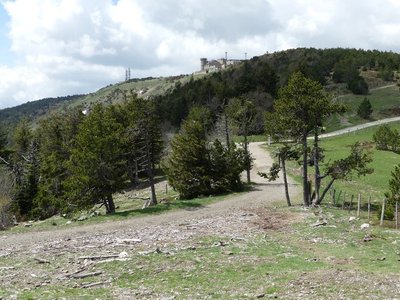
Vue sur la forêt de l'Aigoual - Arnaud.Bouissou FloraReforestation
In 1875, the French State initiated a reforestation policy. It bought up existing beech forests and bare parcels. This was the case of Aire-de-Côte and the land belonging to it. To settle poor soils, foresters planted a pioneering species: the dwarf mountain or bog pine. On more fertile soils, nobler species were planted: fir, spruce and larch. Commercial exploitation began in 1938, when the local mines bought the first harvests to shore up mine tunnels. The original reforested areas were thinned out and firs planted beneath the pines. It is said that in a bedroom at Aire-de-Côte, there was a heap of coniferous tree seeds at least one metre high. They were sown onto the snow, which dragged them into the soil as it melted.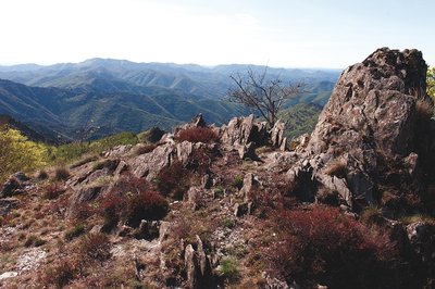
Vue depuis les 4000 marches - Olivier.Prohin  Water
WaterLe Coulet
At Le Coulet (meaning little pass), views open up onto the Mediterranean side, towards Valleraugue. The viewpoint lies on the watershed. Up to this point, the route followed the valley of the Bédil, a brook with a gentle, non-torrential gradient, whose waters flow into the Atlantic. Here, you discover the valley of the Clarou (a tributary of the Hérault), with its typically Mediterranean, i.e. more abrupt, profile. To the south, schist outcrops break through the slopes; to the north, the slopes are entirely wooded.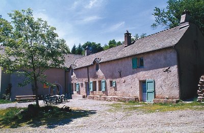
Guy.Grégoire HistoryA Resistance refuge
In early 1943, the first Resistance group of the Cévennes was formed. The refuge of the Aire-de-côte group was one of the wooden shacks used for forestry works, whose roof was camouflaged using branches. On 10 July 1943, a message warned the post office in Rousses that a German attack was imminent. The Resistance was informed – but a storm delayed the group’s departure. The Germans arrived… The forester was arrested as an accomplice, accused of being in radio contact with London. Indeed, the Aire-de-côte Resistance listened to a crystal radio set built by the two Jews who were hiding there.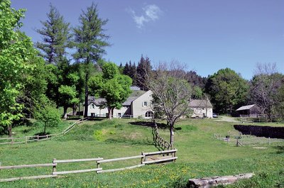
Aire de Côte - Stephan.Corporan HistoryAire de Côte
Aire-de-Côte farm was purchased by the French State in 1862, during the period of reforestation. Before the farm became a stopover gîte, it was for a long time the residence of the local forester and his family. In the first half of the 20th century, Aire-de-Côte was very different. To the north, behind the house, was the draille (drovers’ road), lined by upright stones and 40 to 50 metres wide. Thousands of transhumant animals passed every year on their way to or from summer pastures. The transhumant animals stopped there at lunchtime, then continued on towards Mont Aigoual.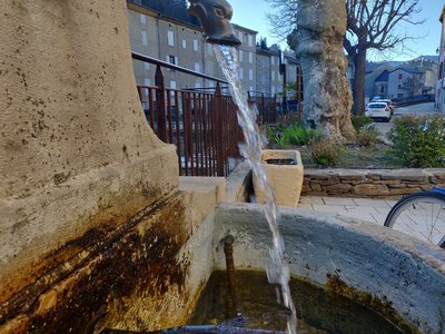
© Béatrice Galzin WaterOne spring, five fountains
This fountain is one of Saint-André’s five public fountains, all of which are supplied by the same spring (its water is thus the same as in the Fontaine du Griffon). Before houses were connected to mains water, there were many more fountains on this side of the quay.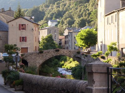
Le village de St André de Valborgne - Béatrice Galzin  Architecture
The village of St André de Valborgne
As you stroll along the quay above the river, you can still see the handsome bourgeois houses dating from the silk boom. If you look around, former spinning mills and industrial buildings dedicated to silk farming can still be seen in the landscape. A little lower down, opposite the 16th century château, you can listen to
Bernadette Lafont on the Camisard saga in and after 1702. As you reach the square again, quench your thirst at the fountain and have a look inside the Romanesque church (12th century).
Description
Signposts will guide you all along this route. In the description below, the signposted place names and/or directions are given in bold italics between quotation marks:
From the observatory, head due east,go to
- "Sommet" then
- "Menhir du Trépaloup",
- "Source du Tarnon",
- "Font de Trépaloup", then
- « Combe de Lambert ». Go to
- « Col de l’Estrade »,
- « Côte 1100 » and
- le « Coulet ». Continue on level ground to
- “Aire de Côte”. Take the left just before the gîte (2) towards
- “Sestrière”,
- « Combe Radal ». Turn right and go straight down to a track. Skip to
- « Serre des Buges ». Then continue to the right, always staying on the same track up to « Saint-André de Valborgne ».
This circuit is taken from the guidebook Massif de l’Aigoual, published by the communauté de communes Causses Aigoual Cévennes as part of the collection Espaces naturels gardois and the label Gard Pleine Nature.
- Departure : Summit of mont Aigoual
- Arrival : St-André de Valborgne
- Towns crossed : Val-d'Aigoual, Bassurels, and Saint-André-de-Valborgne
Forecast
Altimetric profile
Recommandations
NB: The start and finish are not in the same place. Make sure you organise return transport for yourself.
Before committing yourself to a circuit, ensure that it is suitable for your activity level and ability. You must wear a helmet. Protective equipment is recommended. Respect other road users and stay in control of your speed and trajectory.
NB: This trail is also used by horse riders. Make sure your equipment is appropriate for the day’s weather conditions. Remember that the weather changes quickly in the mountains. Take enough water. Please close all gates and barriers behind you. No off-roading.
Caution: patous (livestock guard dogs) at the summit and at Col Salidès pass! Seek advice on how to behave near these dogs from tourist offices and National Park information centres.
Information desks

Tourism & national parc'house
Col de la Serreyrède, 30570 Val d'Aigoual
The Maison de l'Aigoual houses the tourism office Mont Aigoual Causses Cévennes and the Maison du Parc national. This visitor centre provides information on and raises awareness of the Cévennes National Park, its sites and events as well as the rules that must be observed in the National Park's central zone.
On site: changing exhibitions, video projections, Festival Nature events and shop Open year-round

Tourism office Mont Aigoual Causses Cévennes, Saint-André-de-Valborgne
les quais, 30940 Saint-André-de-Valborgne
This office is part of the National Park's associated tourist-information network, whose mission is to provide information on, and raise awareness of, the sites and events as well as the rules that must be observed in the National Park's central zone.
Transport
liO is the regional public transport service of the Occitanie/ Pyrénées – Méditerranée region. It facilitates everyone’s movements by prioritising public transport. For more information, call 08 10 33 42 73 or go to www.laregion.fr
Access and parking
From St-André de Valborgne, take the D907 towards Florac for 8km, then the D19 to Cabrillac. In Cabrillac, take the D18 on the left to mont Aigoual summit -Parking.
Parking :
Calculateur d'itinéraire Lio
Utilisez le calculateur liO pour organiser votre trajet en région Occitanie.
Autres régions
Calculez votre itinéraire en Auvergne Rhône Alpes sur Oùra
Biodiversité autour de l'itinéraire
Source


Report a problem or an error
If you have found an error on this page or if you have noticed any problems during your hike, please report them to us here: