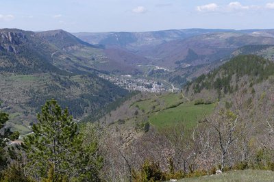
Discovering the Upper Cévennes
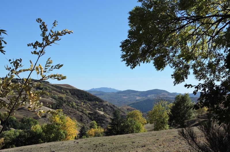
Starting in Florac, a town built at the confluence of three rivers, this route follows the Stevenson Trail upstream into the Mimente valley on the former railroad. It then joins Barre des Cévennes, a village strategically located on one of the most frequented passages between the lower and upper Cévennes, two different and complementary regions. To round off the hike, you cross the cans, small limestone plateaux, with dominant views onto the Tarnon valley and the edge of the Causse Méjean plateau.
3 steps
8 points of interest
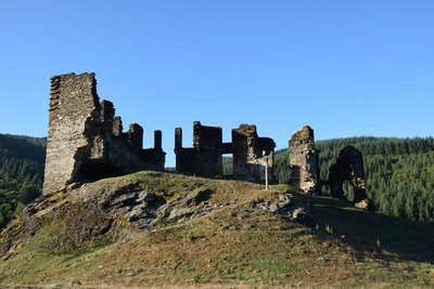
Château de Saint-Julien-d'Arpaon - © com com Florac Sud Lozère  History
Château de Saint-Julien-d'Arpaon
This 13th century castle was the property of the Lords of Anduze, who owned the barony of Florac in what was then the Gévaudan. In 1618, when the Gabriac family owned it, the castle was demolished. In the 18th century, it was inherited by the Montcalm family from Rouergue province, which owned several properties in the Gévaudan. The family restored the building, but it has suffered from effects of time and is currently in ruins – though in a better state of preservation than other castles in the Gévaudan.
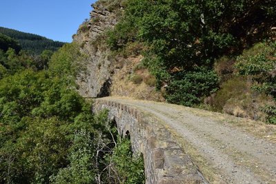
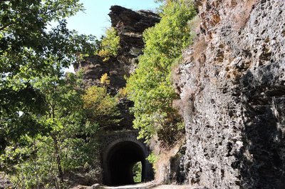
Pont sur le CéFéDé - © com com Florac Sud Lozère HistoryThe CFD (mountain-bike route)
Users and employees still talk of the former railway (CFD) with regret and emotion:
“To go to Montpellier on Mondays, I could leave at 6 in the morning, and arrive in Montpellier at 10, and you could get back here in the evening. The train arrived at 10 o'clock in the evening. Now (with the coach), you can go down, but you have to wait for the next day to come back up. It was very useful. Nowadays, if you don't have a car, what do you do? You hitch-hike, you walk!” (P. Grime)
“Two years after the train was shut down, we had the idea of putting it back on the track and turning it into a tourist train. We managed to get a railcar to start... We hadn't told anyone: apparently we didn't have the right to do it, we even risked getting a correctional sentence. Nothing happened... Except that at St-Julien-des-Points we gave a blast of this kind of horn that we had, and M., from the restaurant, came up with a litre of pastis, and two or three farmers from the area arrived too. We all cried like babies. We had the impression that the heart of the area was beating again.” (Revue Cévennes, issue 15)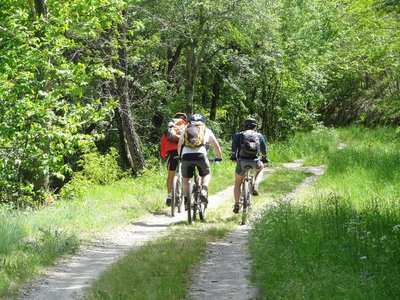
CFD - © Cévennes Evasion HistoryThe disused railway (CéFéDé)
From 1909 to 1968, this railway line linked Florac and Sainte-Cécile-d'Andorge (50 km). A metre-gauge single-track line, it was managed by the department's railway company. It was linked to the SNCF state railway network. The trains transported passengers and merchandise: ore from Ramponenche mine near Florac; baryte from the mine at Jalcreste, and plums, chestnut wood, dried boletus mushrooms, etc., destined for northern France. As you move along the disused line, you will see former engineered constructions (bridges, tunnels, etc.).

Circaète Jean-le-Blanc - © Régis Descamps  Fauna
FaunaShort-toed snake eagle (Circaetus gallicus)
This bird of prey nests in the surrounding woodland. The best times of year for spotting it are March/April and July to September. It spends winters in sub-Saharan Africa, returning to France in early March. Along with its mate, it will spend five months incubating a single egg and bringing up the chick.
 History
Place de la Madeleine
Marker 5
The fountain dates from the 18th century. At the end of the 19th century, the bust of Marianne – the personification of the French Republic – was added. At the same time, a poplar was planted by republican youth as a symbol of freedom. From here, you can see several bourgeois houses, which mostly date from the 17th and 18th centuries. They bear witness to the village’s thriving past, when it had some 20 voituriers (merchant-carters), who would drive their carts down to the plains laden with wool and chestnuts and return with salt, wine and oil. Under the houses' large porches, harnesses and carts were kept. During fairs, the seed market took place in these vaults and those of the town hall.- History
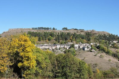
The Château
Marker 6
Constructed in the 12th and 13th centuries, the Château was entirely rebuilt in the early 16th century. From 1710 to 1715, it was modified by the Lord of Barre, who had his coat of arms carved above the entrance. Two towers were also added at this time. During the 1789 Revolution, the coat of arms disappeared under vigorous hammer strokes. In the early 19th century, during an expansion, the main tower was removed. - History
Place de la loue (Hiring Square)
Marker 1
This little square, located at the north-eastern entrance to the village, was where the “loue” (hiring) used to be held during the great spring and autumn fairs: shepherds, domestics and chestnut gatherers would sit on the parapet and hope for an employer to take them on. The village hosted 12 to 15 fairs every year. The spring and autumn ones could attract up to ten thousand people from neighbouring departments, but also from the Var, Vaucluse and Bouches-du-Rhône. This village-rue (one-road village) was protected at each end by a fortified gate. One of them, called the Florac Gate, stood near the Place de la Loue. It was destroyed in the early 19th century. 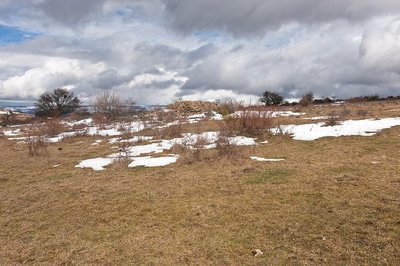
La Can de Ferrières - © Guy Grégoire AgricultureThe Can de Ferrières
This limestone plateau continues to be grazed by flocks of sheep. Note the piles of stones, called clapas. They are not there by chance! They are the result of locals clearing their fields and pastureland of stones. These piles shelter many species.
Description
- Day 1: 18 km from Florac to the former train station at Cassagnas or 21 km from Florac to Cassagnas village, on the GR® 70 long-distance hiking path (waymarked white and red).
- Day 2: 9 km from the former train station at Cassagnas to Barre des Cévennes or 12 km from Cassagnas village to Barre des Cévennes, on the GR® 72 (waymarked white and red).
- Day 3: 15 km from Barre des Cévennes to Florac on the GR®7-67 / GR®43 (waymarked white and red).
You first take the GR®7 and GR®67 to the Col des Faïsses pass, then the GR®43 to Florac.
- Departure : Florac
- Arrival : Florac
- Towns crossed : Florac Trois Rivières, Cans et Cévennes, Cassagnas, Barre-des-Cévennes, and Vebron
Forecast
Altimetric profile
Recommandations
Make sure your equipment is appropriate for the day’s weather conditions. Remember that the weather changes quickly in the mountains. Take enough water, wear sturdy shoes and put on a hat. Please close all gates and barriers behind you.
Information desks

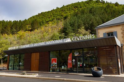
Tourism'house and national Parc at Florac
Place de l'ancienne gare, N106, 48400 Florac-trois-rivières
This office is part of the National Park's associated tourist-information network, whose mission is to provide information on, and raise awareness of, the sites and events as well as the rules that must be observed in the National Park's central zone.
On site: exhibitions, video projections, events and shop Open year-round
Transport
Former train station car park
Bus line Florac-Mende
Daily year-round bus line, Monday to Saturday (except public holidays)
https://lio.laregion.fr/IMG/pdf/oc-1903-fhbus-48-251-3v_bd_04_.pdf
Bus line Florac Ste-Enimie Le Rozier, every day in July and August
https://lio.laregion.fr/IMG/pdf/oc-1903-fhbus-48-258-3v_bd_04_.pdf
Bus line Alès-Florac (by reservation only if departing from Ispagnac) Boulet bus company +33 (0)4 66 65 19 88
Daily bus line (except Sundays and public holidays) from 15 April to 31 October.
https://fr.calameo.com/read/003034667db3a5b1c0788
Access and parking
Florac-Trois-Rivières on the RN 106.
Parking :
Calculateur d'itinéraire Lio
Utilisez le calculateur liO pour organiser votre trajet en région Occitanie.
Autres régions
Calculez votre itinéraire en Auvergne Rhône Alpes sur Oùra
Biodiversité autour de l'itinéraire
Source

Report a problem or an error
If you have found an error on this page or if you have noticed any problems during your hike, please report them to us here: