
The Causse Méjean circuit, GR de Pays
10 points of interest
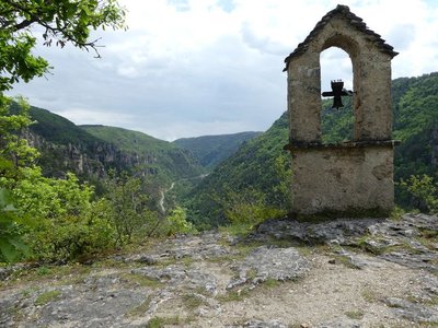
Sanctuaire du Roc Saint-Gervais - nathalie.thomas  History
The sanctuary of Roc de Saint-Gervais
According to Philippe Chambon, “this minuscule chapel is dedicated to Saints Gervase and Protase. It is in the Romanesque style but has been remodelled many times. The apse seems to date from the beginning of the Romanesque period (11th century). The stepped nave, which follows the slope of the bedrock, is less ancient. This sanctuary was originally a mediaeval stronghold, surrounded by a chapel, a cemetery and a few houses, some vestiges of which can still be seen between the rocks. Since the foundation of the hamlet of Les Douzes, its dead have been buried in the cemetery adjoining the chapel. They are carried to their final resting place by their family and friends. On the first Sunday in July, a pilgrimage takes place here, with farmers coming for a blessing for their herds and harvests”.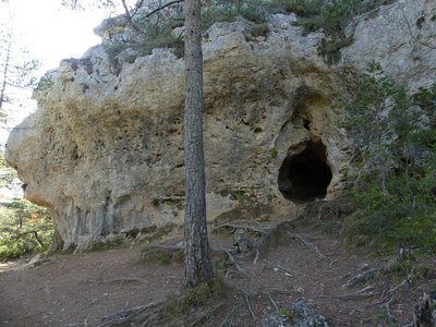
Grotte de l'homme mort - Nathalie Thomas HistoryL'Homme-Mort (Dead Man’s) Cave
In 1867 Dr Barthélémy Prunières and Prof Paul Broca discovered some 50 human skeletons from the Chalcolithic or Copper Age (2,200 to 1,800 BC) in this cavity with its almost round entrance. It was the first ever discovery in France of skulls bearing signs of trepanning-style lesions that were in the process of scarring over. Trepanning was carried out using a flint drill. The surgeon operated rather brutally to begin with, but once the cancellous bone had been penetrated, he seems to have drilled into the internal table of the skull bone more carefully. The individuals treated in this way were normally adults.
In some cases, where the skull had previously been staved in, the purpose was probably to relieve the injury.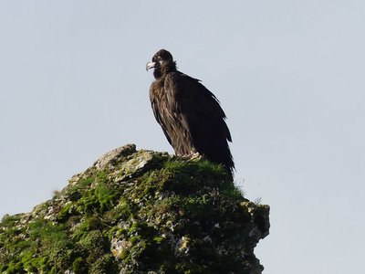
Le vautour moine - nathalie.thomas  Fauna
FaunaVultures
You are close to the historic site where the griffon vulture was reintroduced from 1982 onwards. Since then, the cinereous vulture (1992) and the bearded vulture (2012) have also been reintroduced. The Egyptian vulture returned of its own accord in 1986. It nested locally in 1997, but it remains rare and very localised in this region. In the Mediterranean basin, the presence of vultures is associated with sheep farming and herd mortality.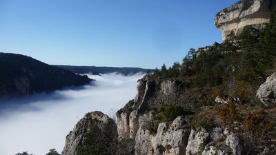
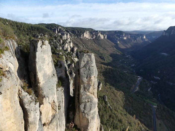
Les corniches de la Jonte - nathalie.thomas  Landscape
Balcon du vertige (vertigo balcony)
This site, almost 400m above the bed of the Jonte, deserves it name. It is the only spot on the walk from which you have such breathtaking views over the gorge. Opposite you is the Causse Noir, with a heavily fissured rock in the foreground, the Ranc del Pater, on which remain some wall sections of Saint Michael’s hermitage (former château of Montorsier). The tall rectangular cliff on its right is known as Roc Fabié. If you lean forwards, you can see, from upstream to downstream, La Caze and Le Truel hamlets, and below you the Maison des Vautours (vulture belvedere), which was opened in 1998 and traces the local history of vultures.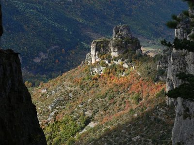
Capluc et son rocher - NT AgricultureCapluc and its terraces
As you leave Capluc, you become aware of how the site, which at first sight seems barren, has in fact been shaped by humans. All of this south-facing slope, which is protected by the tall dolomite cliffs, was farmed using terraces (grains, fruit trees, grapevines). Temperatures are so favourable that the most southern Mediterranean vegetation of the region grows here (narrow-leaved ash, jasmine, Montpellier maple, holm oak, etc.).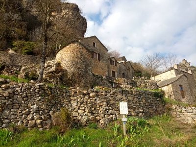
Capluc - NT HistoryCapluc
Capluc was once a defensive and surveillance site, with a castle that (like many of the village’s houses) no longer exists. Some of the houses were renovated once a track suitable for motor vehicles was opened to the hamlet. The name Capluc is believed to come from cap and luz, meaning head and light, thus symbolising the place illuminated by the first rays of the rising sun.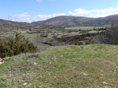
La vallée de Carnac - nathalie.thomas  Archaeology
The White Lady of Anilhac
The valley of Carnac is one of the most fertile on the Causse. The relatively deep soils and numerous wells (17 in Caussignac) have attracted over a third of the plateau’s population. Its tumuli (individual tombs) have been excavated; one is believed to date from the Iron Age. Next to some carbonised bones, a large quantity of jewels was found here, which proved both the gender and the social status of the buried person. She has been nicknamed the White Lady of Anilhac.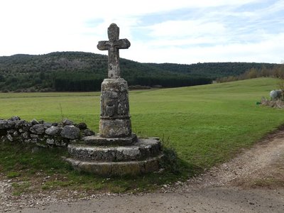
La croix du Buffre - nathalie.thomas HistoryLe Buffre cross
This is one of the oldest and most handsome crosses in Lozère. On its cylindrical pedestal (12th c.), which is set on three steps, two persons face each other on either side of a holy water basin representing a human face. The basin is carved into the pedestal and also projects from it. The more recent actual cross is believed to date from the 18th century. Le Buffre cross is one of many that dot the Saint Guilhem route, to both guide and encourage pilgrims.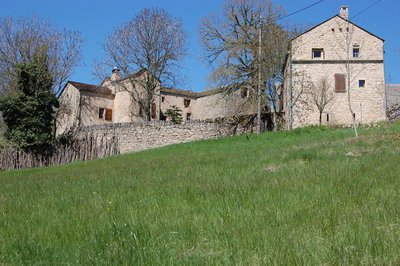
Vue sur Pauparelle - © Nathalie Thomas HistoryPauparelle
From Pauparelle, there is a nice view of the village of Ayres. This hamlet came into being in the 11th century around a Benedictine priory, founded by the Abbey Saint-Victor-de-Marseille on the current site of the castle. The latter, laid out in the 16th century on the ruins of the monastery, was pillaged and burned to the ground by the Camisards in 1703. Rebuilt in 1710, it is now a renowned hotel. Pauparelle is a private property that is not open to visits. Its name means “estate of the poor”. The farm buildings and living quarters date from the 17th and 19th centuries. Until 1850, the property belonged to the Charity Office of the town of Meyrueis, which, at that time, had about 5,000 inhabitants. (Jérôme Reversat)
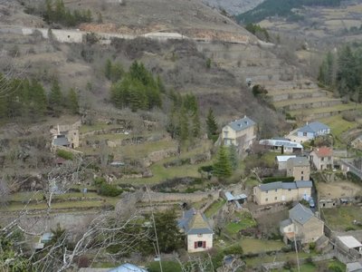
Terrasses sur Meyrueis - © Nathalie Thomas AgricultureTerrace
Throughout the climb, you will see abandoned former crop terraces. A few grapevines have persisted since local wine-growing came to an end. They bear witness to the fact that the slopes around these hamlets and villages were once cultivated and planted with fruit trees and vines. Terraces like these were the only way for the valley's inhabitants to have flat areas with deep soil suitable for growing.
Description
1) Meyrueis - Hyelzas: 13.8 km
2) Hyelzas - Le Rozier:17.4 km
3) Le Rozier - Les Vignes: 11.5 km
4) Les Vignes - Mas St Chély: 15.5 km
5) Mas St Chély - Meyrueis: 5 ½ hrs / 21 km
As a variant, you can also pass through Rieïsses to reach La Viale.
All information on this itinerary in its totality can be found on the site monGR.fr of the French hikers’ federation, the Fédération française de la randonnée pédestre. Map ref. IGN 2640 OT
- Departure : Meyrueis
- Arrival : Meyrueis
- Towns crossed : Meyrueis, Hures-la-Parade, Saint-Pierre-des-Tripiers, Le Rozier, Massegros Causses Gorges, La Malène, and Mas-Saint-Chély
Forecast
Altimetric profile
Recommandations
For various reasons, the waymarked path may differ from that shown in the topographic guidebook: please follow the waymarks on the trail. Make sure your equipment is appropriate for several days of hiking as well as the day’s weather conditions. Remember that the weather changes quickly in the mountains. Take enough water, wear sturdy shoes and put on a hat. Please close all gates and barriers behind you. Bivouacking in the National Park’s central zone is regulated and, on some stretches, prohibited.
Information desks

Tourism'house and national Parc at Florac
Place de l'ancienne gare, N106, 48400 Florac-trois-rivières
This office is part of the National Park's associated tourist-information network, whose mission is to provide information on, and raise awareness of, the sites and events as well as the rules that must be observed in the National Park's central zone.
On site: exhibitions, video projections, events and shop Open year-round
Transport
- Line 215 Millau - Le Rozier - Meyrueis
- Line 258 Le Rozier - Florac
Access and parking
Parking :
Calculateur d'itinéraire Lio
Utilisez le calculateur liO pour organiser votre trajet en région Occitanie.
Autres régions
Calculez votre itinéraire en Auvergne Rhône Alpes sur Oùra
Biodiversité autour de l'itinéraire
Source


Report a problem or an error
If you have found an error on this page or if you have noticed any problems during your hike, please report them to us here: