
Camias trail
History is under your feet and all around. Every stone has a story to tell about its use: in a retaining wall, a house, a rail track.
3 points of interest
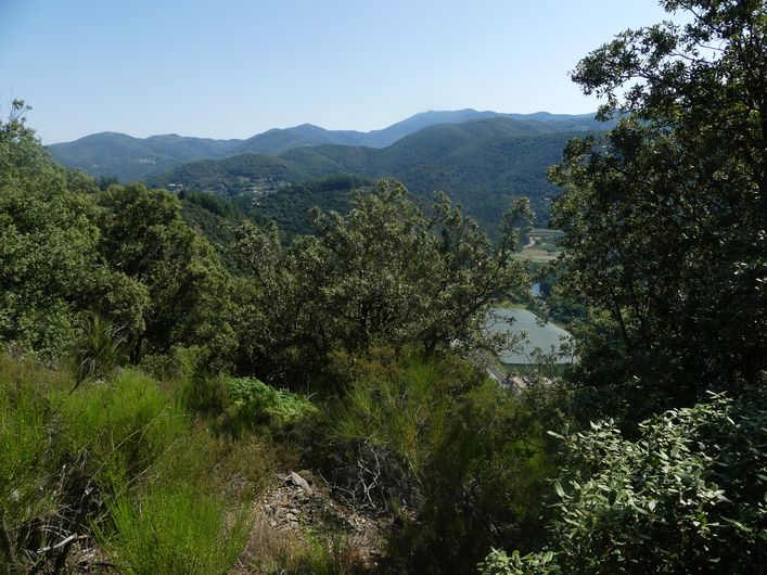
Le hameau de Camias - Béatrice Galzin AgricultureCamias and its agriculture
In the 20th century, the hamlet of Camias still had 80 inhabitants. They grew grapes for wine. Some olive trees can also still be seen on the sunny sheltered slopes and some magnificent chestnut orchards on the shaded slopes (ubac). It is not difficult to imagine sheep and goats keeping these spaces open.
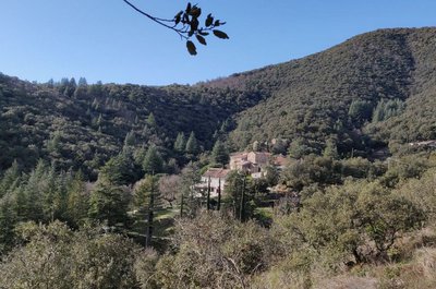
This is where Albertine Sarrazin lived, the author of the two novels Astragal and La Traversière, while her husband raised hell in Montpellier or elsewhere.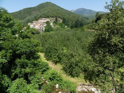
Le hameau d'Arboux et ses vergers - Nathalie Thomas AgricultureThe Reinette apple and the sweet onion
The Arboux valley is the valley of the queen of apples! Apples have been grown here since the 11th century, and King Louis XIV was very partial to them. There are still many apple trees in the area.
But the sweet onion also has its birthplace in this valley. It has been grown here for almost two centuries. The local climate and soil favour it: a sandy acidic soil, dry weather in summer, and a lot of water. The sweet onion is sown in February, planted out in May and harvested in August. It keeps several months in a cool dark place.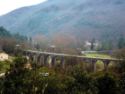
La voie de chemin de fer - Michel Monnot  History
The railroad
On 11 June 1863, an imperial decree approved a convention between the minister of agriculture, trade and public works and the Paris-Lyon-Mediterranean Railway Company to build the railroad from Quissac to Le Vigan.
It was built in sections: the Ganges-Quissac line was opened in 1872, the Ganges-Le Vigan line in 1874.
On 24 August 1896, the Midi Railway Company opened a line called the Tournemire, between Le Vigan and Alby. At an average speed of 23km/h, the train carried passengers and goods such as wood, silk and hosiery.
The old railway station at Pont d’Hérault is imposing and was built in a strategic location. In 1897 there was a project to extend the line to Valleraugue but it was never realised.
Passenger transport on the Tournemire line was suspended in 1939; the line then closed section by section until it definitively ceased all operation in 1971.
In contrast, the line linking Quissac and Le Vigan, which stopped carrying passengers in 1969, continued to convey freight until 1987 between Le Vigan and Ganges and until 1989 between Ganges and Quissac. Today, some walks use sections of this railway line to help us explore this heritage and the economic life of the time.
Description
Signposts will guide you all along this route. In the description below, the signposted place names and/or directions are given in bold italics between quotation marks:
From the entrance to “L’ancienne gare de Pont d'Hérault”, head towards
- "les Quatre Chemins". At the crossroad “Les Quatre Chemins", take the road furthest on the left towards
- "Camias",
- Continue towards "Pié Camp", then
- "L'Arboux", (steep downhill section to “L'Arboux”), then
- "La Placette". Continue towards
- "Tunnel du Rey", Turn left onto the railroad to return to “L’Ancienne gare de Pont d'Hérault".
- Departure : Old train station at Pont d’Hérault
- Arrival : Old train station at Pont d’Hérault
- Towns crossed : Saint-André-de-Majencoules and Mandagout
Forecast
Altimetric profile
Recommandations
Before committing yourself to a circuit, ensure that it is suitable for your activity level and ability. Remember that the weather changes quickly in the mountains. Take enough water.
Information desks

Tourism & national parc'house
Col de la Serreyrède, 30570 Val d'Aigoual
The Maison de l'Aigoual houses the tourism office Mont Aigoual Causses Cévennes and the Maison du Parc national. This visitor centre provides information on and raises awareness of the Cévennes National Park, its sites and events as well as the rules that must be observed in the National Park's central zone.
On site: changing exhibitions, video projections, Festival Nature events and shop Open year-round
Tourism office Mont Aigoual Causses Cévennes, Valleraugue
7 quartier des Horts, 30570 Valleraugue
This office is part of the National Park's associated tourist-information network, whose mission is to provide information on, and raise awareness of, the sites and events as well as the rules that must be observed in the National Park's central zone. : Open year-round
Transport
liO is the regional public transport service of the Occitanie/ Pyrénées – Méditerranée region. It facilitates everyone’s movements by prioritising public transport. For more information, call 08 10 33 42 73 or go to www.laregion.fr
(in term time).
Access and parking
From Ganges, drive towards Le Vigan on the D 999; just after the crossroads for Valleraugue (D 986), use the car park at the old train station on your right.
Parking :
Calculateur d'itinéraire Lio
Utilisez le calculateur liO pour organiser votre trajet en région Occitanie.
Autres régions
Calculez votre itinéraire en Auvergne Rhône Alpes sur Oùra
Biodiversité autour de l'itinéraire
Source


Report a problem or an error
If you have found an error on this page or if you have noticed any problems during your hike, please report them to us here: