
La Chadenède, The Monks
4 points of interest
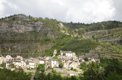
Vue sur le village de Montbrun. - © OTGCC nc  History
Montbrun: a perched village
Many villages showcase the conditions that led to their establishment. For Montbrun, it was the defensive value of the site. But was that really the only reason? In a gorge, where cultivatable land is often in short supply, building the village on a rock allowed villagers to save on precious farmland. While the slopes of the Causses are green today, in the 18th and 19th centuries they were stripped relatively bare. The small villages were true oases. Human hands have shaped, laid out and designed this landscape. They have optimised the space, cultivating the tiniest patch of land right up to the feet of the Cause cliffs.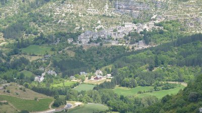
Autour de Montbrun - Nathalie Thomas AgricultureA recovery farm
Unlike the Causses plateaux, the Tarn valley experienced strong agricultural decline. To revitalise the area, the municipality of Montbrun launched a recovery farm in 2008. The most time-consuming aspect was bringing together the different owners’ parcels by creating a pastureland association. In 2010 a couple arrived to run the organic market garden and livestock farm… It’s almost a return to the days when the flood plain was cultivated by the inhabitants of Montbrun. Don’t miss the small farmers’ market every Sunday morning in July and August.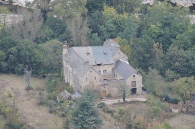
Château de Charbonnières. - © OTGCC nc  Architecture
The Château de Charbonnières
In a bend of the Tarn downstream from the village of Montbrun stands the Château de Charbonnières. While the former castel has lost some of its defensive elements, it has nevertheless preserved a knightly characterand traces of many historical episodes of the Tarn valley. It is first recorded in the 13th century. Its defensive role was tightly linked to a whole “fortified system” downstream of Ispagnac, which consisted of Quézac, Javillet, La Roche, Rocheblave, Montbrun, Castelbouc, Prades and Sainte-Enimie.
The château has three rectangular //buildings arranged in a horseshoe shape around an internal courtyard. The facade overlooking the Tarn has a square tower that dominates the river. Access to the internal courtyard is via gates under a semi-circular arch. From the courtyard, a stone staircase leads up to the chapel, whose doorways is decorated with fleur-de-lys. The modest interior has a ribbed vault framing a keystone engraved with the arms of the Montesquiou family, lords of Charbonnières from the 13th century onwards. The other parts of the residential building have handsome fireplaces, a monumental staircase and fine vaulted halls. In the 17th and 18th centuries, the château became the property of the Volonzac Malespina family and, in the 19th century, of the Boutin family. It is not open to the public.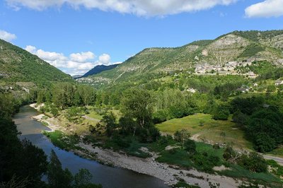
Les gorges du Tarn et le village de Montbrun - BOUISSOU Arnaud / TERRA Ministère de l'Environnement  Water
WaterNot always a docile river!
For 52 km, from the point it enters the canyon at Quézac to Le Rozier, the Tarn has no overground tributary. However, it is fed by about 170 karst springs stemming from subterranean aquifer networks. These springs release the rainwater absorbed by the avens, dolines and fissures of the Causses plateaux. When reserves are high, the water gushes with great force from the karst environment. Locals say that “the corks are popping”. In the event that the tributaries of the Tarn (the Mimente and Tarnon) rise and add to the springs, the time will have come to move the furniture upstairs.
Description
From the small car park, take the lane that goes uphill between the houses. The path starts up the slope, passes in front of a cistern and continues to a junction.
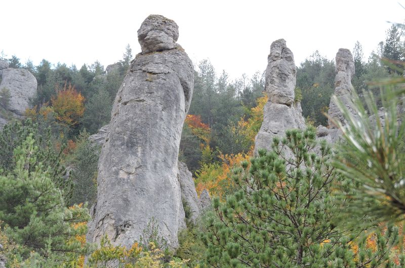
- Take, on the left, the steep climb until it cuts across a small ravine. Continue up the rather vertiginous steps until you reach a flat area at the foot of the monoliths. The path continues uphill in hairpin bends through the beech forest, until it comes out on the Causse plateau.
- As you arrive on the plateau, turn left and follow the faint track that runs along the edge of the Causse. Go slightly downhill to a basin to reach an intersection with a more marked path.
- Turn left onto this built track (low walls and, in places, stone slabs) and follow it downhill onto the Montbrun road.
- Turn left onto the road and walk to the intersection before Montbrun bridge.
- At the bridge, continue straight ahead towards the hamlet of La Chadenède and your departure point.
- Departure : La Chadenède car park
- Arrival : La Chadenède car park
- Towns crossed : Gorges du Tarn Causses
Forecast
Altimetric profile
Recommandations
/!\ Some uphill sections are tricky: vertiginous and very steep. Make sure your equipment is appropriate for the day’s weather conditions. Remember that the weather changes quickly in the mountains. Take enough water, wear sturdy shoes and put on a hat. Please close all gates and barriers behind you.
Information desks

Tourism'house and national Parc at Florac
Place de l'ancienne gare, N106, 48400 Florac-trois-rivières
This office is part of the National Park's associated tourist-information network, whose mission is to provide information on, and raise awareness of, the sites and events as well as the rules that must be observed in the National Park's central zone.
On site: exhibitions, video projections, events and shop Open year-round
Access and parking
On the D 907 bis, between Ispagnac and Blajoux, turn off towards La Chadenède.
Parking :
Calculateur d'itinéraire Lio
Utilisez le calculateur liO pour organiser votre trajet en région Occitanie.
Autres régions
Calculez votre itinéraire en Auvergne Rhône Alpes sur Oùra
Biodiversité autour de l'itinéraire
Source


Report a problem or an error
If you have found an error on this page or if you have noticed any problems during your hike, please report them to us here: