
Souls
4 points of interest
Salagosse - N Thomas  History
The municipality of Bréau-Salagosse
The municipality of Bréau-Salagosse consists of two distinct villages. The older one of the two is Salagosse. Bréau was not founded until the 7th century when part of the population of Salagosse, feeling hemmed in, decided to settle on a sunny slope lower down in the valley. Separated in 1669, the two parishes reunited in 1818. The name of Salagosse probably comes from Feragus, the nickname of a local man-at-arms, meaning “sharp iron”. Its inhabitants are known as salabousards.
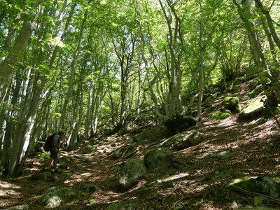
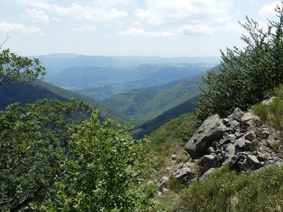
La hêtraie - N Thomas  Flora
FloraAltitudinal vegetation zones
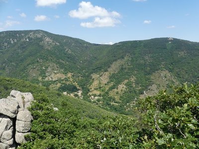
The path ranges from 700 to 1,250m in altitude and clearly shows the changes in vegetation as you climb. Vegetation zones have been defined based on altitude; they are given the name of the predominant plant species.
The first, the holm oak zone, stops at around 500m. It occurs mainly on schist or limestone. From 500 to 900m is the zone of deciduous oaks and sweet chestnut. From 1000m to 1500m is the beech zone; here you are in the Aigoual state forest. The final vegetation zone, above 1500m, is treeless and only concerns a small circle around the Aigoual summit.
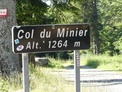
Le col du Minier - N Thomas HistoryForesters’ houses
When you arrive at the forest road, you turn left onto it. On the right used to be Le Minier forester’s house. Many foresters’ houses were scattered throughout the mountains where the forest rangers lived with their families. But living in such isolation was difficult, and school age children had to board. Gradually, these isolated houses were abandoned; the rangers now live in the villages.
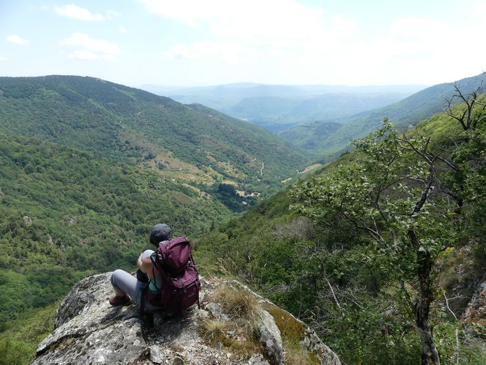
La vallée de Souls - N Thomas FloraA wild zone rich in game
On the downhill section, the path goes through a wild area rich in game, which, in the Middle Ages, belonged to the Baron d’Hierle. On 2 March 1361, the municipality of Bréau persuaded him to make concessions for Le Minier mountain range : “the men-at-arms, burghers and villagers will have the right to freely hunt bears and wild boar, to graze their livestock, to seed and cut the wood necessary for domestic use. In exchange for which, the Baron will receive the profits of easements, tax income and right to delegate” (designate consuls…).
Description
Signposts will guide you all along this route. In the description below, the signposted place names and/or directions are given in bold italics between quotation marks :
Starting from “SALAGOSSE", walk towards "COL DU MINIER” along the Souls river to :
- "Sous le Col du Minier". From here, walk towards "MARS" till you reach :
- "Le Bois de l’Homme", where you fork off to the left :
- "Le Pré de Serre". Then return to "SALAGOSSE".
This walk is taken from the guidebook Les Vallées Cévenoles - En Pays Viganais, published by the Communauté de communes Pays Viganais-Cévennes as part of the collection Espaces Naturels Gardois and the label Gard Pleine Nature.
- Departure : Salagosse (municipality of Bréeau-Mars)
- Arrival : Salagosse (municipality of Bréeau-Mars)
- Towns crossed : Bréau-Mars
Forecast
Altimetric profile
Recommandations
Make sure your equipment is appropriate for the day’s weather conditions. Take enough water, wear sturdy shoes and put on a hat. Please close any gates and barriers behind you.
Information desks

Tourism office Cévennes and Navacelles, Le Vigan
Maison de pays, place du Marché, BP 21, 30120 Le Vigan
This office is part of the National Park's associated tourist-information network, whose mission is to provide information on, and raise awareness of, the sites and events as well as the rules that must be observed in the National Park's central zone.
Open year-round
Transport
LiO is the regional public transport service of the Occitanie/ Pyrénées – Méditerranée region. It facilitates everyone’s movements by prioritising public transport. For more information, go to the lio Occitanie app or visit : https://www.mestrajets.lio.laregion.fr
Access and parking
From Le Vigan take the D999 towards Cavaillac, then at the roundabout turn onto the D272, towards Salagosse, Mars. Before the village of Mars, fork onto the D272b towards Salagosse. Park 300m before the village
Parking :
Calculateur d'itinéraire Lio
Utilisez le calculateur liO pour organiser votre trajet en région Occitanie.
Autres régions
Calculez votre itinéraire en Auvergne Rhône Alpes sur Oùra
Biodiversité autour de l'itinéraire
Source


Report a problem or an error
If you have found an error on this page or if you have noticed any problems during your hike, please report them to us here: