
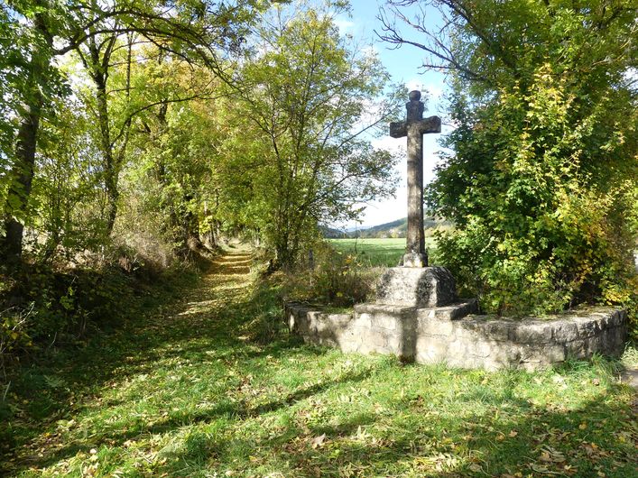
Handsome tracks through the forest, a trail section on the banks of the Lot, pretty hamlets to be crossed… Here is a circuit without major difficulty to explore the surroundings of Bagnols-les-Bains.
1 point of interest
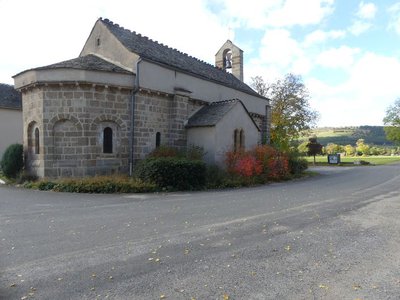
Eglise Saint-Privat - © Nathalie Thomas  History
Saint-Privat’s church
Mentioned for the first time in 1258, Saint-Privat’s church seems to have been built between the 12th and the early 13th century. It was damaged during the French Wars of Religion, like many churches in the Gévaudan. Despite the many overhauls, its architecture is neat.
Description
Signposts will guide you all along this route: follow the waymarks for trail #8.
Cross the village’s main road, the municipal campsite and a recent housing estate, then take a pleasant path on the bank of the Lot river. The path leads you to the pretty village of Chadenet, via Le Crouzet, on the GR®43. This flat section is ideal for making a gentle start.
At Chadenet, you embark on a track that climbs gradually for two kilometres before levelling out in the forest: perfect for lengthening your stride!
At Allenc, you start climbing again to reach Le Mourre d'Allenc, altitude 1,198 m.
Then, all that is left is to head downhill on a large track through fields and forest.
Signposts will guide you all along this route, as well as yellow painted waymarks. In the description below, the signposted place names and/or directions are given in bold italics between quotation marks:
From "Bagnols-Les-Bains », go to « Chadenets » via :
- « Avenue de la Gare »,
- « Le Crouzet » (GR®43).
- At « Chadenet » go to « Le Moure d’Allenc » via
- « Lou Claoux »,
- « Village »,
- « Lavit »,
- « Le Mas ».
- At « Le Moure d’Allenc », return to "Bagnols-les-Bains" via
- « Pessasse »,« Bagnols-les-Bains ».
This hike is taken from the guidebook Mont Lozère – Pays des sources, de la montagne du Goulet aux gorges du Bramont, published by the Pôle de pleine nature du Mont Lozère.Lozère.
- Departure : Bagnols-les-Bains
- Arrival : Bagnols-les-Bains
- Towns crossed : Mont Lozère et Goulet, Chadenet, and Allenc
Forecast
Altimetric profile
Recommandations
Before committing yourself to a circuit, ensure that it is suitable for your activity level and ability. Remember that the weather changes quickly in the mountains. Please close all gates and barriers behind you. Stay on the marked path.
Information desks

Tourism office Coeur de Lozère, Mende
BP 83, place du Foirail, 48000 Mende
This office is part of the National Park's associated tourist-information network, whose mission is to provide information on, and raise awareness of, the sites and events as well as the rules that must be observed in the National Park's central zone.
Open year-round

Office de tourisme Des Cévennes au mont Lozère
le Quai, 48220 Le Pont de Montvert sud mont-Lozère

Tourism office Mont-Lozère, Bagnols-les-Bains
avenue de la gare, 48190 Bagnols-les-Bains Mont-Lozere et Goulet
This office is part of the National Park's associated tourist-information network, whose mission is to provide information on, and raise awareness of, the sites and events as well as the rules that must be observed in the National Park's central zone. Open from mid-April to late September
Access and parking
From Le Bleymard, on the D 901.
From Mende, towards Badaroux on the RN 88, then to Ste-Hélène / Bagnols-les-Bains on the D 901.
Parking :
Calculateur d'itinéraire Lio
Utilisez le calculateur liO pour organiser votre trajet en région Occitanie.
Autres régions
Calculez votre itinéraire en Auvergne Rhône Alpes sur Oùra
Biodiversité autour de l'itinéraire
Source


Report a problem or an error
If you have found an error on this page or if you have noticed any problems during your hike, please report them to us here: