GR® 68, the Mont Lozère circuit
18 points of interest

 Tradition
The fairs at Villefort
Since 1511, Villefort market has been held on Thursday mornings. In the early 19th century, there were up to 14 fairs a year. Children had to attend mass at Saint-Loup-et-Saint-Roch Chapel to be allowed to go to the fairs. Large crowds were attracted to the fairs by their good reputation. The fair held on 14 September was one of the most impressive, with countless cattle blocking the village's squares and lanes. Today, Villefort is a lively place with bric-a-brac shops and artisan fairs.
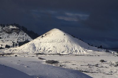
Puechs des Bondons sous la neige - © Jean-Pierre Malafosse  Geology
Puech d'Allègre and Puech de Mariette
Marker 2
These natural eccentricities with their generous proportions have reminded some of female forms. Were they at the origin of a fertility cult connected also with the menhirs and their phallic silhouettes? According to one legend, it was Gargantua who created the puechs by scraping dirt off his clogs. Geologically, the Cham des Bondons is part of the Causse de Sauveterre, to which it is connected by the Col de Montmirat pass. The limestone cham sits atop the granite bedrock of the Mont Lozère and offers remarkable landscapes, notably the Eschino d'Aze with its donkey's-back appearance, and the puechs, buttes of fossil-rich black marl.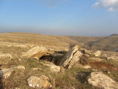
Dolmen des Combes - © Eddie Balaye  Archaeology
Dolmen at Les Combes
Marker 3
Of the megalithic monuments, dolmens (megalithic portal tombs) tend to be better-known than menhirs. They were linked to funeral practices from 3500 BC (end of the Neolithic) to 200 BC. The dead were deposited in these collective tombs alongside personal objects. Funeral practices offer precious clues for understanding the beliefs and organisation of ancient societies. These monuments are often located in spots that dominate the surroundings, and would certainly have reminded the living of the dead.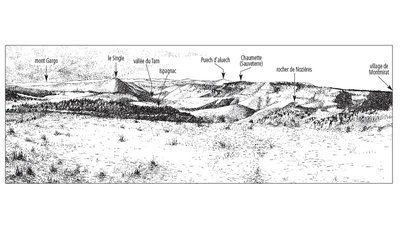
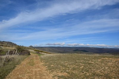
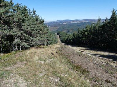
L'horizon des causses - © Olivier Prohin  Landscape
Panoramic viewpoint
Marker 4
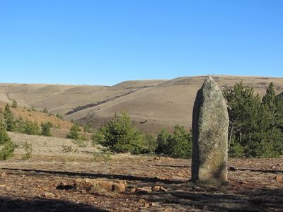
Menhirs de Chabusse - © Eddie Balaye ArchaeologyChabusse
Marker 5
The Chabusse berm, which cuts abruptly across the slope, has three handsome menhirs and a fourth modest and incomplete one, and also bears other traces of successive settlement. Dr Charles Morel, who published the first menhir inventory of the Cham des Bondons, reported that a large axe made out of polished granite was found here. This, in addition to other objects found more recently (shaped flints, arrowheads, scrapers, etc.), shows that the area was inhabited at the time of the menhirs. On the same site, excavations of two tumuli uncovered human remains from multiple burials and/or bone burials, along with objects dating from the Bronze Age to the beginning of the Roman occupation.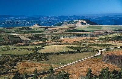
Les Puechs des Bondons vus du Rocher des Laubies - © Jean-Pierre Malafosse GeologyMines and menhirs
Marker 6
The region is scattered with geological faults, which are responsible for the presence of ores. Locally there is predominantly barite, but also zinc and silver-bearing lead. Scientific analyses carried out in local peat bogs demonstrate that lead was being mined 2,500 years ago and again a thousand years later. Recently a uranium deposit was mined in the municipality of Les Bondons. The fact that menhirs stand just above the seam has led some people to associate megalithism with the hypothesis of magnetism, though there is no scientific proof for this. Recent research has shown that the choice of location for menhirs is mainly linked to the way territory was organised at the end of the Neolithic.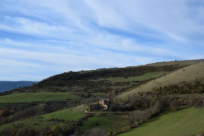
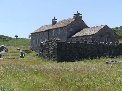
Le manoir d'Issenges - © CC Florac Sud Lozère  Architecture
The Manoir d'Issenges
This fortified house, built from 1624 onwards, is an example of a type of rural seigneurial estate inherited from the Middle Ages. The complex consists of three buildings: the main building with its almost square ground plan, and two long and low wings of farm buildings, which together enclose a courtyard open to the gardens to the east. The entrance is via an archway located at the southern corner of the main building. This building must have had four corner turrets, a projecting tower in the centre that contained the spiral staircase, and an entrance topped by a pediment. This fortified look was reinforced by musket slits and a parapet, or at least a brattice over the entrance gates. The turrets have been demolished and the central tower reduced in height. The mullioned windows have been preserved. A stone shows the date of 1624.
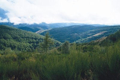
Draille de la Margeride - © CC Florac Sud Lozère  Pastoralism
The draille de la Margeride
The ascent to Issenges is on the draille de la Margeride. A draille is a path used by herds of goats during the transhumance: moving up to the mountain pastures in June and coming back down again in September.
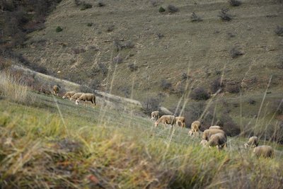
Troupeau de brebis - © com com Florac Sud Lozère  History
Transhumant history
“I moved my sheep to summer pastures all the way in the Margeride. I'm from up there myself. When I was a kid, there were many of us in the family, and whenever we saw a transhumant [seasonally migrating] shepherd pass by, my dad would say: one day you'll have to go off with a shepherd... I left and became a transhumant shepherd. My first stopover was Bonperrier. Then we'd eat at L'Hospitalet, and go down to Florac for the night. I moved pastures with 4,000 sheep.”
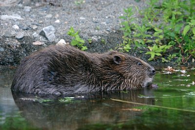
Castor au réfectoire - © Bruno Descaves  Fauna
FaunaThe European beaver (Castor fiber)
The calm deep stretches of the Tarn are good areas to settle for the European beaver, which lives in a lodge dug into the river bank. An essentially vegetarian animal, it bases its diet on cellulose. It eats young shoots, bark, aquatic plants, and foliage that is abundant in the riparian forest. It is thus useful in regulating the woody vegetation of river banks, facilitating the development of riverside fauna and flora. Through its activities, it prevents the potentially dangerous accumulation of dead wood during floods. It does not build dams.
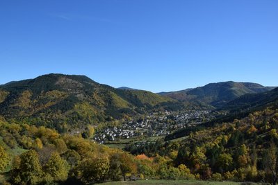
Vue sur le Lempezou et Florac - © CC Florac Sud Lozère LandscapeSummit of Mont Lempézou
Mont Lempézou is the mountain overlooking Florac and the Tarnon valley. From the Col (pass) of the same name, you can take a path to the summit. Panoramic views over the three valleys (Tarn, Tarnon, Mimente) will give you a better idea of the local hydrography.
La Draille du Languedoc - otcevennesmontlozere PastoralismThe Languedoc draille
This draille (path for seasonal livestock migration) is known as the Languedoc draille and has seen tens of thousands of sheep pass by that have come up the many drailles from the Midi, combining into ever larger flocks before reaching the summer pastures on the Mont Lozère plateau. The plant cover, grazed and trampled by so many sheep, had no time to grow back. A few flocks and a few shepherds still keep the tradition alive. Other flocks are brought to the summer pastures by lorry.
Boisement du Bougès sud - © Guy Grégoire  Flora
FloraThe Bougès state forest
This covers an area of about 3,300 hectares. Reforestation was carried out between 1880 and 1925, at the beginning of the agricultural decline, to fight the erosion caused by over-grazing. Today, the Office National des Forêts manages this forest, primarily with the goal of protecting the different forest species and ecosystems, but also with a view to making it productive. The forest is made up of a number of tree species, including spruce, silver fir, larch and Corsican pine. A varied fauna inhabits the forest (deer, wild boar, birds of prey). A few capercaillies, re-introduced by the Cévennes National Park, live in these wide open spaces. (Julie Hugon)
Gourdouze - nathalie.thomas HistoryGourdouze
In the 14th century, this village was a priory of Castagnols parish. In 1906 all its thatched roofs burned down. Parts of the village were bought by a private individual in the 1960s who greatly modified them. It subsequently became the property of the Cévennes National Park, which sold 250 hectares back to a Mont Lozère livestock cooperative: their herds maintain the space. The cooperative manages 1,200 hectares at Mas Camargues and Gourdouze. These uplands receive sheep and cattle herds from 15 May to 15 November.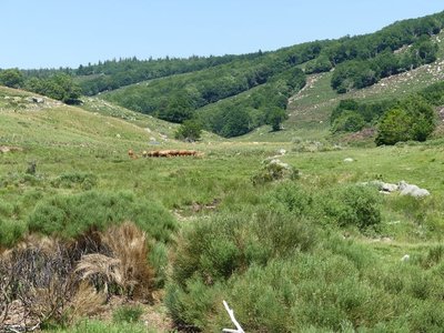
Troupeau au dessus de Gourdouze - nathalie.thomas  Know-how
Slash-and-burn
This technique consists of clearing weeds and shrubs using fire: the fire is utilised to get rid of broom, especially in places that a motorised shredder cannot access. Slash-and burn is carried out every 4 to 5 years in a zone chosen by the farmer. Over larger areas, it is supervised by the fire brigade. In the 19th century, 100,000 sheep migrated to summer pastures here (transhumance) and joined the plateau herds, leaving no room for broom. As soon as the meadows are no longer grazed, they are colonised by broom, then shrubs, then forest. These open spaces are due to human activity (clearing) to allow herds to graze on grass. Grazing prevents the spontaneous growth of shrubs and any generalised invasion of forest.- Agriculture
The tourism boom
Villefort dam, located a kilometre north of the village, was filled on 14 July 1964, creating an economic alternative to agriculture. Tourist activities developed: fishing, swimming and water sports. Local tourism is also founded on the canton's abundant natural heritage, with a great number of hiking trails, canyoning in the Chassezac gorge, skiing at the Mont Lozère ski stations, etc.
- History
Troubled times
Villefort was embroiled in the religious wars of the 16th and 17th centuries. In 1629, Henri de Rohan besieged the village. Rue de la Bourgade was torched by the Huguenots. In the 17th century, town walls were built around Villefort, which were demolished between 1808 and 1813. During the French Revolution, heraldic shields recalling the Ancien Regime were chiselled off walls, testament to the locals' hatred of their lords. A cross on Place du Portalet is a reminder of the 1794 execution of a defiant priest from Saint-Frézal-d'Albuges. The First World War caused many local casualties. During the Second World War, Villefort was occupied by the Germans. A resistance movement nevertheless emerged in the area, consisting of many different groups.
- History
The origins of Villefort
In the Middle Ages, Villefort was known as Villa Montisfortis, a name that might stem from a former Roman agricultural estate. At the time, a castle overlooked the village, of which nothing remains today. This castrum was strategically located on the heights of Le Collet (at the southern exit of Villefort) to protect the Regordane Way – and to collect tolls.
Description
- Departure : Villefort
- Arrival : Villefort
- Towns crossed : Villefort, Pourcharesses, Altier, Cubières, Cubiérettes, Mont Lozère et Goulet, Lanuéjols, Saint-Étienne-du-Valdonnez, Les Bondons, Ispagnac, Bédouès-Cocurès, Florac Trois Rivières, Pont de Montvert - Sud Mont Lozère, Cans et Cévennes, Cassagnas, Saint-André-de-Lancize, Saint-Privat-de-Vallongue, Vialas, Génolhac, Concoules, Ponteils-et-Brésis, and Saint-André-Capcèze
Forecast
Altimetric profile
Recommandations
Information desks

Office de tourisme Des Cévennes au mont Lozère
le Quai, 48220 Le Pont de Montvert sud mont-Lozère

Tourism office Mont-Lozère, Villefort
43, Place du Bosquet, 48800 Villefort
This office is part of the National Park's associated tourist-information network, whose mission is to provide information on, and raise awareness of, the sites and events as well as the rules that must be observed in the National Park's central zone.
Open year-round
Transport
- Line 251 Florac - Mende
- Line 253 Mende - Mont Lozère
- Line 261 Mont Lozère - Pont de Montvert - Florac
- Train line: Clermont-Ferrand - Nîmes (Villefort - Génolhac)
Access and parking
Parking :
Calculateur d'itinéraire Lio
Utilisez le calculateur liO pour organiser votre trajet en région Occitanie.
Autres régions
Calculez votre itinéraire en Auvergne Rhône Alpes sur Oùra
Source


Report a problem or an error
If you have found an error on this page or if you have noticed any problems during your hike, please report them to us here: