
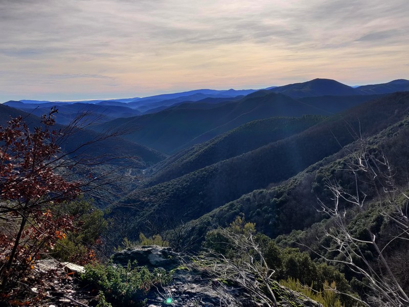
On Fageas ridge (day 2)
You briefly leave the catchment basin of the Vallée Borgne to look down over the Hérault valley, with the village of Valleraugue below. Higher up, the Aigoual dominates the surrounding mountains. Today you will be walking on the draille, a path that is thousands of years old and which livestock have been using for centuries.
3 points of interest
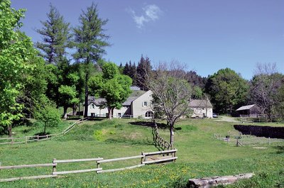
Aire de Côte - Stephan.Corporan  History
Aire de Côte
Aire-de-Côte farm was purchased by the French State in 1862, during the period of reforestation. Before the farm became a stopover gîte, it was for a long time the residence of the local forester and his family. In the first half of the 20th century, Aire-de-Côte was very different. To the north, behind the house, was the draille (drovers’ road), lined by upright stones and 40 to 50 metres wide. Thousands of transhumant animals passed every year on their way to or from summer pastures. The transhumant animals stopped there at lunchtime, then continued on towards Mont Aigoual.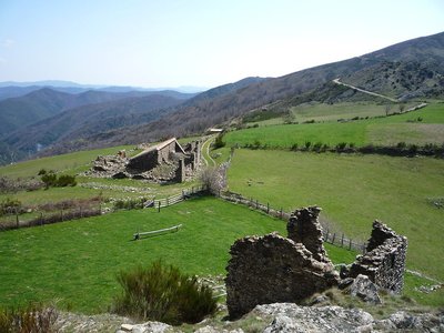
Les prairies de Bonperrier - Michel Monnot AgricultureBonperier
The etymology of this name is believed to be “good fields”. Indeed, there are fields surrounding the hamlet that are still maintained today. It is said that the hamlet’s inhabitants grew cereals. After harvest, they would take the wheat and rye down to the mill in the village. The oats, however, stayed in the hamlet as livestock fodder.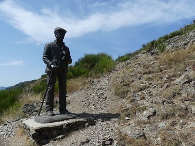
Le pastre - Nathalie Thomas AgricultureThe draille (drovers’ road) and the sheep bridge
The draille (drovers’ road) and the sheep bridge architecture The sheep bridge at the Col de l’Asclier is on an important draille (a traditional path for livestock migrating to the upland summer pastures of Mont Aigoual and Mont Lozère), which was also a King’s road during the Camisard revolt in the 18th century, a peddlers’ road and is now a long-distance hiking path. The Col de l’Asclier pass (from Occitan asclar, to split), where the road seems to go through a gap, is well-named: it lies on a fault line in the rock. But the most astonishing is the bridge, a bridge without road. It was built to help sheep flocks negotiate this difficult spot!
Description
From ”Aire de Côte” take the GR® 6-67 long-distance hiking path to “Col du Pas” via “Le Fageas”.
1) At “Col du Pas”, continue on the GR®6-67 to “Col des Traverses”, “Bonperrier”, “Col de l’Homme Mort”, “Col de l’Asclier”.
2) At “Col de l’Asclier”, go downhill on the road for 10 metres, then take on the right a path going downhill to “Mas Corbière” (yellow waymarks).
- Departure : Aire de Côte
- Arrival : Mas Corbière (municipality of Notre Dame de la Rouvière)
- Towns crossed : Bassurels, Saint-André-de-Valborgne, Val-d'Aigoual, and Les Plantiers
Forecast
Altimetric profile
Recommandations
Make sure your equipment is appropriate for the day’s weather conditions. Remember that the weather changes quickly in the mountains. Take enough water, wear sturdy shoes and put on a hat. Please close any gates and barriers behind you.
Information desks

Tourism & national parc'house
Col de la Serreyrède, 30570 Val d'Aigoual
The Maison de l'Aigoual houses the tourism office Mont Aigoual Causses Cévennes and the Maison du Parc national. This visitor centre provides information on and raises awareness of the Cévennes National Park, its sites and events as well as the rules that must be observed in the National Park's central zone.
On site: changing exhibitions, video projections, Festival Nature events and shop Open year-round

Tourism office Mont Aigoual Causses Cévennes, Lassale
Centre Viala, rue de la Place, 30460 Lasalle
This office is part of the National Park's associated tourist-information network, whose mission is to provide information on, and raise awareness of, the sites and events as well as the rules that must be observed in the National Park's central zone. : Open year-round

Tourism office Mont Aigoual Causses Cévennes, Saint-André-de-Valborgne
les quais, 30940 Saint-André-de-Valborgne
This office is part of the National Park's associated tourist-information network, whose mission is to provide information on, and raise awareness of, the sites and events as well as the rules that must be observed in the National Park's central zone.
Tourism office Mont Aigoual Causses Cévennes, Valleraugue
7 quartier des Horts, 30570 Valleraugue
This office is part of the National Park's associated tourist-information network, whose mission is to provide information on, and raise awareness of, the sites and events as well as the rules that must be observed in the National Park's central zone. : Open year-round
Calculateur d'itinéraire Lio
Utilisez le calculateur liO pour organiser votre trajet en région Occitanie.
Autres régions
Calculez votre itinéraire en Auvergne Rhône Alpes sur Oùra
Biodiversité autour de l'itinéraire
Report a problem or an error
If you have found an error on this page or if you have noticed any problems during your hike, please report them to us here: