
On the traces of the mouflon
“7 June 2005. Evening is falling on the Aigoual massif. The air is cooling down after this hot spring day. I'm sitting on a small rock overlooking the heath above the Taleyrac valley. I've been at my post for only a few minutes when a triangular head with two small horns emerges out of the broom a few metres away. There can be no doubt: it's a young mouflon!”
Nicolas Pagès, Fédération des chasseurs du Gard
8 points of interest
Mouflon brebis - © Chantal Daquo  Fauna
FaunaWhat is a mouflon?
Marker 1
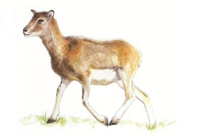
The mouflon is a ruminant mammal related to the domestic sheep. Its staple diet is herbaceous plants, which it finds in open spaces such as heaths. It also feeds on about a hundred other plants (ferns, mosses, mushrooms, etc.).The horns of the male (ram) are spiral-shaped and grow continuously, which makes it possible to estimate its age. The female (ewe) rarely has horns. The mouflon's life expectancy is around 14 years. Being an excellent climber, it can easily escape to steep areas in case of danger. These rocky zones also help limit the growth of its hooves through wear.
 History
André Chamson (1900-1983)
In his works, André Chamson constructed an imaginary Cévennes park. His writings bear witness to his love for the area and his attachment to his Huguenot ancestors. A nationally renowned writer, he was elected to the Académie française in 1956. His final works see time and death become more powerful than work or human faith.
Mouflons - © Gaël Karczewski FaunaThe saga of the mouflon
Marker 2
Twenty-three mouflons were introduced to this mountain range in 1954. They roamed the ridge rimmed by heath that you can see in front and to the right of you. Since introduction, the population has slowly grown on the Cevenol slopes. In 1999, the Gard Departmental Hunters' Federation in tandem with the Office National des Forêts, the Cévennes National Park, farmers and hunters took over the management and monitoring of the species. Since then, the population has grown steadily in the Aigoual area, and has recently started to settle other districts as well.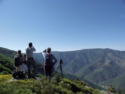
Formation mouflon, Aigoual, juin 2015 - © Michel Monnot  Landscape
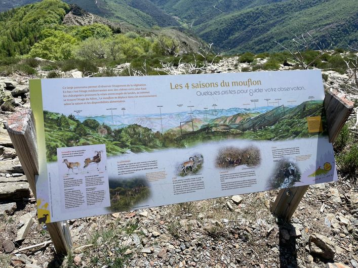
The 4 seasons of the mouflon
Marker 3
A vantage point for mouflon spotting, which is equipped with an information panel on how to detect mouflons and how to get your bearings in this vast landscape.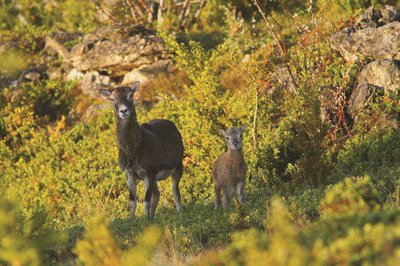
Quelques indices pour les repérer (au printemps et en été) - © Régis Descamps FaunaPic de Barette
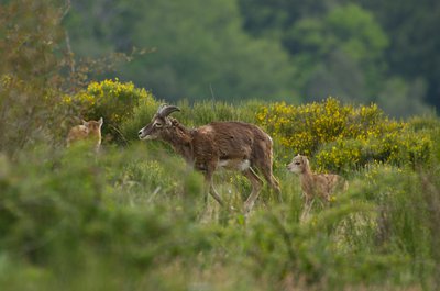
Marker 4
The Pic de Barette is a perfect viewpoint for spotting a great variety of animals, especially the golden eagle. Mouflons like to warm up in the sun and graze quietly on the slope opposite you, near the rocks that stick out of the forest. You will need patience and silence to spot mouflons. In spring and summer, their beige colour stands out against the rather green surroundings. In autumn and winter, it is easiest to make out the females' white 'face masks' and the males' saddles (white mark on the back).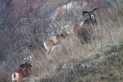
Mouflons - © Régis Descamps HistoryManaging the species
Marker 5
The Cévennes National Park is unusual for a national park in that hunting is allowed in its central zone. In the absence of large predators, hunting is considered compatible with maintaining a good natural balance. Local mouflons are subject to a compulsory hunting plan, which estimates the numbers to be culled every year. There is regular monitoring to check population levels. Knowing that a mouflon group grows by about 25% a year, it is possible to calculate the number of animals that can be culled without compromising the future of the herd.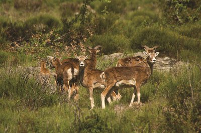
Groupes de femelles - © Gaël Karczewski HistoryHead counts
There are two methods for counting mouflons. “Relative abundance indices” estimate variations in the population. In May, observers position themselves in fixed spots at day's end and record the number of animals they see in 20 minutes. Head counts “by combined observation from a hide and from stalking” are used at the end of winter. Observers move through thickets where mouflons shelter. The groups of animals they disturb escape towards fixed observers, who count them. The mouflon population is currently estimated at around 200. Local actors and inhabitants are very involved in the monitoring and counting operations.
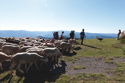
Passage de la transhumance au col de l'Asclié - © Olivier Prohin HistoryThe origins of the mouflon
Marker 6
L'Abeuradou is located on a draille, a drovers' road for shepherds and their flocks to move between the plains of Languedoc and summer pastures on the southern Massif Central. The name L'Abeuradou indicates that it is a spot where the flocks drink and rest before continuing their long hike. Today's domestic sheep is descended from the mouflon. Since being introduced to the slopes of Mont Aigoual, the mouflon has thus been rubbing shoulders with its cousin, which grazes here in summer. Their cohabitation does not seem to be a problem for the livestock farmers.
Forecast
Altimetric profile
Recommandations
In February 2020, a forest fire affected the path. Please respect the trail markings.
You are strongly advised to bring binoculars if you hope to spot mouflons.
Horse-riding or mountain-biking are not allowed on or adapted to discovery trails.
Information desks

Tourism & national parc'house
Col de la Serreyrède, 30570 Val d'Aigoual
The Maison de l'Aigoual houses the tourism office Mont Aigoual Causses Cévennes and the Maison du Parc national. This visitor centre provides information on and raises awareness of the Cévennes National Park, its sites and events as well as the rules that must be observed in the National Park's central zone.
On site: changing exhibitions, video projections, Festival Nature events and shop Open year-round
Access and parking
On the D 548 and D 329 from L'Espérou via the Col de la Lusette pass, towards Mandagout
On the D 170 from Le Vigan towards Mandagout, then on the D 329 towards L'Espérou / Col de la Lusette
Parking :
Calculateur d'itinéraire Lio
Utilisez le calculateur liO pour organiser votre trajet en région Occitanie.
Autres régions
Calculez votre itinéraire en Auvergne Rhône Alpes sur Oùra
Biodiversité autour de l'itinéraire
Source


Report a problem or an error
If you have found an error on this page or if you have noticed any problems during your hike, please report them to us here: