
A walk in Menhir Country
5,000 years ago, groups of humans settled the Cham des Bondons plateau and marked the landscape by erecting megaliths (imposing stone monuments). With almost 200 standing stones identified so far, this site has one of the most important concentration of menhirs in France. The five-kilometre trail showcases some of the monuments and has panoramic views over the Causses plateaux.
10 points of interest
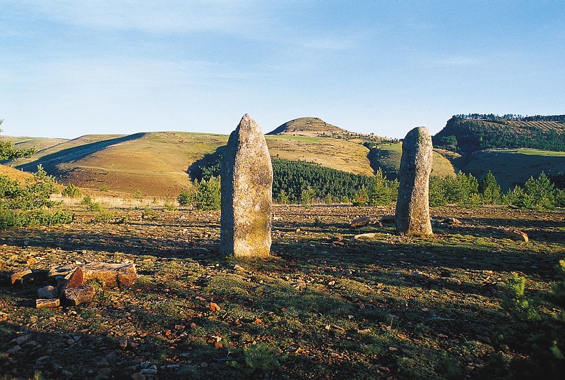
Pierre des trois paroisses - © Eddie Balaye  Archaeology
Three-Parish Stone
Marker 1
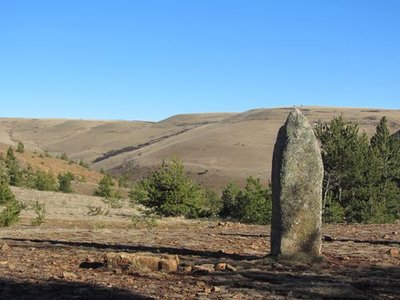
The most majestic menhir in this sector is known as the Three-Parish Stone because of its location at the point where the municipalities of Les Bondons, Ispagnac and Saint-Etienne-du-Valdonnez meet. There are many hypotheses as to the origins of the menhirs, ranging from the very rational to the very esoteric, but the stones retain a large share of mystery. Often weighing several tonnes, they were extracted, shaped and moved – in some cases over distances of several kilometres – before being erected. For what purpose? Archaeology allows us to find clues to the daily life of prehistoric humans; their world view and spirituality, however, remain largely unknown.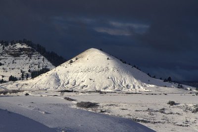
Puechs des Bondons sous la neige - © Jean-Pierre Malafosse  Geology
Puech d'Allègre and Puech de Mariette
Marker 2
These natural eccentricities with their generous proportions have reminded some of female forms. Were they at the origin of a fertility cult connected also with the menhirs and their phallic silhouettes? According to one legend, it was Gargantua who created the puechs by scraping dirt off his clogs. Geologically, the Cham des Bondons is part of the Causse de Sauveterre, to which it is connected by the Col de Montmirat pass. The limestone cham sits atop the granite bedrock of the Mont Lozère and offers remarkable landscapes, notably the Eschino d'Aze with its donkey's-back appearance, and the puechs, buttes of fossil-rich black marl.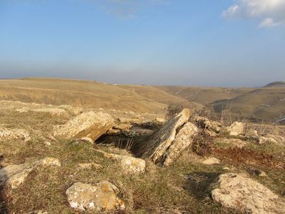
Dolmen des Combes - © Eddie Balaye ArchaeologyDolmen at Les Combes
Marker 3
Of the megalithic monuments, dolmens (megalithic portal tombs) tend to be better-known than menhirs. They were linked to funeral practices from 3500 BC (end of the Neolithic) to 200 BC. The dead were deposited in these collective tombs alongside personal objects. Funeral practices offer precious clues for understanding the beliefs and organisation of ancient societies. These monuments are often located in spots that dominate the surroundings, and would certainly have reminded the living of the dead.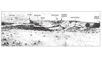
L'horizon des causses - © Olivier Prohin  Landscape
Panoramic viewpoint
Marker 4
Menhirs de Chabusse - © Eddie Balaye ArchaeologyChabusse
Marker 5
The Chabusse berm, which cuts abruptly across the slope, has three handsome menhirs and a fourth modest and incomplete one, and also bears other traces of successive settlement. Dr Charles Morel, who published the first menhir inventory of the Cham des Bondons, reported that a large axe made out of polished granite was found here. This, in addition to other objects found more recently (shaped flints, arrowheads, scrapers, etc.), shows that the area was inhabited at the time of the menhirs. On the same site, excavations of two tumuli uncovered human remains from multiple burials and/or bone burials, along with objects dating from the Bronze Age to the beginning of the Roman occupation.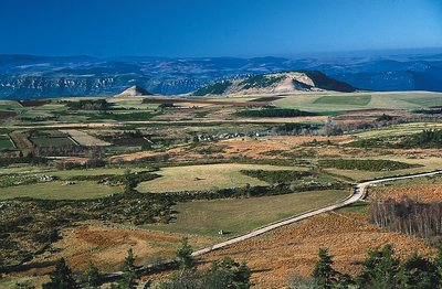
Les Puechs des Bondons vus du Rocher des Laubies - © Jean-Pierre Malafosse GeologyMines and menhirs
Marker 6
The region is scattered with geological faults, which are responsible for the presence of ores. Locally there is predominantly barite, but also zinc and silver-bearing lead. Scientific analyses carried out in local peat bogs demonstrate that lead was being mined 2,500 years ago and again a thousand years later. Recently a uranium deposit was mined in the municipality of Les Bondons. The fact that menhirs stand just above the seam has led some people to associate megalithism with the hypothesis of magnetism, though there is no scientific proof for this. Recent research has shown that the choice of location for menhirs is mainly linked to the way territory was organised at the end of the Neolithic.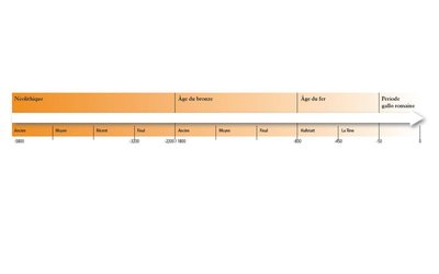
Chronologie de la Préhistoire - © Olivier Prohin  History
Les Combettes
Marker 7
The village of Les Combettes is built in a natural depression, as its name indicates (combette = little valley). The exhibition on display in the communal oven building emphasises how late Mont Lozère was first settled. By the Upper Neolithic (around 3500 BC), the region of the Grands Causses was widely settled, following a population increase. The first agro-pastoral communities formed, creating farms and villages and clearing land to grow cereals and breed livestock, whilst still hunting and gathering. These groups are behind local megalithism. The age of metals put an end to the practice of erecting menhirs, but dolmens were in use for a while longer.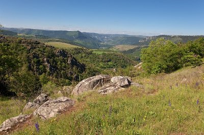
Gorges depuis la combe des Cades - © Guy Grégoire LandscapeConstructing landscapes
Marker 8
Did the menhir-builders move in the same landscape that we see today? Current archaeological knowledge does not allow us to reproduce with great accuracy what the landscape of Mont Lozère’s slopes would have looked like in the late Neolithic. Yet the birth of agriculture and livestock rearing in the Neolithic without doubt opened a new chapter in the relationship between humans and nature. For the first time in their history, populations designed the landscape by dotting it with monuments, but more importantly by developing agricultural and pastoral activities. Today – 5,000 years later – human interventions are carried out based on Natura 2000 measures, which focus notably on keeping open spaces intact and maintaining agro-pastoral activities.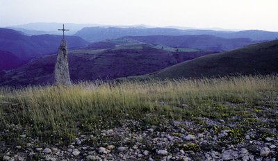
Menhir christianisé des Combes - © Michèle Sabatier  Tradition
Throughout time
Marker 9
For millennia, the menhirs stayed put – adored or ignored, sometimes re-used – despite the wear and tear of time. During Christianisation in the early Middle Ages, they became too troublesome. Menhirs were thus laid flat and a few had crosses erected on them so as to conquer pagan cults.
More recently, some monuments have been moved to allow plots of land to be cultivated, and many others have been divided up and used as construction materials. After considerable work making an inventory of the menhirs, over 200 are now known and protected, of which 70 have been put upright again. Here, however, there are signs that vandalism and ignorance can still strike.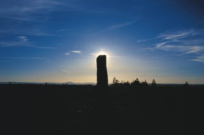
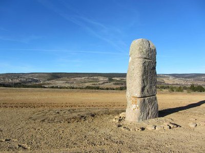
Menhir des Bondons - © Rémi Noël TraditionFairy country
Marker 10
At Les Bondons, the common place names of Peyrefiche, Peyre Plantade and Perjazen are associated with those of Peyre de la Vieille, Terre de Malavieille and La Fare, fares and vieilles being synonyms for “fairy” in local folklore. Today, a very large number of place names all over Europe still refer to the presence of former megaliths, even where those are hidden or have disappeared.
Description
The path goes downhill on a wide draille (drovers' road) that has a superb viewpoint over the Causses plateaux, before gradually reaching the Chabusse plateau and the hamlet of Les Combettes. After a quick there-and-back within the hamlet itself (exhibition in a former oven building), you gently go uphill again in Les Cades valley, a Natura 2000 site, on a wide track that winds between pastures and pine forests.
- Departure : Menhirs car park
- Arrival : Menhirs car park
- Towns crossed : Saint-Étienne-du-Valdonnez, Les Bondons, and Ispagnac
Forecast
Altimetric profile
Recommandations
Information desks

Tourism'house and national Parc at Florac
Place de l'ancienne gare, N106, 48400 Florac-trois-rivières
This office is part of the National Park's associated tourist-information network, whose mission is to provide information on, and raise awareness of, the sites and events as well as the rules that must be observed in the National Park's central zone.
On site: exhibitions, video projections, events and shop Open year-round
Access and parking
On the RD 35 road between the Col de Montmirat pass and Le Pont de Montvert. The car park and starting-point are at the crossroads of the RD 35 with the Route des Combes.
Parking :
Calculateur d'itinéraire Lio
Utilisez le calculateur liO pour organiser votre trajet en région Occitanie.
Autres régions
Calculez votre itinéraire en Auvergne Rhône Alpes sur Oùra
Biodiversité autour de l'itinéraire
Source

Report a problem or an error
If you have found an error on this page or if you have noticed any problems during your hike, please report them to us here: