
Villefort
Villefort, a one-road village at the foot of Mont Lozère, was built along a north-south geological fault between granite bedrock and schist. Its location on the Regordane Way, which was an economic and cultural artery during the Middle Ages, stimulated its growth. Villefort experienced another boom around 1860, becoming a true commercial hub of the Cévennes, when its train station – one of the main stations of the railway through the Cévennes – was built.
16 points of interest

 History
The origins of Villefort
In the Middle Ages, Villefort was known as Villa Montisfortis, a name that might stem from a former Roman agricultural estate. At the time, a castle overlooked the village, of which nothing remains today. This castrum was strategically located on the heights of Le Collet (at the southern exit of Villefort) to protect the Regordane Way – and to collect tolls.
- History
The Regordane Way
The Regordane Way linking Alès (Gard) and Luc (Lozère) is a section of the important route that connected Lower Languedoc and the Auvergne in the Middle Ages. It facilitated trade between the Mediterranean basin and parts of the Kingdom of France. The mule-drivers that used it – known locally as Régordans or Rigourdiers – transported oil, wine and salt. It was also a religious path, taking pilgrims called Romieux to Saint Gilles It was progressively abandoned in the 14th century, when the port at Marseille and the fairs in Lyon grew in importance. Ruts left by cartwheels can still be seen north of Prévenchères (between Le Thort and La Molette) and near Saint-André-Capcèze.
 Architecture
Stone architecture
The architecture of Villefort's old buildings is typical for one-street villages:
• the houses with the two vaulted porches were once inns, tradesmen's or artisans' shops: one of the porches was used to store merchandise, the other to display it;
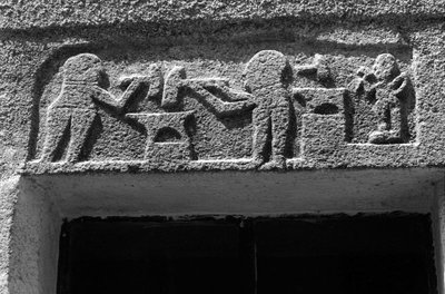
• the sculpted lintels above the entrances to some houses on Rue de l'Eglise and Rue de la Bourgade bear witness to the activities of former occupants;
• several facades have handsome mullioned windows from the Renaissance.- Architecture
Rue de l’Église
The town hall is a former private mansion of the 15th century, with a spiral staircase and ground-floor rooms with vaulted ceilings. The lintel behind the gate comes from a fortified house in the village of Bayard, which is now under the waters of the Lake. On the facade of the 16th century house opposite is a finely crafted mullion window.
• The oldest house in the village is a listed monument and dates from the 14th century. It has Gothic windows and a pulley system once used to bring forage into the loft.
• An archway giving onto an internal courtyard shows you mediaeval walls made from large regular blocks.
• Two lintels bear Christ's monogramme: IHS, Iesus Hominum Salvator (Jesus saviour of mankind). One instance is followed by the inscription Ave Maria. - Agriculture
The sweet chestnut
In 1900, sweet chestnuts were the main farm produce. The nuts of this so-called “bread tree” fed many families as well as their farm animals. Chestnut-growing is a year-round activity, but is especially busy at harvest time. Harvesters would meet in the evening for a brousillade (chestnuts roasted on a wood fire). When parts of the rural population left, many chestnut orchards were abandoned while others were cut down for their tannin to be extracted. Chestnut bleeding canker and chestnut blight, diseases caused by mushrooms, also killed off a great number of trees. Today, chestnut farming in the Cévennes is being revived with a focus on quality.
- History
How the village is arranged
Located at an altitude of 605 m, Villefort developed as a one-street village alongside the Regordane Way (now known as Rue de l'Eglise and Rue de la Bourgade). In the 19th century, a main road was built through Villefort and became its main traffic artery. Today it is called Avenue des Cévennes.
- History
The Paris to Marseille railway line
From 1865 onwards, the P.L.M. (Paris-Lyon-Marseilles) Company constructed the railway line that the Cévenol train still uses to link Paris and Marseilles via Clermont-Ferrand, Alès and Nîmes. The line helped to open up the area and was thus a real asset for the towns located along its path in the Lozère. New occupations were created: P.L.M. employee (during construction) or dispatcher of local products (e.g. chestnuts from the Borne valley). But the disappearance of mule trains struck a blow at the local economy, in particular craftsmen and innkeepers.
 Archaeology
Place de l'Ormeau
Villefort's former market square, Place de l'Ormeau hosted Clédou market on Thursday mornings until the 1980s. The square teemed with smells and colours. Livestock, meat, vegetables, grains and chestnuts were sold here, especially in the 19th century. The lime tree on the square was planted on 11 November 1920 as a “victory tree” so that future generations might remember their ancestors' fight for freedom during the First World War. The Maison Chambon, with its double-archway entrance, has an inscribed lintel: Metre Iehan Martin 1595, flanked by a diamond shape and a heart.
- Agriculture
The tourism boom
Villefort dam, located a kilometre north of the village, was filled on 14 July 1964, creating an economic alternative to agriculture. Tourist activities developed: fishing, swimming and water sports. Local tourism is also founded on the canton's abundant natural heritage, with a great number of hiking trails, canyoning in the Chassezac gorge, skiing at the Mont Lozère ski stations, etc.
- History
Troubled times
Villefort was embroiled in the religious wars of the 16th and 17th centuries. In 1629, Henri de Rohan besieged the village. Rue de la Bourgade was torched by the Huguenots. In the 17th century, town walls were built around Villefort, which were demolished between 1808 and 1813. During the French Revolution, heraldic shields recalling the Ancien Regime were chiselled off walls, testament to the locals' hatred of their lords. A cross on Place du Portalet is a reminder of the 1794 execution of a defiant priest from Saint-Frézal-d'Albuges. The First World War caused many local casualties. During the Second World War, Villefort was occupied by the Germans. A resistance movement nevertheless emerged in the area, consisting of many different groups.
- History
Merchants and craftsmen
Local crafts first emerged in the Middle Ages. In the late 18th century, lead mining began in the area, affording farmers another source of income. A foundry was built upstream of the village. A century later, the attraction of industry and the city led to a rural exodus and the decline of trade and crafts.
Villefort, rue de la Bourgade, maison de forgeron, enseigne sculptée - © Guy Grégoire ArchitectureRue de la Bourgade
At the southern end of Rue de la Bourgade is the birthplace of Odilon Barrot (1791-1873), an eminent barrister at the Toulouse parliament and the court of appeal, parliamentarian, president of the council of ministers, etc. A plaque was put up on the wall in 1991. In this street, you can also see two lintels dated 1617 and 1620 respectively, as well as a third that has been sculpted to indicate a blacksmith's workshop (on a house near Avenue de la Gare).
- History
Religious buildings and pilgrimages
Rue de Rome leads to Saint-Jean Chapel, also called gleisetto (little church). In the Middle Ages, sick pilgrims or pilgrims looking for a roof for the night were welcomed in this former Romanesque chapel-turned-residence. A leper colony was attached to it. Further north, Saint-Loup-et-Saint-Roch Chapel overlooks the Lake. It was built to look exactly like a Romanesque edifice of the 12th or 13th century, on the precise site where a hermit, who had followed the example set by St-Loup, had his shelter. It has been restored several times. St-Loup is the region's patron saint; St-Roch has been associated with him since the 1720 plague. Two pilgrimages persist to this day: on 29 July for St-Loup and on 16 August for St-Roch.
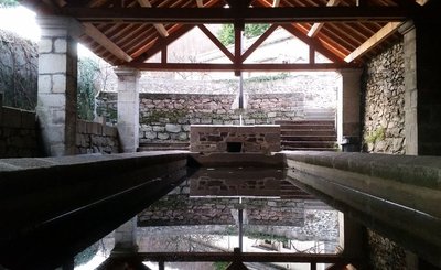
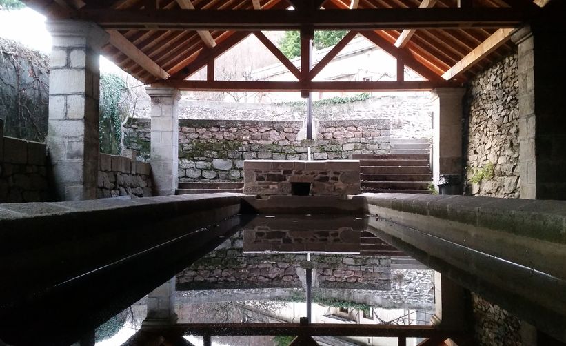
Lavoir de Villefort - OT Mont Lozère HistoryLavoir
This 19th-century granite washing place has two basins. Laundry was beaten in the large basin using a washing bat, then rinsed in the clear water of the smaller basin which was fed by the river. You can still see the traces of soot from the stoves used to boil water. This lively site, where the grievances and joys of the washerwomen resounded, was in use until the 1950s.
 Water
WaterRiver network
The river Palhères flows through Villefort on its way down from Mont Lozère. It goes through one of the two mismatched Gothic arches of Saint Jean bridge. This humpback bridge dates from the 14th century. Two rivers flow through the centre of the village, under Place du Bosquet. Having become unsanitary after being used as drains and latrines, they were vaulted over for reasons of hygiene in 1934. This created both the square and Rue des Jardins.
 Tradition
The fairs at Villefort
Since 1511, Villefort market has been held on Thursday mornings. In the early 19th century, there were up to 14 fairs a year. Children had to attend mass at Saint-Loup-et-Saint-Roch Chapel to be allowed to go to the fairs. Large crowds were attracted to the fairs by their good reputation. The fair held on 14 September was one of the most impressive, with countless cattle blocking the village's squares and lanes. Today, Villefort is a lively place with bric-a-brac shops and artisan fairs.
Description
A few clarifications:
• To reach Panels 5 (How the village is arranged) and 6 (Paris-Marseille train line), go up Rue du Chazalet and take the first lane on the right. Take a small path (GR 44) that climbs about 50 m to the viewpoint.
• To get to Panel 13 (River network), continue along Impasse du Lavoir and take the first road on the left, which heads downhill to the river.
- Departure : Pharmacy in the centre
- Arrival : Place du Bosquet
- Towns crossed : Villefort
Forecast
Altimetric profile
Recommandations
This path has 14 numbered information panels.
Information desks

Tourism office Mont-Lozère, Villefort
43, Place du Bosquet, 48800 Villefort
This office is part of the National Park's associated tourist-information network, whose mission is to provide information on, and raise awareness of, the sites and events as well as the rules that must be observed in the National Park's central zone.
Open year-round
Transport
- Bus line 254 Mende – Villefort – La Garde Guérin.
- Train line Nîmes - Clermont-Ferrand
Access and parking
From Mende on the D 901, or from Florac on the D998, then on the D 906 towards Génolhac to Villefort centre
Parking :
Calculateur d'itinéraire Lio
Utilisez le calculateur liO pour organiser votre trajet en région Occitanie.
Autres régions
Calculez votre itinéraire en Auvergne Rhône Alpes sur Oùra
Biodiversité autour de l'itinéraire
Source

Report a problem or an error
If you have found an error on this page or if you have noticed any problems during your hike, please report them to us here: