
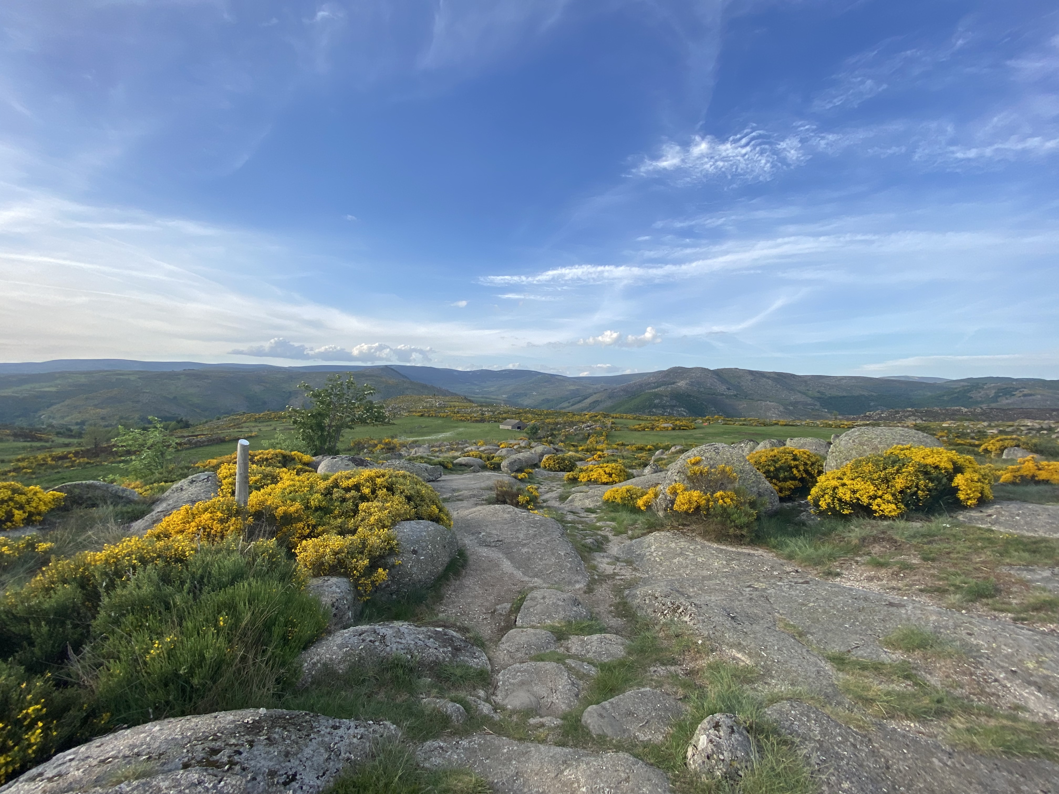
The Cham de l'Hermet plateau
The Cham de l'Hermet, on the north slope of the Bougès, showcases the diverse landscapes of the Tarn valley, including the L'Hermet plateau where the handsome granite hamlet of the same name is situated. The downhill section towards Le-Pont-de-Montvert offers magnificent panoramic views onto the entire Mont Lozère mountain range with its highest point, Pic de Finiels (1,699 m).
13 points of interest

 Natural environment
Natural evolution of beech and oak groves
Marker 1
This steep terrain consists of a mass of fallen granite rocks (scree), which makes it unusable by domestic animals. The beeches and chestnuts growing here have thus evolved naturally, the only intervention being felling for timber or firewood. Other species are also associated with tree cover (hazelnuts, blueberries, ferns, etc.), as well as rocks covered in mosses, which attest to the relatively damp conditions.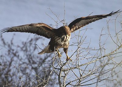
Buse variable - © Régis Descamps  Landscape
The Tarn valley and its landscapes shaped by human activity
Marker 2
The open scenery overlooking the Tarn offers a grand panorama. The landscape has been profoundly shaped by the presence of humans and their flocks. Farmers practise slash-and-burn farming to contain the spreading forest. This needs to be regularly repeated to stop Pyrenean broom from getting the upper hand. On the plateau, you will see hay meadows and, along the edges of plots, pruned ash trees (whose branches are used as animal fodder in the autumn). Some birds of prey like these open spaces, where hunting rodents is easier. Architecture
L'Hermet hamlet
Marker 3
A viewpoint indicator explains the architecture of the hamlet. Geology
Granite boulders
Marker 4
Granite, which is used for dressed stone as you saw in the hamlet, is a vulnerable rock on the geological timescale. The erosive power of water is furthered by the cracks that divide the rock. These occur because of the stresses to which granite – which rose as magma at the end of the Paleozoic – has been exposed since cooling. The speed of this erosion depends on the climate. This is why whole, undamaged granite blocks break off. They form particularly picturesque block fields (felsenmeer) once the coarse sands have disappeared.- Natural environment
Scots Pine forest (Pinus sylvestris)
Marker 5
The Scots pine is a typical example of a dynamic, sun-seeking species that colonises soils impoverished by centuries of grazing. Its winged and light seeds can be carried over several hundred metres by the wind, thus enabling it to spread rather quickly. Here we are in a young pine forest that is winning the battle against callune (heather). Its pale foliage lets light penetrate to the undergrowth and enables other species (oak, beech or fir) to grow. They will eventually dominate the pines by depriving them of light.  Fauna
FaunaPine-forest fauna
Pine forests associated with blueberry zones are interesting environments for fauna: stags and roe deer come to browse the blueberry plants. Wild boar, foxes, martens and all birds eat their berries, including the Western capercaillie, which was reintroduced here by the National Park. You can also find coal tits, European crested tits, wrens, robins, mistle thrushes and black woodpeckers. Some birds of prey, such as the short-toed snake eagle, may come and build their nests at the highest point of a topped Scots pine.
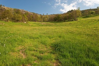
Prairie vers l'Hermet - © Guy Grégoire Natural environmentHeath alternating with hay meadows
Marker 6
Callune has established itself on the knolls, meaning the convex areas which have poor and dry soils, whereas the meadows occupy the concave areas with their deeper and damper soils. All of these territories offer food sources for specific fauna. You may see hares, but also birds of prey (buzzards, hen and Montagu’s harriers, short-toed snake eagles, common kestrels) and red-legged partridges.- Architecture
A sheepfold in ruins
Marker 7
You need to leave the path on the left and walk for about 200 metres to see this former shelter for farm animals (ovines and bovines). The materials for its construction were found locally: granite for the walls, Scots pine or oak for the timber part of the roof, rye thatch for the roof. The variety of rye grown locally had fine long straw. It was cut by scythe at the end of July and put into swathes, then stored in stacks and threshed on threshing-floors. Finally it was made into small sheaves, which were soaked before use to make the last seeds germinate and make the straw less breakable during thatching. - Landscape
Panorama
Marker 8
Views of the southern slope of Mont Lozère - Architecture
Sheepfold with lauze-covered roof
Marker 9
Unlike the previous sheepfold, this one was built out of heavy, compact and solid materials. A granite vault instead of a timber roof suggests the rarity of wood. The roof was made watertight by schist lauzes (tilestones) on a bed of clay or coarse granite sand. This place is called La Jasse de Chanteloup (jasse/jas: resting place for animals; canteloube in popular etymology = place where the wolves howl, or, according to scholarly sources, luppe = stone, height, rounded mountain). - Geology
A rolling stone...
Marker 10
On the plateau, the path has not always made a very distinct mark on the ground, evidence of little erosion. By contrast, the entire descent towards Le Pont-de-Montvert shows signs of more intense erosion, especially near the top where a large block has rolled into the middle of the path. It is the repeated passage of humans and animals that, combined with natural factors, eventually destabilised the rock. After the rock moved, the path was re-routed. 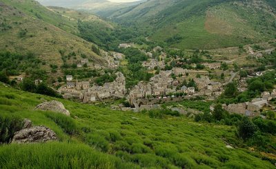
Chemin des camisards - © Brigitte Mathieu  History
The Camisards' path
Marker 11
This path used to be an important communication route linking Le Pont-de-Montvert with Barre-des-Cévennes. On 24 July 1702, it was used by a gathering of Huguenots coming from the Col des Trois Fayards, who intended to liberate their fellow Protestants being held by Abbot du Chayla in Le Pont-de-Montvert. These men thus used the path on which you stand. The tragic events that followed (including the Abbot’s violent death) triggered the Camisard War. The landscape surrounding the village is the result of intense agricultural activity. All neighbouring slopes were cultivated, especially with rye, on man-made terraces called bancels.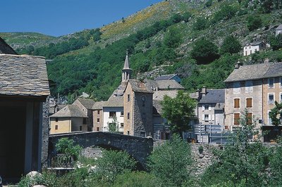
Le Pont-de-Montvert - © Guy Grégoire HistoryPont-de-Montvert
Marker 12
Le Pont-de-Montvert is at the confluence of the Tarn and two of its tributaries: the Rieumalet and the Martinet. The draille (drovers’ road) has today almost disappeared, but it was once used by flocks from the south of France to reach the summer pastures on the Mont Lozère. The first neighbourhoods were established along this axis. In 1630 the village was almost as extensive as in the early 19th century. Three stone bridges were built over the rivers, but the great floods of 1827 and 1900 seriously damaged or destroyed them. The grand Tarn Bridge is the only stone bridge still standing. New neighbourhoods developed on the village’s periphery, preserving the historic centre.
Description
Start at the Tour de l'horloge (clocktower), cross the bridge over the Tarn and turn right.
- Departure : Tour de l'Horloge (clocktower)
- Arrival : Tour de l'Horloge (clocktower)
- Towns crossed : Pont de Montvert - Sud Mont Lozère
Forecast
Altimetric profile
Recommandations
Information desks

Tourism'house and national Parc at Florac
Place de l'ancienne gare, N106, 48400 Florac-trois-rivières
This office is part of the National Park's associated tourist-information network, whose mission is to provide information on, and raise awareness of, the sites and events as well as the rules that must be observed in the National Park's central zone.
On site: exhibitions, video projections, events and shop Open year-round
Transport
Bus stop: Abri-bus route de Finiels
- Bus line 261 “Florac – Le Pont de Montvert – Mont Lozère”, every day in July and August
https://lio.laregion.fr/
Access and parking
Le Pont-de-Montvert, on the D 998 from Florac
Parking :
Calculateur d'itinéraire Lio
Utilisez le calculateur liO pour organiser votre trajet en région Occitanie.
Autres régions
Calculez votre itinéraire en Auvergne Rhône Alpes sur Oùra
Biodiversité autour de l'itinéraire
Source

Report a problem or an error
If you have found an error on this page or if you have noticed any problems during your hike, please report them to us here: