
The Roof of the Cévennes (by mountain-bike)
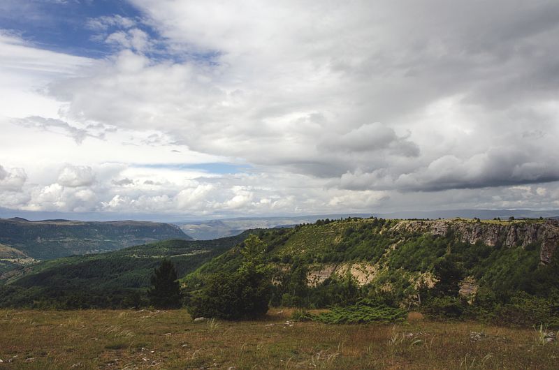
The Tarnon valley is shaded by the old beech groves of Le Marquairès state forest. At the Col de Salidès, views open up onto the characteristic landscapes of the National Park. In the distance, flocks of sheep still graze on the limestone plateau of the Can de l'Hospitalet sitting on its schist platform.
5 points of interest
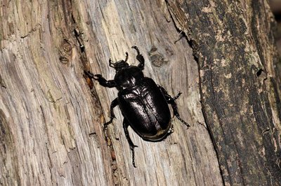
Pique prune (Osmoderme) - © Jean Pierre Malafosse  Fauna
FaunaHermit beetle (Osmoderma eremita)
This beetle is a declining, endangered and protected species. It is considered a reliable bio-indicator of environmental quality. An essential link in the proper functioning of forest environments, it likes mature deciduous forests and dead wood. The specific management of the strict nature reserve of Le Marquairès favours its development. Here, forestry is forbidden, and the forest is left to evolve naturally.
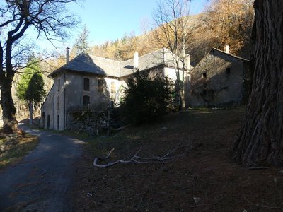
Maison forestière du Marquairès - nathalie.thomas  History
1938: the forestry road
You are on the “road of the unemployed”. From 1936 to 1939, the crisis that shook the country led the government to put in place social programmes giving the jobless employment on major works: forest planning, thinning out tree stands, opening up new roads, etc. This road was created using shovels, picks and axes by 20 or so unemployed men and some locals. The “unemployment card” of the day gave the unemployed the right to a bonus when they worked on major works. A refectory was set up in the forester’s house at Le Marquairès, then at Les Cabanes (at the other end of the road); locals brought their own food.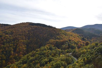
Vue sur la vallée du Trépalou - © com com Florac Sud Lozère  Water
WaterThe Tarnon
The Tarnon is 38.9 km long and has its spring on the Aigoual massif (1,565 m) in the municipality of Bassurels. After its confluence with the Mimente, it flows into the Tarn downstream of Florac. It separates the Causse Méjean plateau from the Cévennes. Upstream of Rousses, the Trépalous flows into the Tarnon. This small river has carved out the Tapoul Gorge, which is famous for canyoning. The Tarnon is a Cévenol river: very abrupt and intense floods can occur during extreme weather events.
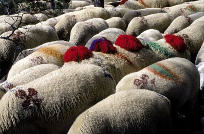
Transhumance - © Michelle Sabatier AgricultureThe Margeride draille (drovers’ road)
The draille follows the ridge and crosses the Can de l'Hospitalet plateau. This transhumant trail enables the sheep flocks of the plains (of the southern Cévennes and the Crau) to move up to northern Gévaudan (Aubrac, Margeride, Mont Lozère). This draille is only one branch of a larger network along which transhumant livestock still travel.
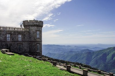
Météosite de l'Aigoual - © Olivier Prohin WaterMont Aigoual
A beautiful view onto Mont Aigoual (1,567 m) – a mountain of winds, fog, snow and rain. Banks of clouds coming from the Mediterranean rub against its slopes and can cause violent precipitation (also called Cévenol episodes). This temperamental mountain is home to the last mountain weather-station in France.
Description
Mountain-bike route #14. From the village, take the D 907 for 4 km towards the Tunnel du Marquairès. Before the tunnel, fork right towards Le Marquairès forester's house and continue on the forestry track to Gaseiral. Take the road uphill to the Col de Salidès and there take the ridge track on your left to L'Hospitalet (GR 7). After about 3 km, take the track on the left that leads back to Rousses.
- Departure : Rousses
- Arrival : Rousses
- Towns crossed : Rousses and Bassurels
Forecast
Altimetric profile
Recommandations
No cycling off-track. You are strongly advised to wear a helmet. Do not forget your repair kit and a small set of tools. Please shut all gates and barriers after yourself. Slow down in farms and hamlets.
Access and parking
From Florac or Meyrueis, take the D 996 to Vébron. In Vébron, take the D 907 to get to Rousses
Parking :
Calculateur d'itinéraire Lio
Utilisez le calculateur liO pour organiser votre trajet en région Occitanie.
Autres régions
Calculez votre itinéraire en Auvergne Rhône Alpes sur Oùra
Biodiversité autour de l'itinéraire
Source


Report a problem or an error
If you have found an error on this page or if you have noticed any problems during your hike, please report them to us here: