
Massevaques
This is an incredibly varied trail – through beech forests, along a ridge with views onto the cliffs of the Causse Méjean, through a hundred-year-old chestnut grove and past unexpectedly handsome isolated hamlets – which ends in riverside meadows.
5 points of interest
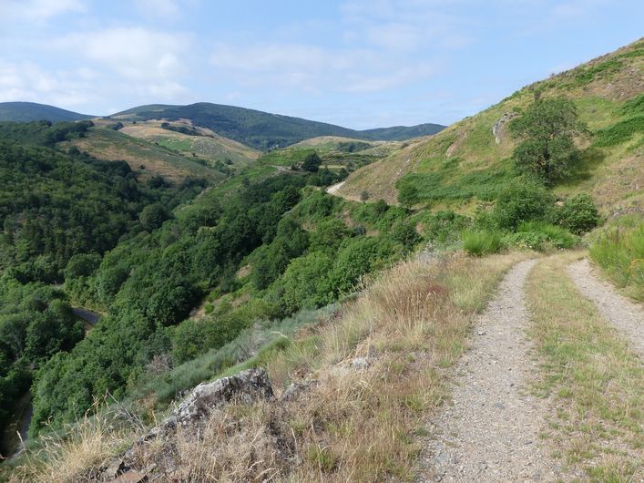
Chemin vers Le Gua - N Thomas AgricultureSmall walls and terraces
"The path, lined in places by a wall, used to lead from Rousses to Massevaques. Some locals still remember having used it to get back up to Massevaques after a wake in Rousse. At the start of the path, you can see on your left the small walls of two bancels (crop terraces), where rye was grown. Then you enter the beech forest. This slope is exposed to the north and west winds, which suits beech, but it is only in the more protected vales that you will find a few sweet chestnuts interspersed with conifers. This forest is still exploited by the inhabitants of the district, who cut their firewood here.” (P. Grime)
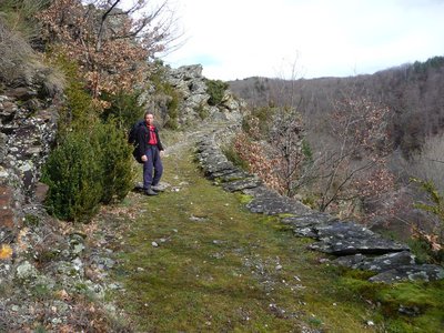
Vue sous le col de Porte - PnC-N Thomas  History
Col des Portes
This col (pass)] used to be pastureland, but has now been abandoned by the local flocks. Oral tradition states that a battle between Camisards and Catholics took place at this pass. The inhabitants of Rousses and Fraissinet-de-Fourque were in fact in conflict over grazing rights. The former were overwhelmingly Protestants, while the latter were Catholics. It is said that the graves are at the col and that a bird, incarnating the soul of the dead, comes to sing there when anyone passes by.
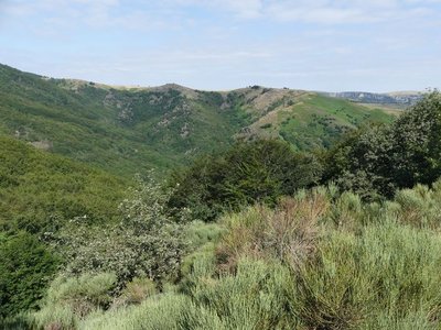
Chemin entre Massevaques et Rousses - PnC - N Thomas HistoryMassevaques
Massevaques has had up to 80 inhabitants. It was after the First World War that desertification intensified. Those who returned from the fighting chose to work in administration: the railways, the police... There are currently two year-round households left in Massevaques.
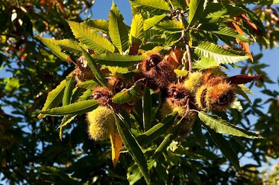
Bogue de châtaigne - © Bruno Daversin AgricultureThe sweet chestnut: the tree of life
This tree used to be a presence throughout the lives of the Cévenols, and was considered the tree of life. Its wood was used for building cradles, one's furniture and roof structures. It was also used for firewood. The fruit was eaten in bajanat, a soup made from dried chestnuts (bajanes), or ground into flour. Chestnuts were dried in clèdes, small schist buildings located in the orchards. The fruit also fed the farm's animals.
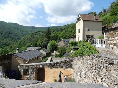
Le village des Ablatats - PnC-N Thomas HistoryLes Ablatats : village of refuge
With their rugged terrain, the Cévennes became a refuge during the Second World War. About 60 Jews were hidden in Vébron and Rousses, a dozen of them in the hamlet of Les Ablats. Whilst they certainly benefited from the locals' silence, they were able to seek refuge here thanks to the mayors of the two villages, the pastors and an assistant to the prefect. Reportedly some of them were even sent directly here by the prefecture.
Description
From the carpark, head towards Massevaques/Mont Aigoual. After the campsite, take the second track on the right (paved with concrete at first). This is the trail starting-point.
1) At the first intersection, continue straight. Follow signs for the Col des Portes.
2) At the Col (pass), take the left-hand track.
3) At the next crossroads, turn right and immediately left and continue to Massevaques. Turn right onto the road, then turn onto the small concrete lane which goes up into the hamlet and joins the D 11.
4) Take the road for a few metres, then fork right onto a footpath towards Le Pré de Thérond.
5) The path comes out into a field. Continue straight ahead to join the track and turn right onto it (further on, ignore the track on the right). As you leave the forest, continue straight ahead along the ridge of the Serre de Combe- Calde. Follow the main track, which goes downhill.
6) At the Col de Peyrerol, go downhill on the right towards Montcamp. Follow the road for 2 km.
7) then take the first path on the right which leads uphill into the chestnut grove to reach Les Ablatats.
8) In the hamlet, coninue on the small lane, which joins up with the road. Take a path on the left that goes downhill to the river.
9) After the river, follow the meadow to end up on a forestry track, onto which you turn left. At the first intersection, continue straight alongside the river. At the second, go uphill on the right to get back onto your originl outbound track.
- Departure : Rousses
- Arrival : Rousses
- Towns crossed : Rousses and Fraissinet-de-Fourques
Forecast
Altimetric profile
Recommandations
The Col des Portes can be very windy. Make sure your equipment is appropriate for the day's weather conditions. Remember that the weather changes quickly in the mountains. Take enough water, wear good shoes and put on a hat. Please close all gates and barriers after yourself.
Information desks

Tourism'house and national Parc at Florac
Place de l'ancienne gare, N106, 48400 Florac-trois-rivières
This office is part of the National Park's associated tourist-information network, whose mission is to provide information on, and raise awareness of, the sites and events as well as the rules that must be observed in the National Park's central zone.
On site: exhibitions, video projections, events and shop Open year-round
Access and parking
From Florac, take the D 907 and in Les Vanels follow signposts for Rousses
Parking :
Calculateur d'itinéraire Lio
Utilisez le calculateur liO pour organiser votre trajet en région Occitanie.
Autres régions
Calculez votre itinéraire en Auvergne Rhône Alpes sur Oùra
Biodiversité autour de l'itinéraire
Source


Report a problem or an error
If you have found an error on this page or if you have noticed any problems during your hike, please report them to us here: