
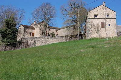
Pauparelle
3 points of interest
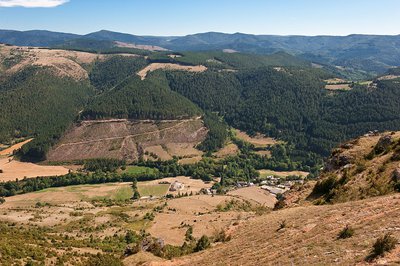
Terrasses sur Meyrueis - © Nathalie Thomas AgricultureTerrace
Throughout the climb, you will see abandoned former crop terraces. A few grapevines have persisted since local wine-growing came to an end. They bear witness to the fact that the slopes around these hamlets and villages were once cultivated and planted with fruit trees and vines. Terraces like these were the only way for the valley's inhabitants to have flat areas with deep soil suitable for growing.
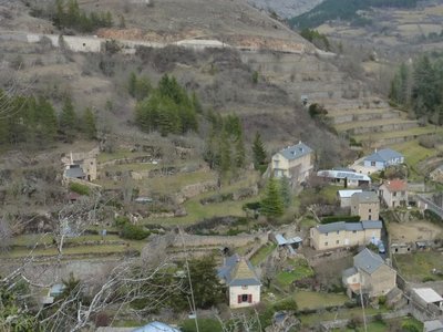
Vue sur Pauparelle - © Nathalie Thomas  History
Pauparelle
From Pauparelle, there is a nice view of the village of Ayres. This hamlet came into being in the 11th century around a Benedictine priory, founded by the Abbey Saint-Victor-de-Marseille on the current site of the castle. The latter, laid out in the 16th century on the ruins of the monastery, was pillaged and burned to the ground by the Camisards in 1703. Rebuilt in 1710, it is now a renowned hotel. Pauparelle is a private property that is not open to visits. Its name means “estate of the poor”. The farm buildings and living quarters date from the 17th and 19th centuries. Until 1850, the property belonged to the Charity Office of the town of Meyrueis, which, at that time, had about 5,000 inhabitants. (Jérôme Reversat)
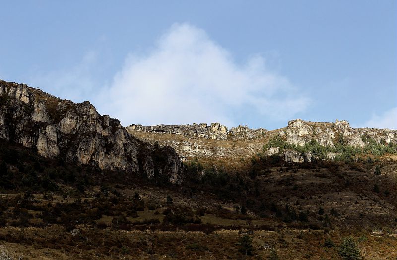
Vue sur la vallée de la Jonte - © Guy Grégoire  Flora
FloraJonte valley
The two valley sides contrast greatly. On the south-facing side (adret), the limestone slopes present sparse vegetation. You will find box, shadbush (Juneberry) and common juniper – species belonging to the plants associated with downy-oak groves and Scots pine forests. These slopes, which are mostly covered by short-grass prairie, serve as sheep pastures. You will also see orchids in a thousand different colours and shapes. On the north side (ubac), on the foothills of Le Puech Pounchu, the ground is chalky and forms an island that has been detached from the Causse Méjean by the active erosion of the river Jonte in contact with siliceous soils. This side has been reforested with black pines, a species that is well-adapted to the poor dry soil. It had originally been wooded before the replanting, but over-exploitation of the forest and over-grazing suppressed those woods in the 19th century.
Description
From the Champ de Mars car park, take on the right Rue du Commandeur, then on the left Rue du Mgr Maret, cross the bridge and turn right onto Quai Sully. At the end of the street, by the tourism office, take the road towards Florac by turning first right then immediately left. Stay on the road for 200 m.
1) By the small public garden with a stone cross, take the path on the left alongside the high wall. After 250 m, by a tarred road, take the lane on your right that runs along the back of a large building. The path joins up with the D 986, which you cross before taking the steep path opposite for 150 m, where it meets an old track. Turn left onto this until you reach the road leading to Pauparelle.
2) Turn right onto the road to reach the hamlet of Pauparelle. Pass the hamlet on the right and continue straight ahead on a track suitable for motor vehicles. After about 100 m, at a fork, take the steep ascent on the right. After 200 m, the track runs alongside the cliffs of the Causse Méjean plateau. When it parallels the road, keep walking along until you join up with it.
3) Just before the road, go downhill on the right on the old path to the cistern of Salvinsac. The descent finishes by the D 996.
4) Cross it to take a tarred downhill section into the hamlet. Cross the River Jonte and, after the bridge, head towards La cascade campsite.
5) By the campsite, take the track uphill and, after the bend, turn right then left uphill. At the next crossroads, continue straight ahead. At the next fork, turn left uphill.
6) In the pine forest, take the steep descent on the right, which can be slippery (pine needles). At the bottom, take the path on the left (which can be muddy). At the crossroads, turn right onto a road with hairpin bends.
7) Take the tarred road in the middle. From the fountain in the hamlet, you can do a detour downhill to the mediaeval bridge, the Pont des Six Liards. To return to the centre of Meyrueis, go above the Jardin des Cévennes campsite, and turn right then left to reach your starting-point.
- Departure : Meyrueis
- Arrival : Meyrueis
- Towns crossed : Meyrueis
Forecast
Altimetric profile
Recommandations
Make sure your equipment is appropriate for the day's weather conditions. Remember that the weather changes quickly in the mountains. Take enough water, wear good shoes and put on a hat. Please close all gates and barriers after yourself.
Information desks

Tourism'house and national Parc at Florac
Place de l'ancienne gare, N106, 48400 Florac-trois-rivières
This office is part of the National Park's associated tourist-information network, whose mission is to provide information on, and raise awareness of, the sites and events as well as the rules that must be observed in the National Park's central zone.
On site: exhibitions, video projections, events and shop Open year-round
Transport
- Bus line 259 Mende - Sainte Enimie - Meyrueis
- Bus line 215 « Millau – Peyreleau - Meyrueis »
Access and parking
Meyrueis via the D 996 and the Jonte gorges
Parking :
Calculateur d'itinéraire Lio
Utilisez le calculateur liO pour organiser votre trajet en région Occitanie.
Autres régions
Calculez votre itinéraire en Auvergne Rhône Alpes sur Oùra
Biodiversité autour de l'itinéraire
Source


Report a problem or an error
If you have found an error on this page or if you have noticed any problems during your hike, please report them to us here: