
Ravin de l'Enfer (Hell Ravine)
Explore two valleys in Ventalon-en-Cévennes, a village which, like others in the Cévennes, has no centre but consists of scattered hamlets instead.
4 points of interest
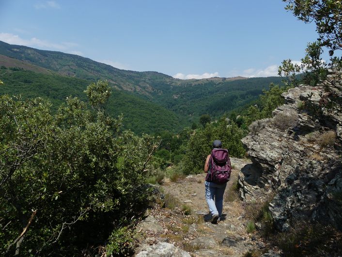
Vue sur la vallée - Nathalie Thomas  Architecture
Le Chambonnet
Until 1965 the water supply for this hamlet was by béal (irrigation channel), from the brook below the temple. Imagine a channel 650 m long, 25 cm wide and 10 cm deep. Upkeep required an enormous effort to plug fissures, remove chestnut burrs, twigs and leaves. The fountain, a granite trough, was where the béal water arrived. Since then, several springs have been tapped.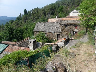
Les Abrits - © Nathalie Thomas  Pastoralism
Boutade des Abrits
This water reservoir is close to where the water was needed. It was built out of stones caulked with soil and is closed by a pierced stone and a wooden clasp.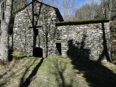
Le moulin - nathalie.thomas ArchitectureThe mill
The mill, whose construction dates to 1790, was built and used by several landowners at Le Salson. It was the largest mill in the valley and had been cleverly designed. Its well-thought-out water course could activate several millstones at once. The mill was thus used to make groats while another millstone ground rye or wheat or buckwheat for flour and yet another crushed walnut kernels for oil.
In another building, pieces of caddis cloth were fulled. The water of the Gardon d'Alès was partially dammed and collected in a gourgue (basin) to activate the mill’s horizontal wheels. When the water re-emerged, it was channelled into béals (irrigation channels). A 2 km-long béal irrigated meadows and chestnut trees all the way to below Le Grenier.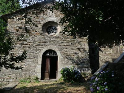
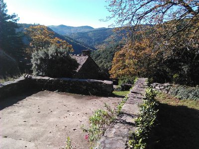
Le Temple - © Nathalie Thomas  History
The temple of St- Frézal de Ventalon
The temple (Protestant church) replaced a Catholic church that had been burnt down by the Camisards. The municipality bought the adjacent ruins in the early 1980s to turn them into a group gîte, an apartment and a community centre. In the hamlet of Le Géripon, you can see a small family cemetery. Cévenol Protestants, not having access to Catholic cemeteries, buried their dead on their land.
Description
Signposts will guide you all along this route, as well as yellow painted waymarks. In the description below, the signposted place names and/or directions are given in bold italics between quotation marks:
Starting at “Ventalon en Cévennes”, walk towards “Conches” via “St-Frézal-Le Temple”, “Le Géripon”, “Le Chambonnet”. In “Conches” head towards “Le Salson”. In “Le Salson”, faire un allée/retour au Moulin par « Salson Nord ». De retour à « Le Salson », direction « Ventalon en Cévennes » par « Le Grenier », « Le Géripon » et « St-Frézal – Le Temple ».
This hike is taken from the guidebook Mont Lozère - Pays des sources, Sommet des Cévennes, published by the Pôle de pleine nature du Mont Lozère.
- Departure : “Le Temple” in St-Frézal de Ventalon
- Arrival : “Le Temple” in St-Frézal de Ventalon
- Towns crossed : Ventalon en Cévennes
Forecast
Altimetric profile
Recommandations
Make sure your equipment is appropriate for the day’s weather conditions. Remember that the weather changes quickly in the mountains. Take enough water, wear sturdy shoes and put on a hat. Please close all gates and barriers behind you.
Information desks

Office de tourisme Des Cévennes au mont Lozère
le Quai, 48220 Le Pont de Montvert sud mont-Lozère
Access and parking
Access via the valley: N106 and D29. Via the ridge: D35.
Parking :
Calculateur d'itinéraire Lio
Utilisez le calculateur liO pour organiser votre trajet en région Occitanie.
Autres régions
Calculez votre itinéraire en Auvergne Rhône Alpes sur Oùra
Biodiversité autour de l'itinéraire
Source


Report a problem or an error
If you have found an error on this page or if you have noticed any problems during your hike, please report them to us here: