
Paros
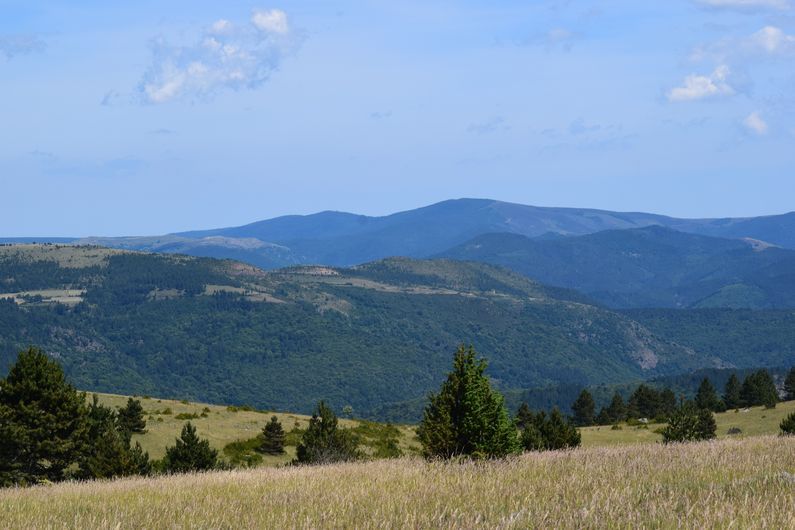
The downhill section gives you panoramic views over the valley of Ispagnac and Quézac. The climb among the pine trees takes you into wooded countryside favoured by many birds and grazed by local flocks of sheep.
5 points of interest
Haie autour du Mas André - C-C Florac - Sud Lozère  Flora
FloraHedges
Hedges (boxwood or thorn bushes) were much used by farmers until the early 20th century to protect crops, flora and fauna, and delimit plots of land. They are the preferred nesting sites of many breeding or migrating birds. They also serve as a hide, not only for birds of prey such as buzzards, sparrowhawks or harriers, but also for insect-eating bids like the Hodgson's redstart and shrike. The berries of certain shrubs (sloe, juniper and dog rose) turn these hedges into larders for seed-eating birds: thrushes, northern grosbeak-canary, ortolan buntings, etc.
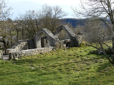
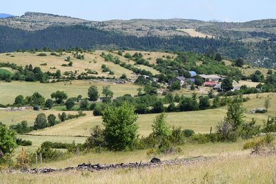
Voûte du Mas André - Nathalie Thomas AgricultureMas André
Mas are estates or small hamlets. Currently, two families of livestock farmers live in Mas André where they raise sheep for meat (500 to 600 animals). As you leave the hamlet, do stop in front of a complex of ruins with superb stone vaults. Vaulting was often used on both the lower and upper floor, and for both attics and to. The absence of water and of timber for roof structures, the fear of house fires and the abundance of stone explain this type of construction. In fact, a wooden roof could not carry a covering made of limestone tiles – it is too heavy (400 to 500 kg/m²).
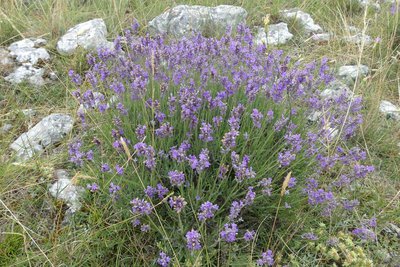
Lavandula angustifolia Miller - Nathalie Thomas FloraWild lavender
Until 1960, wild lavender (Lavandura angustifolia) constituted an important seasonal source of income on the Causse de Sauveterre. A group of women still harvests wild lavender for distillation in two stills in Saint-Etienne-Vallée-Française to produce essential oil. Another part of the harvest is distilled in Faux, near Ispagnac, where there is a distiller. Michel Vieilledent remembers: “The lavender was harvested from the 15th of July to the middle of August. You had to cut the flowers when they changed colour and turned grey, that's when they yield the most scent. A good picker could harvest 120 kg a day. You had to distil 200 kg of stems to obtain just over one litre of essential oil.”
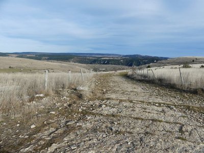
Draille de Paros - Nathalie Thomas  History
Draille
The path quickly changes appearance. In some places, the roadsides are built using masonry. Here, you are walking on parts of the Estrade, the Causse de Sauveterre's first road for wheeled vehicles and a former mule track, first mentioned in 1703 (chemin de Mende). The Estrade ran in the gully between Paros and Vigos, linking Ispagnac to Mende and other major routes. It is now a draille (drovers' road), used by the sheep farmers from Paros to disperse their flocks over the Causse pastureland.
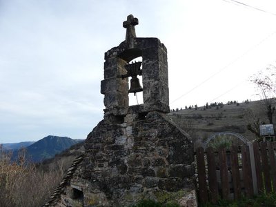
Cloche de l'école - nathalie.thomas HistoryParos (Perros)
The bread oven in Paros stands out for being topped by the school bell, making it look like a “blizzard belltower” (a bell rung at regular intervals during heavy fog or blizzards to guide passers-by to safety). The school bell is a remnant from the days when each hamlet was populated and travel was more difficult. Paros had 13 households in 1873 and, until the 1950s, nine farmers called it home.
Description
From the car park, walk downhill on the road for 150 m, then turn left to follow the left bank of the overgrown dry riverbed. At first, the path is sunk between boxwood hedges and low walls, then it rises slightly and crosses to the right bank of the gully (section shared with the GRP Tour du Sauveterre trail). It gradually goes down into the Ispagnac valley. At mid-slope, at a crossroads, take the path that goes back up to the plateau and the hamlet of Mas André. The path climbs gradually to reach a forestry track, onto which you turn right for 70 m. Then take the path on the left that goes uphill to Mas André. Turn left onto the tarred road, then take the old track (a small draille or drovers’ road to the left of the road) to Mas André. At Mas André, turn right, then right again at the ruins. Go uphill on the large path and fork right at the crest towards the pine plantation. The path goes over a plain with cultivated parcels of land and then heath. You reach a track at the foot of Mont Chabrié (the hill on the right). Fork left, take the track for about 400 m and take the path on the right. This former path where the rock goes down to the hamlet of Paros. The path comes out in the centre of the hamlet between the ferradou (ox-shoeing stocks) and the bread oven. Continue downhill. At the iron cross, take the path on the right to reach the road. Turn left to get back to the car park.
- Departure : Paros (Ispagnac)
- Arrival : Paros (Ispagnac)
- Towns crossed : Ispagnac and Gorges du Tarn Causses
Forecast
Altimetric profile
Recommandations
Make sure your equipment is appropriate for the day's weather conditions. Remember that the weather changes quickly in the mountains. Take enough water, wear good shoes and put on a hat. Please close all gates and barriers after yourself.
Information desks

Tourism office Cévennes Gorges du Tarn, Ispagnac
Place de l'Église, 48320 Ispagnac
This office is part of the National Park's associated tourist-information network, whose mission is to provide information on, and raise awareness of, the sites and events as well as the rules that must be observed in the National Park's central zone.
Open year-round

Tourism'house and national Parc at Florac
Place de l'ancienne gare, N106, 48400 Florac-trois-rivières
This office is part of the National Park's associated tourist-information network, whose mission is to provide information on, and raise awareness of, the sites and events as well as the rules that must be observed in the National Park's central zone.
On site: exhibitions, video projections, events and shop Open year-round
Access and parking
From Ispagnac, head towards Molines, then towards Mende on the D 31 road. At the top of the hill above Molines, fork left toward the hamlet of Paros. The walk’s starting-point is on the left before the small bridge (car park), about 100 m after the turn-off to Vigos.
Parking :
Calculateur d'itinéraire Lio
Utilisez le calculateur liO pour organiser votre trajet en région Occitanie.
Autres régions
Calculez votre itinéraire en Auvergne Rhône Alpes sur Oùra
Biodiversité autour de l'itinéraire
Source


Report a problem or an error
If you have found an error on this page or if you have noticed any problems during your hike, please report them to us here: