
Gourdouze
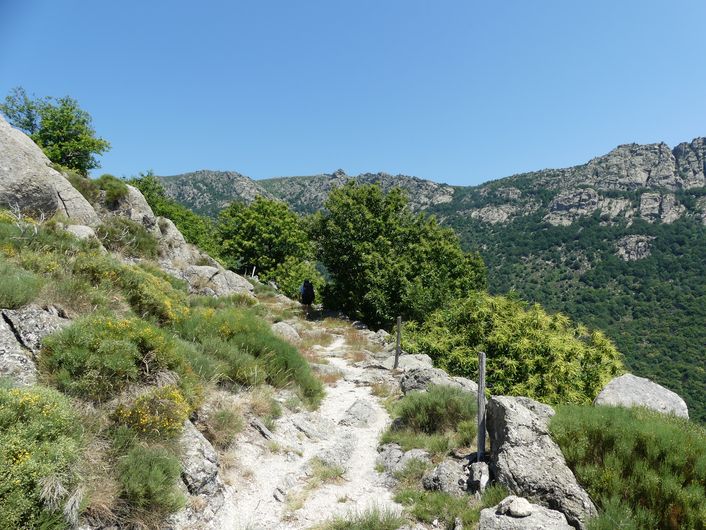
This hike explores the old Mont Lozère mountain range, across broom heaths, on cobblestone paths, and through a landscape of evocatively shaped granite blocks, and especially a geological curiosity, the rocks of Trenze.
3 points of interest
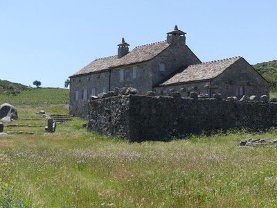
Gourdouze - nathalie.thomas  History
Gourdouze
In the 14th century, this village was a priory of Castagnols parish. In 1906 all its thatched roofs burned down. Parts of the village were bought by a private individual in the 1960s who greatly modified them. It subsequently became the property of the Cévennes National Park, which sold 250 hectares back to a Mont Lozère livestock cooperative: their herds maintain the space. The cooperative manages 1,200 hectares at Mas Camargues and Gourdouze. These uplands receive sheep and cattle herds from 15 May to 15 November.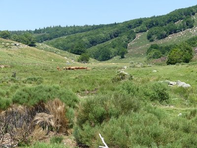
Troupeau au dessus de Gourdouze - nathalie.thomas  Know-how
Slash-and-burn
This technique consists of clearing weeds and shrubs using fire: the fire is utilised to get rid of broom, especially in places that a motorised shredder cannot access. Slash-and burn is carried out every 4 to 5 years in a zone chosen by the farmer. Over larger areas, it is supervised by the fire brigade. In the 19th century, 100,000 sheep migrated to summer pastures here (transhumance) and joined the plateau herds, leaving no room for broom. As soon as the meadows are no longer grazed, they are colonised by broom, then shrubs, then forest. These open spaces are due to human activity (clearing) to allow herds to graze on grass. Grazing prevents the spontaneous growth of shrubs and any generalised invasion of forest.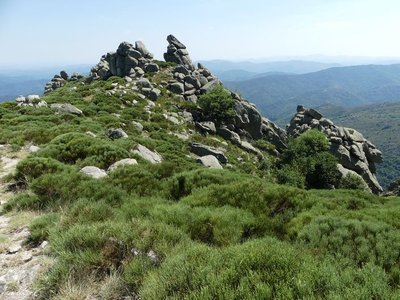
Crête de Trenze - nathalie.thomas  Geology
The formation of Mont Lozère
This ancient massif consists of granite which, as magma, was pushed up from the depths of the Earth to its crust, through the schist. Slow cooling caused fractures, called joints, which allow water to infiltrate deep into the rock and alter it. This crystalline rock, which is composed of mica, quartz and feldspath, erodes slowly under the action of rain and frost, creating the rounded shapes that are characteristic of Mont Lozère.
Description
Signposts will guide you all along this route. In the description below, the signposted place names and/or directions are given in bold italics between quotation marks:
Climb to “Gourdouze” via “La Gendarmerie”, “Rompidou”. At “Gourdouze” continue straight ahead towards “La Chassalde”. Then take the right to “La Jasse d’Olibou”. At “La Jasse d’Olibou” take the right towards “Les Sources”: you are passing above the rocks of Trenze. At “Les Sources”, make for “Nojaret – Ancienne école” via “Lous Pradous”, “Lou Garadou”, “Nojaret Haut”. Return to “Vialas” via “Prat de la Peyre”, “Le Crépon”, “Fontaine de Foirail”.
This walk is taken from the guidebook Massif de l’Aigoual, published by the communauté de communes Causses Aigoual Cévennes as part of the collection Espaces naturels gardois and the label Gard Pleine Nature.
- Departure : Vialas
- Arrival : Vialas
- Towns crossed : Vialas
Forecast
Altimetric profile
Recommandations
For experienced hikers. Considerable elevation gain. Steep section after the rocks of Trenze. Hike not to be undertaken in fog. Make sure your equipment is appropriate for the day’s weather conditions. Remember that the weather changes quickly in the mountains. Take enough water, wear sturdy shoes and put on a hat. Please close all gates and barriers behind you. Access to the ridges of the rocks of Trenze prohibited for mountain-bikes.
Information desks

Tourism'house and national Parc at Florac
Place de l'ancienne gare, N106, 48400 Florac-trois-rivières
This office is part of the National Park's associated tourist-information network, whose mission is to provide information on, and raise awareness of, the sites and events as well as the rules that must be observed in the National Park's central zone.
On site: exhibitions, video projections, events and shop Open year-round

Office de tourisme Des Cévennes au mont Lozère
le Quai, 48220 Le Pont de Montvert sud mont-Lozère

Tourism office Des Cévennes au mont-Lozère, Vialas
1 place de l'ancienne gendarmerie, 48220 Vialas
This office is part of the National Park's associated tourist-information network, whose mission is to provide information on, and raise awareness of, the sites and events as well as the rules that must be observed in the National Park's central zone. Open July and August
Access and parking
Take the D998 to Vialas
Parking :
Calculateur d'itinéraire Lio
Utilisez le calculateur liO pour organiser votre trajet en région Occitanie.
Autres régions
Calculez votre itinéraire en Auvergne Rhône Alpes sur Oùra
Biodiversité autour de l'itinéraire
Source


Report a problem or an error
If you have found an error on this page or if you have noticed any problems during your hike, please report them to us here: