The standing stone of Trépaloup
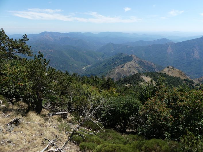
This walk offers panoramic views from the summit, at 1,567 m the highest point of the Gard department. They stretch from the Alps to the Pyrenees, from the Puy de Sancy to the Mediterranean. You overlook the Hérault valley and its legendary 4,000 Steps trail.
5 points of interest
Observatoire de l'Aigoual - nathalie.thomas  History
The meteorological observatory
Inaugurated in 1824, the meteorological observatory was built on the initiative of Georges Fabre, one of the pioneers of the reforestation of Mont Aigoual. His work with the botanist Charles Flahault enabled the creation of the arboretum of L’Hort de Dieu. The first meteorological data were gathered by agents from the French National Water and Forestry Commission. Since 1943, the observatory has been managed by the National Meteorological Office. It is France’s last mountain weather station that is inhabited year-round.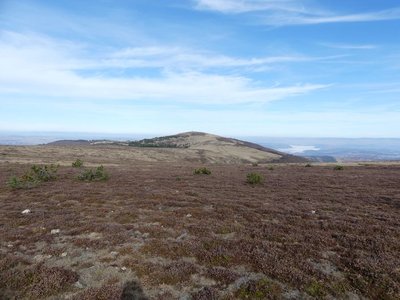
Le Portalet - nathalie.thomas  Flora
FloraShort-grass prairies and heath on the summit of Mont Aigoual
Here, only species with a short reproductive cycle can settle due to the frequently glacial climate. The heath has been invaded by heather and mountain pine. This zone is barely wooded due to the violent winds and is comparable to subalpine vegetation, consisting of short-grass prairies and heather and blueberry moor. It is sometimes called pseudo-alpine.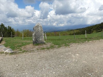
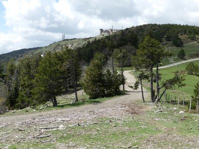
Vue depuis Font de Trépaloup - nathalie.thomas FloraThe evolution of plant life
At the pass stands a schist menhir (standing stone). To the north, in Trépaloup ravine, hewn flint implements bear witness to a human presence in the region since prehistoric times. Palynological analyses (studies of pollen fossilised in peatbogs) have allowed scientists to piece together the plant life on Mont Aigoual from 8,000 to 5,000 BC. Pine predominated, accompanied by birch and hazelnut. Then pine populations gradually diminished. The damp climate warmed up, favouring the spread of oak and hazelnut. Finally, the increased damp and cloud cover at altitude allowed fir and beech to develop. From the end of the first century BC, the substantial percentage of grasses shows that forest had receded in favour of pasture and prairies. This was the start of the great deforestation.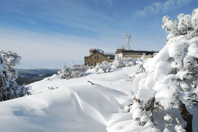
L'Aigoual sous la neige - © Météosite du Mont Aigoual HistoryMont Aigoual weather station
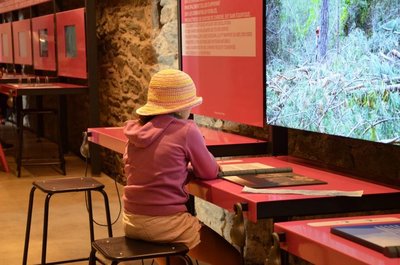
Inaugurated in 1894, this infrastructure is France’s last mountain weather station to be inhabited. Its history is closely linked to the reforestation of Mont Aigoual. It has become a high-performance weather station with an array of modern test instruments, measuring devices for extreme conditions, and a museum/exhibition on meteorology. The 800 sq m exhibition will tell you more about climatology on Mont Aigoual and about meteorology in general.
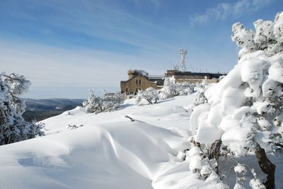
L'Aigoual sous la neige - © Météosite du Mont Aigoual HistoryMont Aigoual weather station
Inaugurated in 1894, this infrastructure is France’s last mountain weather station to be inhabited. Its history is closely linked to the reforestation of Mont Aigoual. It has become a high-performance weather station with an array of modern test instruments, measuring devices for extreme conditions, and a museum/exhibition on meteorology. The 800 sq m exhibition will tell you more about climatology on Mont Aigoual and about meteorology in general.
Description
Signposts will guide you all along this route. In the description below, the signposted place names and/or directions are given in bold italics between quotation marks:
Starting from "Mont Aigoual – Parking", make for
- "Menhir de Trépaloup", then"
- Source du Tarnon",
- "Combe Rude". Walk around the summit to return to "Menhir de Trépaloup". Climb towards
- "Mont Aigoual" (0.6 km). Walk past the front of the meteorological museum to reach the car park.
This walk is taken from the guidebook Massif de l’Aigoual, published by the communauté de communes Causses Aigoual Cévennes as part of the collection Espaces naturels gardois and the label Gard Pleine Nature.
- Departure : Summit of Mont Aigoual
- Arrival : Summit of Mont Aigoual
- Towns crossed : Val-d'Aigoual and Bassurels
Forecast
Altimetric profile
Recommandations
No mountain-biking. Make sure your equipment is appropriate for the day’s weather conditions. Remember that the weather changes quickly in the mountains. Take enough water, wear sturdy shoes and put on a hat. Please close all gates and barriers behind you.
Information desks

Tourism & national parc'house
Col de la Serreyrède, 30570 Val d'Aigoual
The Maison de l'Aigoual houses the tourism office Mont Aigoual Causses Cévennes and the Maison du Parc national. This visitor centre provides information on and raises awareness of the Cévennes National Park, its sites and events as well as the rules that must be observed in the National Park's central zone.
On site: changing exhibitions, video projections, Festival Nature events and shop Open year-round
Transport
liO is the regional public transport service of the Occitanie/ Pyrénées – Méditerranée region. It facilitates everyone’s movements by prioritising public transport. For more information, call 08 10 33 42 73 or go to www.laregion.fr
Access and parking
From L'Espérou on the D986, D269, D18 and RD 118. From the Col de Perjuret on the D18 and D 118.
Parking :
Calculateur d'itinéraire Lio
Utilisez le calculateur liO pour organiser votre trajet en région Occitanie.
Autres régions
Calculez votre itinéraire en Auvergne Rhône Alpes sur Oùra
Biodiversité autour de l'itinéraire
Source


Report a problem or an error
If you have found an error on this page or if you have noticed any problems during your hike, please report them to us here: