
Malpertus
3 points of interest
Malpertus - nathalie.thomas  Architecture
Malpertus
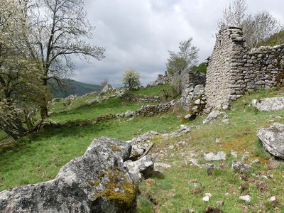
The ruined hamlet of Malpertus is a splendid and moving site, with its feel of a paradise lost which one would like to restore to its former glory. The views onto the Dourbie valley are stunning. The short grass makes it easy to see far, and spot friends or enemies early. Weapons were hidden here in World War Two, stored in a rock shelter at the Roc du Salidou, just behind the buildings. The hamlet’s last inhabitant left this site, inaccessible except on muleback, in the 1960s. Today it is home to diverse small fauna: birds, insects, lizards, common frogs, etc.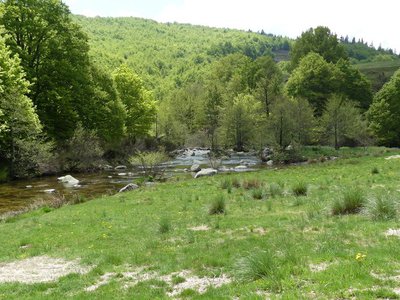
Dourbies - nathalie.thomas  Fauna
FaunaThe Dourbie
In the upper reaches of the river, a diverse and fascinating wildlife has developed despite the strong current. The clear running waters condition the presence and future of the brown trout. It cohabits with minnows, otters… You may see a white-throated dipper on a rock, or else a grey heron or wagtail on the bank. But it is in the clear waters and under rocks that a whole little aquatic world exists: molluscs, crustaceans, insect larvae, etc. They pile up quite harmoniously, dozens per square metre. Some stick to the rocks; others drift, lurk or float. It all depends on the equipment nature has provided them with: bristles, suckers, hooks, sheaths weighted with gravel...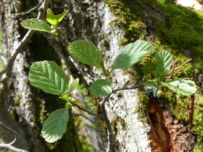
Aulne glutineux - nathalie.thomas  Flora
FloraThe common alder
A wise tree lives in the sunshine with its feet in the waters of the Dourbie: the common alder. You can identify it even in winter by looking for its strobili on the ground or on its branches - female inflorescences shaped like small pinecones. The alder’s tangled roots are solidly anchored in low riverbanks, thus ensuring their protection. By symbiosis between alders and a bacteria called frankia living in their root, nitrogen is fixed in the ground at about 60 to 200 kg per hectare per year! This is a bonanza for poor soils, which are quickly enriched.
Description
Starting at "Les Parcs à Moutons", go to "Ruines Malpertus", then "Les Faïsses" and "La Tranchée" before returning to "Les Parcs à Moutons".
This walk is taken from the guidebook Massif de l’Aigoual, published by the communauté de communes Causses Aigoual Cévennes as part of the collection Espaces naturels gardois and the label Gard Pleine Nature.
- Departure : 800 m upstream from Les Laupies
- Arrival : 800 m upstream from Les Laupies
- Towns crossed : Dourbies
Forecast
Altimetric profile
Recommandations
Information desks

Tourism & national parc'house
Col de la Serreyrède, 30570 Val d'Aigoual
The Maison de l'Aigoual houses the tourism office Mont Aigoual Causses Cévennes and the Maison du Parc national. This visitor centre provides information on and raises awareness of the Cévennes National Park, its sites and events as well as the rules that must be observed in the National Park's central zone.
On site: changing exhibitions, video projections, Festival Nature events and shop Open year-round
Transport
Access and parking
Parking :
Calculateur d'itinéraire Lio
Utilisez le calculateur liO pour organiser votre trajet en région Occitanie.
Autres régions
Calculez votre itinéraire en Auvergne Rhône Alpes sur Oùra
Biodiversité autour de l'itinéraire
Source


Report a problem or an error
If you have found an error on this page or if you have noticed any problems during your hike, please report them to us here: