
Saint-Sauveur: the path of the Dead
7 points of interest
Le chemin des morts - nathalie.thomas  History
The Path of the Dead
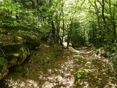
In the Middle Ages and until 1870, the Catholic village of Camprieu had neither church nor cemetery. “Its inhabitants therefore went to the hamlet of Saint-Sauveur de Pourcils. To transport their dead to the remote cemetery, they had to take the ‘Path of the Dead’. They carried the coffins on their backs and, at every rest stop, recited the prayer De Profundis. Funeral processions stopped using the path in summer 1872. That year, the village of Camprieu finally obtained its own cemetery. But the name has stuck: “the Path of the Dead”.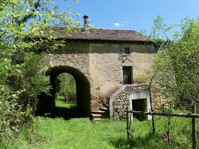
La ferme de La Boissière - nathalie.thomas HistoryLa Boissière farm
La Boissière farm was abandoned by its inhabitants when Mont Aigoual was reforested. A salary from the French National Water and Forestry Commission was so much more secure than the meagre revenues from a farmer’s endless work. You pass through the farm’s porch and walk on its threshing floor – but there are no chickens or cereals on the threshing floor, and no herds ambling to the meadow. Today the forest has won.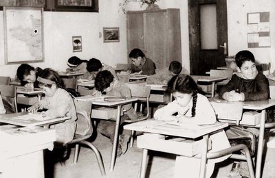
Ecole de Villemagne dans les années 1960 - © Coll. G. Mathon HistoryA cemetery that reveals histories
The small cemetery of Saint-Sauveur des Pourcils, so peaceful today, reveals a rich and eventful history. The gravestones bear the names of Catholic, Orthodox, Protestant, Jewish and Muslim families. This religious plurality is partly due to the arrival in the 20th century of foreign workers to mine argentiferous lead and copper in the neighbouring hamlet of Villemagne. During the murky period of World War II, the wife of a resistance fighter and her six children took refuge in the surrounding area. The Muslim graves bear witness to the period following the Algerian War when a camp for harkis was set up in the region. These Algerian Muslims, who had served in the French army, were employed by the French Forestry Office for the reforestation of the Aigoual massif.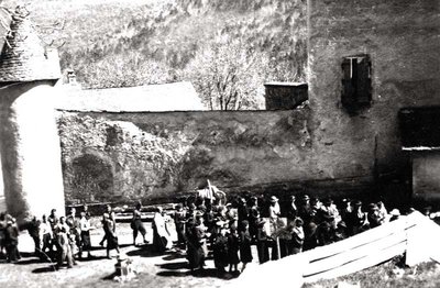
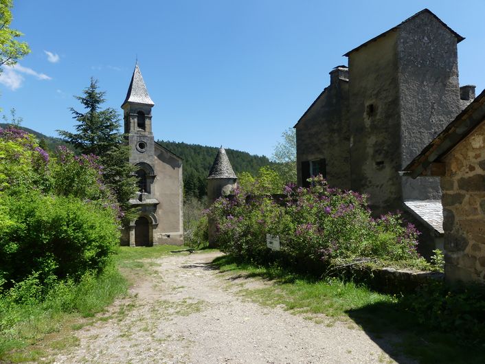
© Coll. G. Mathon HistoryA church at the heart of it all
Why was such an imposing church built in a small hamlet? The profound attachment of the parishioners to their place of worship was key. The church was destroyed three times, by Protestants (1562 and 1703) and by the ravages of time (1848). But each time the parishioners who lived in neighbouring hamlets decided to rebuild it. Despite this determination, the church and cemetery were eventually transferred to Camprieu (1871). The episcopal authorities cited difficulties in accessing the place of worship and disagreements between the mayor and parish priest. The local faithful, who were opposed to the transfer, managed to keep masses for the yearly pilgrimage, baptisms, funerals and weddings in St-Sauveur.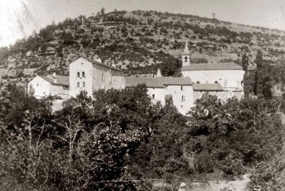
Saint Sauveur des Pourcils au début du XXe siècle - © Coll. G. Mathon  Natural environment
Un domaine agricole reboisé
Today, the hamlet of Saint-Sauveur des Pourcils is surrounded by trees but in the 19th century the Aigoual massif was bare! Its reforestation began as a state programme managed by foresters. The French Forestry Office bought many farm estates to turn them into foresters’ houses. Saint-Sauveur des Pourcils had all the required characteristics: buildings for housing foresters; varied soils; good sun exposure; and water nearby (the river below). The foresters set up a tree nursery to grow young trees and an arboretum to test how well-adapted different species were.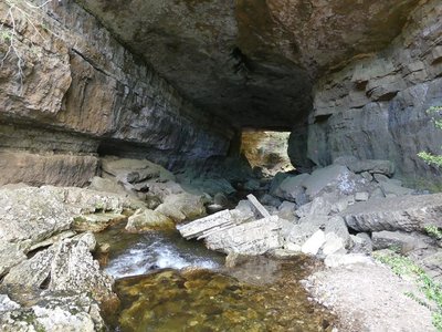
Perte du Bonheur - nathalie.thomas  Water
WaterThe Bonheur river
The Bramabiau site is an example of a karst spring. Here, slightly east of Camprieu, the Bonheur River has dug into the Causse (limestone plateau) and disappears in a natural tunnel. It re-emerges into the open at the bottom of the Aven de Balset, but it twists to the south to disappear again below ground. The river meanders through more than 10 km of tunnels. Then, 700 horizontal meters from its sinkhole, it reappears as a spring! The rock walls of the narrow canyon magnify the sound of its waters and add to its rumbling some acoustic vibrations that are close to a gigantic roaring. This is no longer the tranquil Bonheur, it is the tumultuous Bramabiau.
Camprieu - nathalie.thomas HistoryCamprieu
In the 19th century, the village streets were bustling year-round with a throng of artisans, labourers and shopkeepers, who lived in these modest mountain houses that were also suitable for livestock rearing. Camprieu had: two cobblers, six clog makers, two basket makers, one carpenter, two wheelwrights, two farriers, one miller, two stonemasons, one glassworks, one sawmill, one dairy, two grocer’s shops, a haberdashery and ironmonger’s and one shop for ladies’ “fashion and dresses”. There was also a cheese cellar that produced Roquefort until 1932, a hotel and an inn.
Description
Starting at "Camprieu – parking", make for "ferme de La Boissière" via "La Croix Basse", then "La Croix Haute", "La Clédette", "St Sauveur", "Ferme de la Boissière". At "ferme de La Boissière" take on the left a small path towards "La Fonderie", "Arboretum 0.1 km", "Les Plots". At "Les Plots", head towards "St-Sauveur-Eglise", "St-Sauveur-Carrefour". Take the track on the right towards "Croix de St-Sauveur", "St-Sauveur-Parking", "Valat de la Fonderie", "Ferme de la Boissière". At the farm, turn left towards "Camprieu" via "Rouveyrolle", "Abîme de Bamabiau", turn right towards "Camprieu-Perte du Bonheur", (there and back to the sinkhole), then "Camprieu – Mairie" and return to the football pitch.
This walk is taken from the guidebook Massif de l’Aigoual, published by the communauté de communes Causses Aigoual Cévennes as part of the collection Espaces naturels gardois and the label Gard Pleine Nature.
- Departure : Camprieu football stadium
- Arrival : Camprieu football stadium
- Towns crossed : Saint-Sauveur-Camprieu
Forecast
Altimetric profile
Recommandations
Information desks

Tourism & national parc'house
Col de la Serreyrède, 30570 Val d'Aigoual
The Maison de l'Aigoual houses the tourism office Mont Aigoual Causses Cévennes and the Maison du Parc national. This visitor centre provides information on and raises awareness of the Cévennes National Park, its sites and events as well as the rules that must be observed in the National Park's central zone.
On site: changing exhibitions, video projections, Festival Nature events and shop Open year-round
Transport
Access and parking
Parking :
Calculateur d'itinéraire Lio
Utilisez le calculateur liO pour organiser votre trajet en région Occitanie.
Autres régions
Calculez votre itinéraire en Auvergne Rhône Alpes sur Oùra
Biodiversité autour de l'itinéraire
Source


Report a problem or an error
If you have found an error on this page or if you have noticed any problems during your hike, please report them to us here: