
Le Suquet ridge
2 points of interest
Montée au col du Suquet - nathalie.thomas  Landscape
Col du Suquet pass
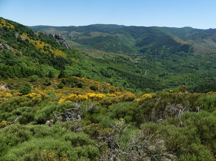
You are at the highest point of the hike. On the right bank of the Dourbie, the path crosses a sheer slope that is alternatively made up of zones of solid granite and other zones where it has decomposed due to weathering into coarse granitic sand. To the south, the views encompass the entire Lingas massif, a high wooded plateau overlooking, further south, the region around Le Vigan and the Languedocian plain.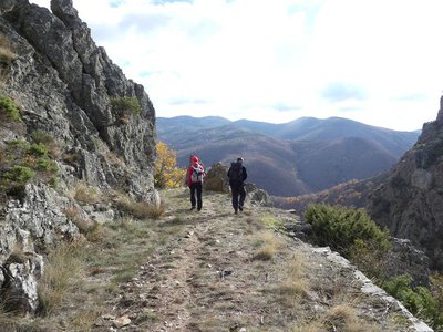
Vue sur le Lingas - nathalie.thomas LandscapeThe Dourbies gorge
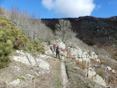
The path comes out on the Dourbie gorge. Opposite you, the western part of the high granite plateau of the Lingas joins up on its right with the limestone plateau called Causse de Larzac. On your right, you can see the granite dome of Saint-Guiral. Closer to you, in the vales that converge on the Dourbie, are the former crop terraces, pastureland, the village built on the riverbank at the valley’s widest point and finally the chestnut orchard. You are seeing the upper limit of its range, which corresponds to it maximum altitude in this zone (800 m).
Description
Starting from "Dourbies- Eglise", head to "Col du Suquet". At the crossroads "Le Vieux hêtre", follow "La plaine du Vialat", "Mont Mal". Return to Dourbies via "Serre du Cade", "Combe étroite", "Roucabie", "La Bourelle", "Las Costes" and "La Combe".
This walk is taken from the guidebook Massif de l’Aigoual, published by the Communauté de communes Causses Aigoual Cévennes as part of the collection Espaces Naturels Gardois and the label Gard Pleine Nature.
- Departure : Dourbies, by the church
- Arrival : Dourbies, by the church
- Towns crossed : Dourbies, Saint-Sauveur-Camprieu, and Trèves
Forecast
Altimetric profile
Recommandations
Information desks

Tourism & national parc'house
Col de la Serreyrède, 30570 Val d'Aigoual
The Maison de l'Aigoual houses the tourism office Mont Aigoual Causses Cévennes and the Maison du Parc national. This visitor centre provides information on and raises awareness of the Cévennes National Park, its sites and events as well as the rules that must be observed in the National Park's central zone.
On site: changing exhibitions, video projections, Festival Nature events and shop Open year-round
Transport
Access and parking
Parking :
Calculateur d'itinéraire Lio
Utilisez le calculateur liO pour organiser votre trajet en région Occitanie.
Autres régions
Calculez votre itinéraire en Auvergne Rhône Alpes sur Oùra
Biodiversité autour de l'itinéraire
Source


Report a problem or an error
If you have found an error on this page or if you have noticed any problems during your hike, please report them to us here: