
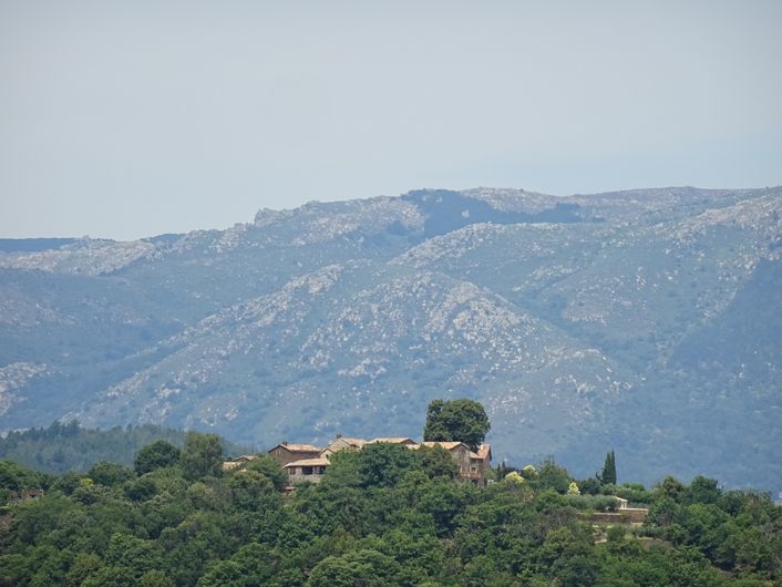
Col des 4 chemins
2 points of interest
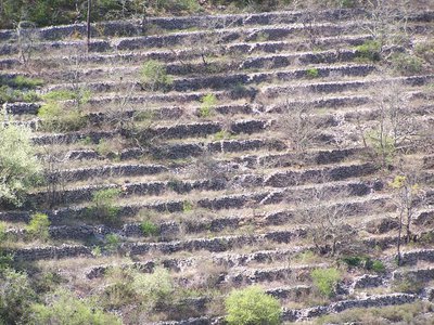
Les terrasses - © O.Pagès  Architecture
Crop terraces (faïsses)
You are taking paths that were once used by farmers to access their often very steep land, which they had laid out in faïsses (terraces). Here, they grew mulberry trees to feed to their silkworms as well as grains and chestnuts. You can see the vestiges of this agriculture, where every mas (isolated farm) had buildings known as magnaneries to breed silkworms and clèdes to dry chestnuts. Despite the substantial rural flight over the last two centuries, you can be almost sure to encounter chestnut farmers, goat or sheep farmers, market gardeners or beekeepers.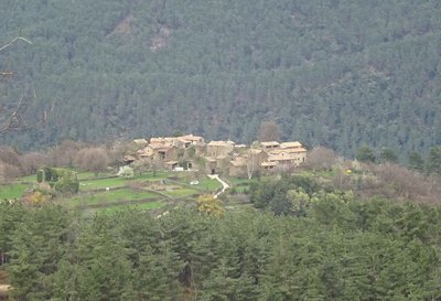
Le Puech - © JF.Raulet ArchitectureHamlet of Le Puech
This mediaeval hamlet was built form schist, lauzes (tilestones) and red roof tiles, and has been renovated using traditional techniques.
Description
Starting from "PEYREMALE", head towards "COL DE MALPERTUS" via "Le Puech", "Carignan", "Les Fourches" and "Les Selves". Continue on towards "Les Cognasses" till you reach "COL DES QUATRE CHEMINS", then head for "Les Fourches", "Carignan" and "Le Puech", before returning to "PEYREMALE".
This hike is taken from the guidebook Cévennes Haute Vallée de la Cèze, published by the Communauté de communes Cèze Cévennes as part of the collection Espaces Naturels Gardois and the label Gard Pleine Nature.
- Departure : Peyremale, by the roundabout
- Arrival : Peyremale, by the roundabout
- Towns crossed : Peyremale, Bessèges, Robiac-Rochessadoule, and Portes
Forecast
Altimetric profile
Recommandations
Information desks

Tourism office CezeCévennes, Bessèges
14 rue de la République, 30160 Bessèges
This office is part of the National Park's associated tourist-information network, whose mission is to provide information on, and raise awareness of, the sites and events as well as the rules that must be observed in the National Park's central zone.
Open year-round
Tourism office Cèze-Cévennes Saint-Ambroix
Place de l'ancien Temple, 30500 Saint-Ambroix
This office is part of the National Park's associated tourist-information network, whose mission is to provide information on, and raise awareness of, the sites and events as well as the rules that must be observed in the National Park's central zone.
Open year-round
Transport
Access and parking
Parking :
Calculateur d'itinéraire Lio
Utilisez le calculateur liO pour organiser votre trajet en région Occitanie.
Autres régions
Calculez votre itinéraire en Auvergne Rhône Alpes sur Oùra
Biodiversité autour de l'itinéraire
Source

Report a problem or an error
If you have found an error on this page or if you have noticed any problems during your hike, please report them to us here: