
Viaduct of Doulovy
3 points of interest
Mineur - © S.M.  History
Disused railway
The train used to call at the former mining site of Gagnières to transport coal and metal products. It connected to the Alès-Bessèges line at Robiac, linking the Gard and Ardèche departments, and, particularly, Alès and Paris, via Le Teil for passengers. The tracks have since been dismantled and the route has become a shaded walk.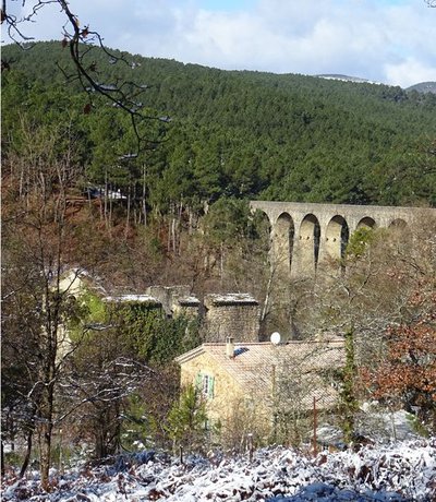
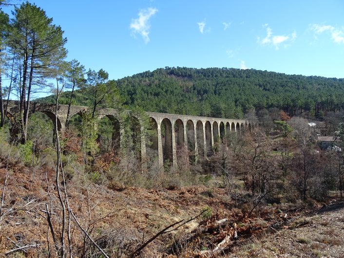
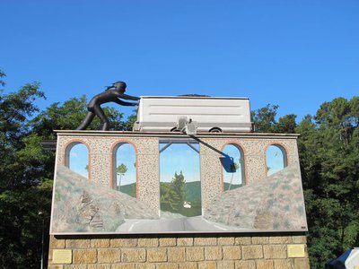
Le viaduc de Doulovy - © JF.Raulet HistoryThe viaduct of Doulovy
This viaduct is both monumental and decisive. The Alès-Bessèges railway was built using private finance and inaugurated in 1857. The viaduct of Doulovy stands at the confluence of the river of that name with the Merle, and bears witness to the pressing need to connect the mining area by rail, even if it meant moving or straddling mountains. To avoid an excessive gradient, this giant bridge – one of the three largest viaducts in the Cévennes – needed a long list of superlatives: 235 m long, 2.35 m wide and 24 arches, of which the highest measures 35 m. Crossing this viaduct, now pedestrianised, is a true voyage. History
Les Hauts-Fourneaux district
Les Hauts-Fourneaux (the Blast Furnaces), previously called Iraille Woods, owes its name to the presence of an iron-smelting site. The blast furnace has the shape of two tree trunks joined at their base. The upper opening is for the top charging system, the lower cavity is called the ‘casthouse’. The furnace, built out of firebricks, was first loaded with coal. Once the fire was lit, it was accelerated by a machine blowing air into the furnace. Iron ore, flux (which facilitates fusion) and coal were introduced through the top of the furnace in turn. The pig iron (iron and carbon) thus obtained accumulated in the casthouse. Once that was full, you removed the clay plug that closed the opening in the lower part, and the liquid iron flowed out onto sand channels where it cooled down to form blocks called pig moulds.
Description
From "GAGNIÈRES" head to "VIADUC DE DOULOVY" via "Gagnières-Sous le Puech", "Ancienne Voie Ferrée" and "Les Hauts Fourneaux", "La Maisonnette" (where you cross into the Ardèche department: different signage system), "Tunnel de la Gadilhe" and "La Vernadelle". Then follow "Chavagnac" via "Bois des Bartres", "Les Combes de Banne", then return to the Gard via "Les Costes" and "Le Saumier". Return to "GAGNIÈRES" via "Complexe Sainte Barbe", "Les Hauts Fourneaux","Ancienne Voie Ferrée" and "Sous le Puech".
This hike is taken from the guidebook Cévennes Haute Vallée de la Cèze, published by the Communauté de communes Cèze Cévennes as part of the collection Espaces Naturels Gardois and the label Gard Pleine Nature.
- Departure : Gagnières, at the mairie (town hall)
- Arrival : Gagnières, at the mairie (town hall)
- Towns crossed : Gagnières, Saint-Paul-le-Jeune, and Banne
Forecast
Altimetric profile
Recommandations
Information desks

Tourism office CezeCévennes, Bessèges
14 rue de la République, 30160 Bessèges
This office is part of the National Park's associated tourist-information network, whose mission is to provide information on, and raise awareness of, the sites and events as well as the rules that must be observed in the National Park's central zone.
Open year-round
Tourism office Cèze-Cévennes Saint-Ambroix
Place de l'ancien Temple, 30500 Saint-Ambroix
This office is part of the National Park's associated tourist-information network, whose mission is to provide information on, and raise awareness of, the sites and events as well as the rules that must be observed in the National Park's central zone.
Open year-round
Transport
liO is the regional public transport service of the Occitanie/ Pyrénées – Méditerranée region. It facilitates everyone’s movements by prioritising public transport. For more information, call 08 10 33 42 73 or go to www.laregion.fr
Access and parking
Parking :
Calculateur d'itinéraire Lio
Utilisez le calculateur liO pour organiser votre trajet en région Occitanie.
Autres régions
Calculez votre itinéraire en Auvergne Rhône Alpes sur Oùra
Biodiversité autour de l'itinéraire
Source

Report a problem or an error
If you have found an error on this page or if you have noticed any problems during your hike, please report them to us here: