
MTB 5 - From Dourbies to St-Guiral – graded blue
1 point of interest
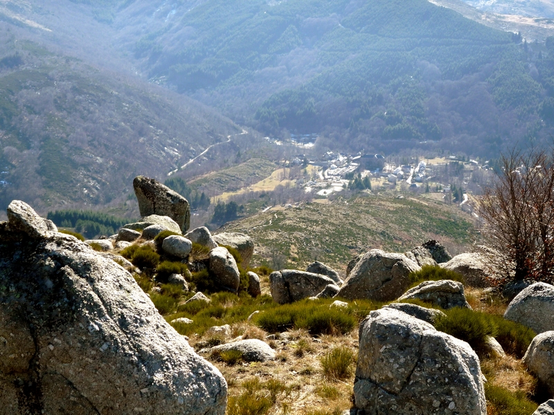
Vue sur Dourbies - nathalie.thomas  History
Dourbies
The village of Dourbies was built on a ridge to maximise the flatter soils for cultivation. Farming having declined in the valley, fields that were once cultivated have now been urbanised, and broom heath is invading more and more land.
Description
Signposts will guide you all along this route. In the description below, the signposted place names and/or directions are given in bold italics between quotation marks:
Starting at "DOURBIES-Église" head towards
- "Place des 3 Ermites", before going down to the river, crossing the footbridge and climbing back up to "La Clède".
- At "La Clède", take the road on the left for 250m, then go up by the track on the right till you reach "Montredon".
- At "Montredon", turn right and go down to
- "La croix de Lagrinier". There follows the technical descent to get back to "La Clède" before you take the same path as on the outbound leg to return to the village via "Place des 3 Ermites" and then "DOURBIES-Église".
This circuit is taken from the guidebook Massif de l’Aigoual, published by the communauté de communes Causses Aigoual Cévennes as part of the collection Espaces naturels gardois and the label Gard Pleine Nature.
- Departure : Village of Dourbies
- Arrival : Village of Dourbies
- Towns crossed : Dourbies
Forecast
Altimetric profile
Recommandations
Before committing yourself to a circuit, ensure that it is suitable for your activity level and ability. You must wear a helmet; further protective equipment is recommended. Respect other road users and stay in control of your speed and trajectory. Make sure your equipment is appropriate for the day’s weather conditions. Remember that the weather changes quickly in the mountains. Take enough water. Please close all gates and barriers behind you. No off-roading.
Caution: patous (livestock guardians)! Seek advice on how to behave near these dogs from tourist offices and National Park information centres.
Information desks

Tourism & national parc'house
Col de la Serreyrède, 30570 Val d'Aigoual
The Maison de l'Aigoual houses the tourism office Mont Aigoual Causses Cévennes and the Maison du Parc national. This visitor centre provides information on and raises awareness of the Cévennes National Park, its sites and events as well as the rules that must be observed in the National Park's central zone.
On site: changing exhibitions, video projections, Festival Nature events and shop Open year-round

Tourism'house and national Parc at Florac
Place de l'ancienne gare, N106, 48400 Florac-trois-rivières
This office is part of the National Park's associated tourist-information network, whose mission is to provide information on, and raise awareness of, the sites and events as well as the rules that must be observed in the National Park's central zone.
On site: exhibitions, video projections, events and shop Open year-round
Transport
l liO is the regional public transport service of the Occitanie/ Pyrénées – Méditerranée region. It facilitates everyone’s movements by prioritising public transport. For more information, call 08 10 33 42 73 or go to www.laregion.fr
Access and parking
From L'Espérou on the D 151.
Parking :
Calculateur d'itinéraire Lio
Utilisez le calculateur liO pour organiser votre trajet en région Occitanie.
Autres régions
Calculez votre itinéraire en Auvergne Rhône Alpes sur Oùra
Biodiversité autour de l'itinéraire
Source


Report a problem or an error
If you have found an error on this page or if you have noticed any problems during your hike, please report them to us here: