
MTB 9 - The 5 Bonheur passes
11 points of interest
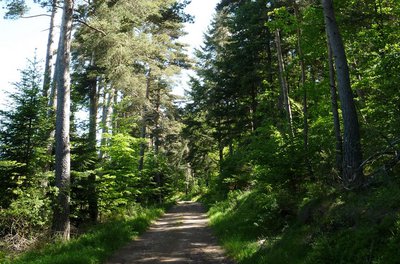
Chemin dans la forêt - Michel Monnot  Natural environment
Beech trees and the Mont Aigoual forest
Beech is the main species of the Mont Aigoual forest, which consists of a large variety of trees adapted to the diverse soil types and exposure. Like most deciduous trees, beech stumps put out many shoots after a tree has been felled. Foresters select the best of these for timber. Old beeches can attain remarkable sizes, such as the beech in Le Suquet forest in the municipality of Camprieu, a vestige of the original forest that has come down to us through the centuries and has a circumference of six metres and a height of 25!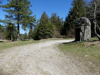
Col de la Caumette - nathalie.thomas  History
The salt road
La Caumette pass is on a former salt road. From Antiquity to modern times, salt has been a precious merchandise used for preserving food and tanning leather. Salt has always been traded and taxed during its transport inland from the Mediterranean coast. The sentry box at the pass was built in the 16th or 17th century at a strategic point at the crossroads of several roads, both to levy the salt tax and for surveillance against smuggling.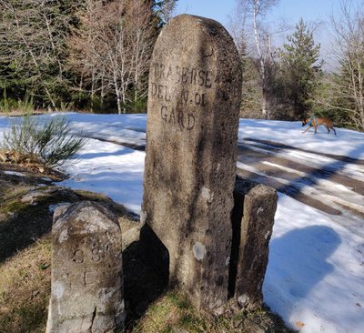
Route Royale - Béatrice Galzin HistoryFrom canons to the King’s Road
Have you noticed that you are on an ancient path?
Let’s plunge into history… Around the year 1000, this track was called Camin Ferrat and was used by transhumant shepherds and their flocks, pilgrims and merchants between Meyrueis and Le Vigan. From the latter, it passed through Mandagout, L'Espérou and the Col de la Serreyrède pass before descending to Bonheur Abbey and going back up to La Croix de Fer and reaching Meyrueis. This important mule track enabled trade between the Mediterranean and Meyruies. The Baron de Roquefueil, the region’s lord, had an abbey built below it, in the Bonheur valley, to aid travellers lost in the mountains. In the late 11th century, he founded a religious community of six canons who performed religious services and, in bad weather, rang the “bell for the lost” at regular times to guide passers-by in danger. The Abbey was abandoned in 1790. In the 18th century, the Camin Ferrat was disused in favour of the King’s Road, which you follow from the Col de la Caumette pass to Meyrueis. This new route went via the Col de la Serreyrède and the Col de la Caumette, after which it followed the ridge. The wall that you walk alongside from La Caumette and La Croix de Fer might be a vestige of the King’s Road or else the limit of the Bonheur Abbey estate. The secret remains, only our ancestors knew…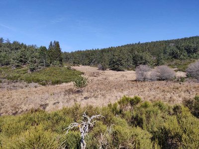
Zone humide - Béatrice Galzin  Water
WaterWetlands
Above the path, the soft sound of trickling water… These are wetlands, a fragile zone that must be protected. The peatbog is made up of rushes, sedge and many types of moss, such as sphagnum. Numerous insects live here, such as the large marsh grasshopper and dragonflies, as well as the common frog. If you make little noise, you may see deer here, or other animals that have come to cool down.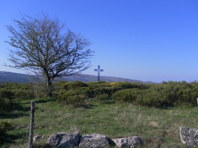
Col de la croix de fer - nelly Carel HistoryCol de la Croix de Fer pass
At the col de la Croix de Fer pass, which is a strategic crossroads of several tracks, there used to be an inn for travellers. The magnificent ruin with its two impressive vaults was also a sizeable farm, owned by the Baron de Roquedols. It was located at the limit of the municipalities of Meyrueis and St-Sauveur-Camprieu on the route of the Camin Ferrat and the King’s Road. In the days of religious persecution, the preacher François Vivens* organised secret Protestant gatherings in the small valley just below the buildings. (*Vivens was killed in 1692, 10 years before the Camisard War)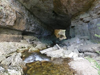
Perte du Bonheur - nathalie.thomas WaterThe Bonheur river
The Bramabiau site is an example of a karst spring. Here, slightly east of Camprieu, the Bonheur River has dug into the Causse (limestone plateau) and disappears in a natural tunnel. It re-emerges into the open at the bottom of the Aven de Balset, but it twists to the south to disappear again below ground. The river meanders through more than 10 km of tunnels. Then, 700 horizontal meters from its sinkhole, it reappears as a spring! The rock walls of the narrow canyon magnify the sound of its waters and add to its rumbling some acoustic vibrations that are close to a gigantic roaring. This is no longer the tranquil Bonheur, it is the tumultuous Bramabiau.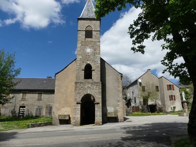
Camprieu - nathalie.thomas HistoryCamprieu
In the 19th century, the village streets were bustling year-round with a throng of artisans, labourers and shopkeepers, who lived in these modest mountain houses that were also suitable for livestock rearing. Camprieu had: two cobblers, six clog makers, two basket makers, one carpenter, two wheelwrights, two farriers, one miller, two stonemasons, one glassworks, one sawmill, one dairy, two grocer’s shops, a haberdashery and ironmonger’s and one shop for ladies’ “fashion and dresses”. There was also a cheese cellar that produced Roquefort until 1932, a hotel and an inn.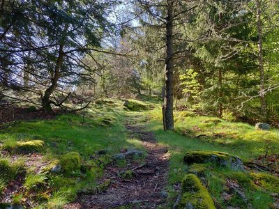
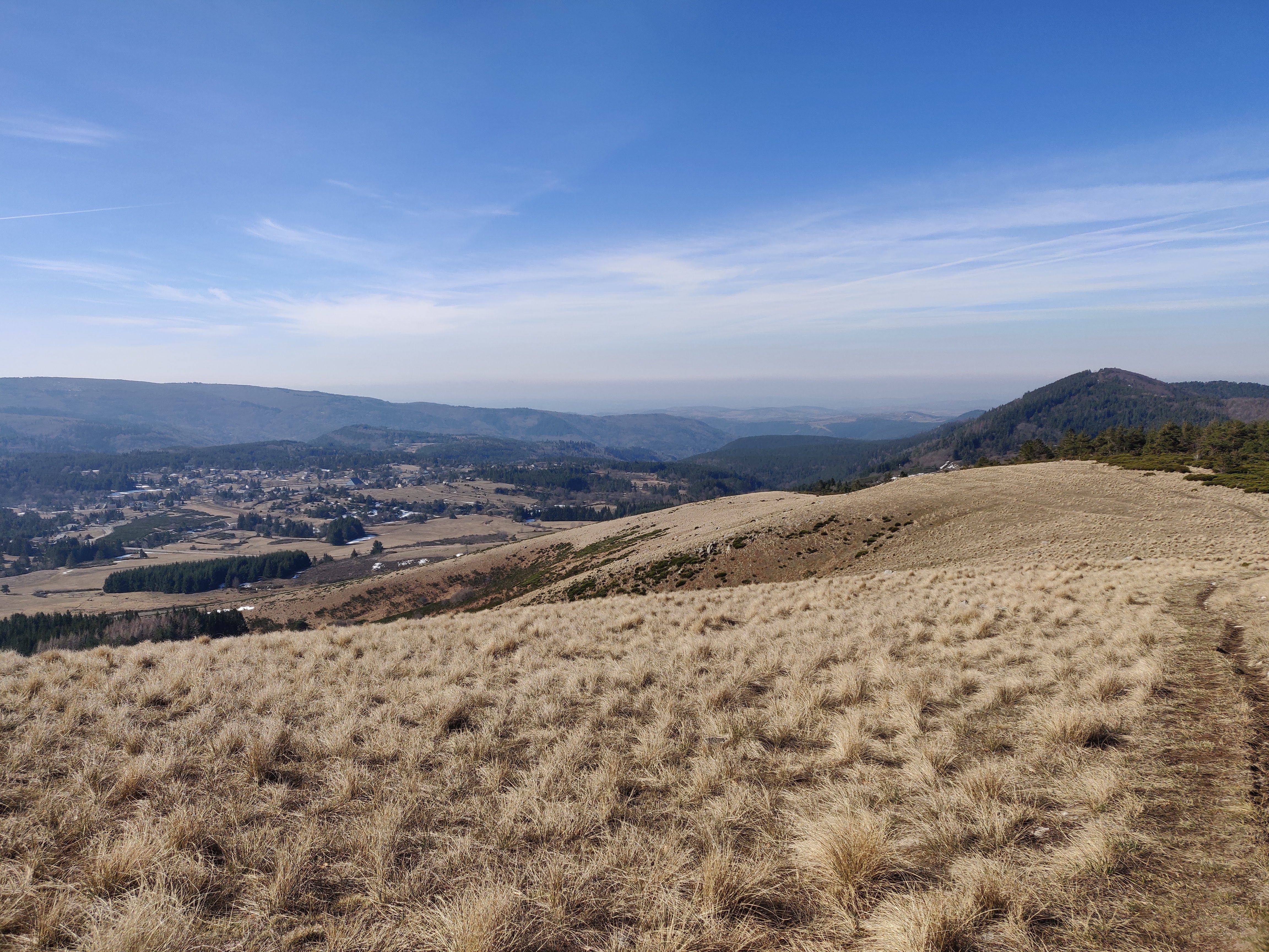
Sous bois du Trévezel - Béatrice Galzin Natural environmentThe Mont Aigoual forest
“Aigoual, Forêt d’Exception”
The French Forestry Office, which manages state forests, launched a programme in 2013 called “Aigoual, Forêt d’Exception” (Aigoual: An Exceptional Forest) with the aim of highlighting the massif’s natural and cultural heritage. The Forestry Office thus tries to foreground the different aspects of its multi-facetted management: production, protection and receiving visitors. One key aspect of this approach, which complements other initiatives by local actors, is to improve visitors’ experience in the forest.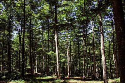
Hêtraie vers Camprieu, Aigoual - © Olivier Prohin Natural environmentThe Aigoual forest
In the 19th century, Mont Aigoual was almost totally bare of trees. Intensive use of the forest and the pressure of transhumant grazing together with the harsh local climate caused devastating floods. The rich vegetation of the grazing grounds was replaced by heather pastures and many gullies. In the valleys huddling at the foot of Mont Aigoual, terrible floods pushing tons of stones downstream carried off roads and pastureland. In response, a reforestation programme was launched in the second half of the 19th century, which created the forest you see today. Nowadays, the forested Aigoual massif protects the valleys while at the same time providing a space for economic production, biodiversity and leisure.
 History
Multi-purpose forest
Marker 6
A draille is a path between winter and summer pastures, used by shepherds and their sheep. In the mid-19th century, this draille was the eastern border of the Miquel woods. At the time, forest covered 20 to 25% of the surface of Mont Aigoual. Following reforestation, that figure has risen to 80%. Foresters ascribe three purposes to forest: being a space the public can enjoy, providing protection and being productive. These objectives were already part of Georges Fabre's vision.- History
Georges Fabre
A graduate of the Ecole polytechnique, and top of his year at the Nancy forestry school, the forester Georges Fabre devoted 30 years of his energy to reforesting the mountains of the Lozère and Gard. His goal was to stabilise mountain soils, but also to provide work for a local population that would otherwise have been condemned, in its entirety, to leave the countryside. In 1894, he initiated the construction of the Mont Aigoual weather observatory. In association with the Club Cévenol and Club Alpin Français, he also laid the foundations of the local “heritage tourism” (creating the Grand Hotel de l'Aigoual, building a shelter and viewpoint indicator at the summit, etc.) that continues to this day.
Description
Signposts will guide you all along this route. In the description below, the signposted place names and/or directions are given in bold italics between quotation marks:
Starting from "Station de Prat Peyrot", head towards "La Croix de Fer" on the GR® 6 trail via the two crossroads
- “Les Fayards” and
- “Col de la Caumette”.
On your descent, make sure to turn left onto the single-lane path and continue to “La Croix de Fer”; leave the GR® 6 behind. - At "La Croix de Fer", turn left towards
- "L’Aubespi",
- "Perte de Bramabiau" and "Mairie".
- At the "Mairie", turn right, go through the village towards
- "La Croix basse",
- "Camprieu", then towards "Maison du bois" via
- “Le Cros”,
- “Tabarde”.
- At the "Maison du bois", head towards "Col de Faubel" via
- "Tailladette",
- "Taillade",
- "Bois de l'Agre".
- At the "Col de Faubel" pass, go towards “Col de l’Espérou” via
- "La pépinière",
- "Montlau", then turn towards "Col de la Serreyrède" via
- At "Col de l'Espérou" go to
- "Serre de Favatel",
- " Trevezel".
- At the "Col de la Serreyrède" pass, climb back up on the drovers’ road (GR® 7) to "Station de Prat-Peyrot" via
- "Le Fangas".
This circuit is taken from the guidebook Massif de l’Aigoual, published by the communauté de communes Causses Aigoual Cévennes as part of the collection Espaces naturels gardois and the label Gard Pleine Nature.
- Departure : Part Peyrot
- Arrival : Part Peyrot
- Towns crossed : Meyrueis, Val-d'Aigoual, Saint-Sauveur-Camprieu, and Dourbies
Forecast
Altimetric profile
Recommandations
Caution: patous (livestock guard dogs)! Seek advice on how to behave near these dogs from tourist offices and National Park information centres.
Before committing yourself to a circuit, ensure that it is suitable for your activity level and ability. You must wear a helmet. Protective equipment is recommended. Respect other road users and stay in control of your speed and trajectory. Make sure your equipment is appropriate for the day’s weather conditions. Remember that the weather changes quickly in the mountains. Take enough water. Please close all gates and barriers behind you. No off-roading.
Information desks

Tourism & national parc'house
Col de la Serreyrède, 30570 Val d'Aigoual
The Maison de l'Aigoual houses the tourism office Mont Aigoual Causses Cévennes and the Maison du Parc national. This visitor centre provides information on and raises awareness of the Cévennes National Park, its sites and events as well as the rules that must be observed in the National Park's central zone.
On site: changing exhibitions, video projections, Festival Nature events and shop Open year-round
Transport
liO is the regional public transport service of the Occitanie/ Pyrénées – Méditerranée region. It facilitates everyone’s movements by prioritising public transport. For more information, call 08 10 33 42 73 or go to www.laregion.fr
Access and parking
From Valleraugue, take the D 986 towards L’Espérou, then towards col de la Serreyrède. At the Col (pass), take the D 269 towards mont Aigoual (4 km) – park at the Prat-Peyrot car park.
Parking :
Calculateur d'itinéraire Lio
Utilisez le calculateur liO pour organiser votre trajet en région Occitanie.
Autres régions
Calculez votre itinéraire en Auvergne Rhône Alpes sur Oùra
Biodiversité autour de l'itinéraire
Source


Report a problem or an error
If you have found an error on this page or if you have noticed any problems during your hike, please report them to us here:
