
Bézuc
6 points of interest
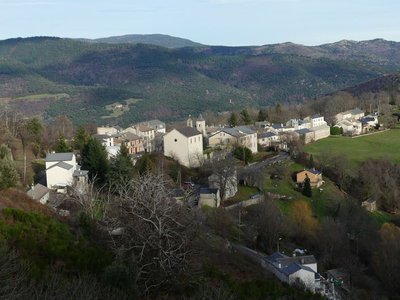
Le Pompidou - nathalie.thomas  History
Le Pompidou
Le Pompidou, like Saint-Roman de Tousque, owes its development to its location on the Corniche des Cévennes road. From the 17th century onwards, this former mule track carried substantial trade, with mule cart drivers bringing up salt, wine and dried fish from southern France to the Gévaudan, taking grains and cloth down from the uplands, and exporting the silk and chestnuts of the Cévennes. You can still see two buildings, the former inn (Le Cheval Blanc) and the Chapeau Rouge staging post, where travellers changed carriage horses.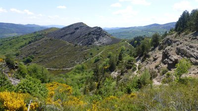
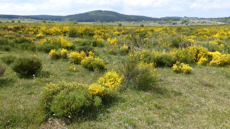
Col de Tartabissac - nathalie.thomas AgricultureSmall buildings
The small buildings you see dotted here and there are jasses (from jas: place where livestock sleeps), sheepfolds of times gone by. There used to be at least 20 between Tartabissac and Bézuc. From the first warm days to 6 December, livestock would spend the night here, and their owners would come up during the day to watch them. An old saying goes, “No livestock in the chestnut groves before the sixth of December”. 6 December was the date of the fair in Florac when the local chestnuts were sold. Today Bézuc hosts 200 sheep for 8 months of the year.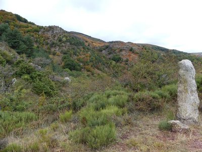
Vue sur La Can depuis le col de Tartabisac - nathalie.thomas  Geology
Contact
At the Col de Tartabisac pass, there is a clear limit between the two bedrocks: on the left, the limestone plateau; on the right, a schist slope. The two rocks are in contact at a geological fault. A layer of very wet sandstone sits at the level of the meadows, at the foot of the limestone. This is where the water that has infiltrated via the thick layers of the Can plateau re-emerges.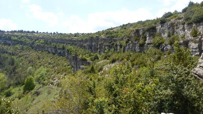
Descente sous Les Crottes - nathalie.thomas GeologySchist, limestone or granite
From the track, you can make out the hamlets on the side of the valley at the foot of the Can: Roumassel, Le Crouzet, Le Crémat, Le Masbonnet. The land stretching from the valley floor to the plateau belongs to these hamlets, including chestnut groves, pasture and parcels for growing grains. After Bézuc, the bedrock is partly schist, where broom and heather grow, partly limestone, which is linked to the presence of the carline thistle. In a meadow beyond the beech forest, you can see blocks of granite, which stem from a vein linking Mont Aigoual to Mont Lozère. The ruiniform rocks on the plateau were shaped by water, which infiltrates fractures in the rock and dissolves the dolomite that they are made of.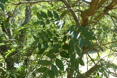
Frêne commun - Nathalie Thomas  Flora
FloraAsh trees
Ash trees, like the ones that border the path, like cool and damp environments. They were planted alongside paths by locals because ash branches, cut towards the end of summer, provided additional fodder for livestock.
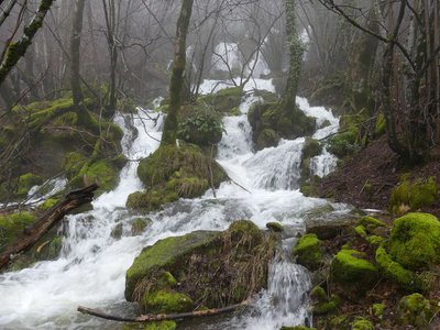
Source du Moulin - nathalie.thomas  Water
WaterWater
On the plateau, mains water was not installed until 1975. Before that, livestock had to be herded to the lavogne (a natural basin made waterproof using clay) to be watered, even in winter. At Les Crottes, two cisterns under the buildings recovered the rainwater from the roofs using a system of gutters: one is accessible via a sort of well from the house; the other, which holds 2,500 litres, can be accessed from the sheepfold. As you go downhill from Les Crottes, you pass a tapped source whose strong flow was surely a factor in the building of the farm just above.
Description
Start on the square in front of the Salle des fêtes.
1) Take the lane, then turn left to join up with the path that climbs to the Col de Tartabissac pass.
2) At the pass, take the path on the left. Be careful fording the river and avoid this walk altogether during heavy rain.
3) At Bézuc, go over the stile and cross the road. Take the path opposite. After 300 m, turn left; then, after 400 m, turn left again and take the path that climbs to L'Hospitalet.
4) At L'Hospitalet, cross the road and continue on the track (GR 7) for 3.9 km. Leave the track to take a path on the left to the hamlet of La Bastide.
5) Go through the hamlet and follow the road to Les Crottes. Go past the farm on the left to take a path that goes downhill through the limestone cliffs. Turn left onto the road to join up with the D 9 and a stile. Arrive at L'Abeuradou, then take the D 9 for 120 m and, in the bend, go straight downhill to Le Pompidou.
- Departure : Le Pompidou: on the square in front of the Salle des fêtes (village hall)
- Arrival : Le Pompidou: on the square in front of the Salle des fêtes (village hall)
- Towns crossed : Le Pompidou, Vebron, Rousses, and Bassurels
Forecast
Altimetric profile
Recommandations
NB: Do not attempt this walk after heavy rain (river crossings). Make sure your equipment is appropriate for the day’s weather conditions. Remember that the weather changes quickly in the mountains. Take enough water, wear sturdy shoes and put on a hat. Please close all gates and barriers behind you.
Information desks

Tourism'house and national Parc at Florac
Place de l'ancienne gare, N106, 48400 Florac-trois-rivières
This office is part of the National Park's associated tourist-information network, whose mission is to provide information on, and raise awareness of, the sites and events as well as the rules that must be observed in the National Park's central zone.
On site: exhibitions, video projections, events and shop Open year-round

Office de tourisme Des Cévennes au mont Lozère
le Quai, 48220 Le Pont de Montvert sud mont-Lozère

Tourism office Des Cévennes au mont-Lozère, Saint-Germain-de-Calberte
Village, 48370 Saint-Germain-de-Calberte
This office is part of the National Park's associated tourist-information network, whose mission is to provide information on, and raise awareness of, the sites and events as well as the rules that must be observed in the National Park's central zone.
Open year-round, except for 2 weeks at Christmas
Access and parking
From Florac-Trois-Rivières, take the D 907 and D 983 towards St-Laurent-de-Trèves, then the D 9 to Le Pompidou.
Parking :
Calculateur d'itinéraire Lio
Utilisez le calculateur liO pour organiser votre trajet en région Occitanie.
Autres régions
Calculez votre itinéraire en Auvergne Rhône Alpes sur Oùra
Biodiversité autour de l'itinéraire
Source

Report a problem or an error
If you have found an error on this page or if you have noticed any problems during your hike, please report them to us here: