
Tourrières
This path linking the schist valleys with the granite plateau was much used by peasants until the mid-19th century. The uplands have the same climate as the Massif Central; water flows towards the Atlantic. On the valley floor, temperatures are Mediterranean, and it is towards the Mediterranean that the rivers run. Walking this path will allow you to experience - in just a few hours - the contrast between these two worlds.
5 points of interest
Polimies Hautes - nathalie.thomas  Architecture
The hamlets of Libourette and Les Polimies Hautes
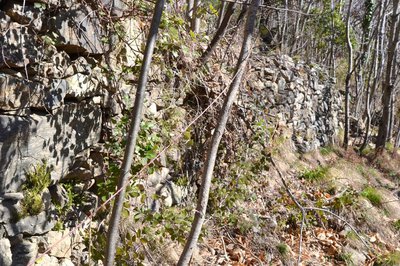
These two hamlets are recorded as far back as the early 14th century. Beyond the handsome dwellings built from the local stone, schist, these typically Cevenol hamlets have remarkable and characteristic architectural elements. When you arrive on the plateau, the contrast is striking: granite replaces schist almost without transition !
Terrasses embroussaillées - © Michel Boulanger AgricultureThe terraces
Unfortunately, not much is left of the former crop terraces. Nevertheless, there are still some herds of goats and sheep in these two hamlets as well as some sweet-chestnut groves. Several beekeepers also make good use of the unspoiled nature. For a reminder of old farming practices, when you get back to the tarred road at Libourette, don’t miss the wooden structure. It held up the cables used by locals to take the hay cut in mid-altitude meadows down the slope.
Le Rieutort - nathalie.thomas  Water
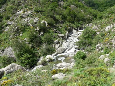
WaterThe Rieutort
This twisted brook deserves its name! Once it has left the plateau, the Rieutort becomes a torrent and gives rise to many superb basins and waterfalls. Its water is indispensable for arable and livestock farming. In the old days, locals spared no effort to build numerous béals (irrigation channels) to bring water all the way to fields at altitude, to crops and sheepfolds. Some still exist and can be spotted with a bit of attention along the contour lines on the right bank, like fish bones sticking out of a spinal column (the brook).
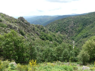
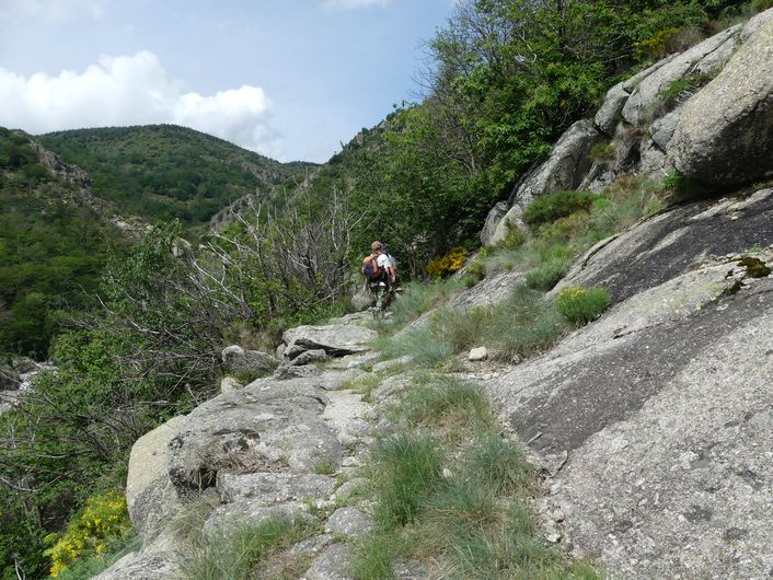
Canyon du Rieutort - nathalie.thomas WaterTourrières
The brooks that you come across on the path all flow towards Vialas and the Mediterranean.
Yet it is not far to the watershed. A little further on is the spring of the Tarn, which has a long way to go to the Garonne river and then the Atlantic.
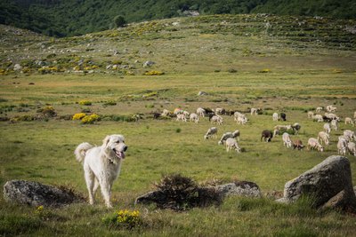
Le troupeau de Tourrières - © Emilie Reydon AgricultureThe hamlet of Les Tourrières
At Les Tourrières, the shepherd has about 1,000 sheep in the summer. In addition to his own flock of 300, he looks after those of a few other owners. The flocks, having come up from the neighbouring Gard department partly by lorry and partly on foot, roam over hundreds of hectares until the end of the autumn, thus maintaining a landscape shaped by humans and livestock.
Description
From the tourist office, go downhill for 60m towards the bar.
1. Turn right onto the calade (cobblestoned way) that goes uphill to Gourdouze.
2. Cross the road once, then turn left onto it to get to Libourette and Polimies Hautes.
3. Walk through the hamlet, continue on the cobbled path to the bridge over the Drelieirède and go uphill to Tourrières. The path overlooks the Rieutort river, and will stay by it till the end. Gradually the views open up, and you discover the high plateau and the few austere dwellings that make up Les Tourrières.
4. Return to Vialas on the same path.
- Departure : Vialas (Tourist office, D37)
- Arrival : Vialas (Tourist office, D37)
- Towns crossed : Vialas
Forecast
Altimetric profile
Recommandations
Make sure your equipment is appropriate for the day’s weather conditions. Remember that the weather changes quickly in the mountains. Take enough water, wear sturdy shoes and put on a hat. Please close any gates and barriers behind you. Bathing is possible in the Rieutord’s pretty basins; but be careful – the currrent can be powerful at certain times of year.
Caution in Les Tourrières : livestock guard dogs (patous) from May to October. Seek advice on how to behave near these dogs from tourist offices and National Park information centres.
Stay on the path and keep your dog on a leash.
Information desks

Tourism'house and national Parc at Florac
Place de l'ancienne gare, N106, 48400 Florac-trois-rivières
This office is part of the National Park's associated tourist-information network, whose mission is to provide information on, and raise awareness of, the sites and events as well as the rules that must be observed in the National Park's central zone.
On site: exhibitions, video projections, events and shop Open year-round

Office de tourisme Des Cévennes au mont Lozère
le Quai, 48220 Le Pont de Montvert sud mont-Lozère
Tourism office Des Cévennes au mont-Lozère, Vialas
1 place de l'ancienne gendarmerie, 48220 Vialas
This office is part of the National Park's associated tourist-information network, whose mission is to provide information on, and raise awareness of, the sites and events as well as the rules that must be observed in the National Park's central zone. Open July and August
Access and parking
From Le Pont-de-Montvert on the D998 or from Génolhac on the D906, then the D998 and D37 to Vialas
Parking :
Calculateur d'itinéraire Lio
Utilisez le calculateur liO pour organiser votre trajet en région Occitanie.
Autres régions
Calculez votre itinéraire en Auvergne Rhône Alpes sur Oùra
Biodiversité autour de l'itinéraire
Source


Report a problem or an error
If you have found an error on this page or if you have noticed any problems during your hike, please report them to us here: