
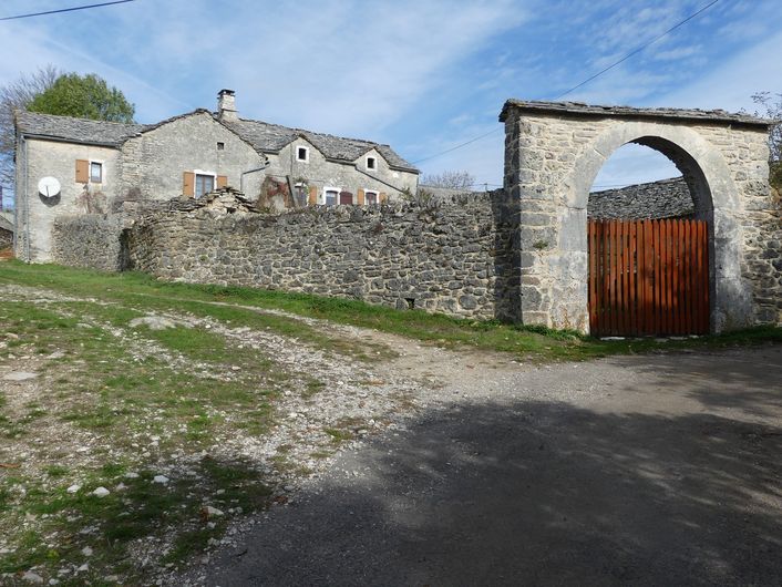
The three hamlets
This ancestral track is partly on a draille (drovers’ road); the built heritage showcases history from the Neolithic to today: a protohistoric enclosure, jasses (overnight pens for livestock), lavognes (man-made watering-holes for livestock), a cross… there is also a strong presence of farming, which maintains the environment.
4 points of interest
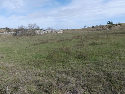
Paysage du Causse - nathalie.thomas  Landscape
The Causse landscape
As you move uphill, and more generally throughout the walk, you will notice the impact of human activity on the landscape: drystone walls built to delimit plots and along paths; clapas (piles of stones) indicating the exits from fields and routes, etc. An emblematic element of the Causse landscape, dolines (or scotchs in Occitan) are small depressions with deep soils, in which grains and forage plants are grown.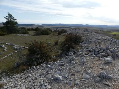
L'enceinte protohistorique - nathalie.thomas  Archaeology
Protohistoric enclosure of Rode
No lasting settlement of the plateau is known before this enclosure -only incursions by hunters following their prey. It was during the Iron Age that humans became sedentary. Soundings of the enclosure walls at Rode have revealed a dwelling with a hearth, ceramics and the contours of meals, including a large quantity of horse remains. The rectangular buildings seem to have backed onto the ramparts, leaving free space at the centre of the enclosure, possibly to shelter the livestock. The elliptical ramparts, 110 m long and 95 m wide, are originally believed to have been 4 m high.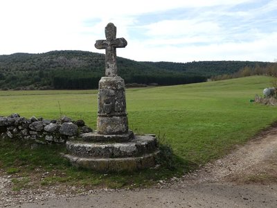
La croix du Buffre - nathalie.thomas  History
Le Buffre cross
This is one of the oldest and most handsome crosses in Lozère. On its cylindrical pedestal (12th c.), which is set on three steps, two persons face each other on either side of a holy water basin representing a human face. The basin is carved into the pedestal and also projects from it. The more recent actual cross is believed to date from the 18th century. Le Buffre cross is one of many that dot the Saint Guilhem route, to both guide and encourage pilgrims.
L'église de Hures - nathalie.thomas  Architecture
The church of Hures
The church was founded in the 11th century by the Benedictine monks of Sainte-Enimie to expand their arable land. It was built in four stages:
- The choir in the early and the nave in the late 12th century,
- the right-hand chapel in the 14th century,
- the left-hand chapel in the 18th century.
Each enlargement of the building corresponded to an increase in the Causse population. The nave has a beautiful window. To the right of the entrance is a funereal recess, which probably belonged to a local dignitary and in which were deposited a number of bones removed from the buried body.
Description
From the parking area, take the road to reach the hamlet of Drigas.
- Turn left and go straight up into the hamlet. As you leave the hamlet, continue straight ahead on the track that goes gently uphill to a gate.
- At this little pass, take a path to the right that leads to the protohistoric enclosure (you will need to retrace your steps to return).
- Back at the pass, take the path opposite, which goes very slightly downhill towards Le Buffre.
- As you leave the woods and the field, turn right onto the track to the hamlet of Le Buffre. Then turn right and, when you reach the road, cross it, walking straight ahead to the cross.
- At the cross, leave the road and continue straight ahead on the track (draille). Pass the watering-hole on its left.
- 100 m after the watering-hole, the path moves up the slope of the hill on the right and goes back downhill to Hures.
- Go through the fence and take the track on the right uphill to the quarry, cross the quarry and continue straight ahead on the track to return to Drigas.
- Departure : Drigas
- Arrival : Drigas
- Towns crossed : Hures-la-Parade
Forecast
Altimetric profile
Recommandations
This walk is not advisable in hot weather. Make sure your equipment is appropriate for the day’s weather conditions. Remember that the weather changes quickly in the mountains. Take enough water, wear sturdy shoes and put on a hat. Please close all gates and barriers behind you.
Information desks

Tourism'house and national Parc at Florac
Place de l'ancienne gare, N106, 48400 Florac-trois-rivières
This office is part of the National Park's associated tourist-information network, whose mission is to provide information on, and raise awareness of, the sites and events as well as the rules that must be observed in the National Park's central zone.
On site: exhibitions, video projections, events and shop Open year-round
Access and parking
From Meyrueis, on the D 986, then the D 47 to Drigas
Parking :
Calculateur d'itinéraire Lio
Utilisez le calculateur liO pour organiser votre trajet en région Occitanie.
Autres régions
Calculez votre itinéraire en Auvergne Rhône Alpes sur Oùra
Biodiversité autour de l'itinéraire
Source


Report a problem or an error
If you have found an error on this page or if you have noticed any problems during your hike, please report them to us here: