
Pessades farm
3 points of interest
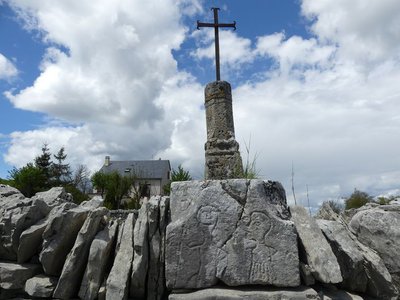
Croix de Champerboux - nathalie.thomas  History
Crosses
On this walk, you will see many ancient crosses. Each is unique and exists for different reasons. The iron cross with the sculpted pedestal in Champerboux is the oldest. It seems to have been linked to pilgrimages and more precisely to the network of routes leading to Santiago di Compostella.
In most cases, the presence of a cross is a reminder by the Church of Catholicism. Very often erected at crossroads, the crosses served as waymarks, showed the parish borders and signposted memorial sites or sites for contemplation.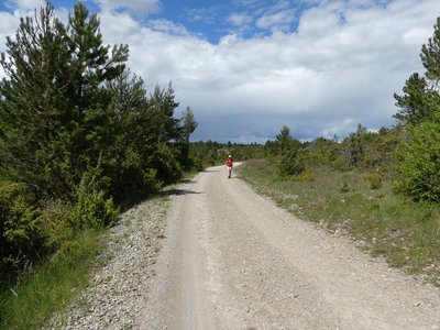
La grande draille d'Aubrac - nathalie.thomas HistoryThe grande draille d’Aubrac (main Aubrac drovers’ road)
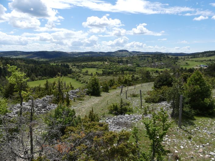
Since they always took the same routes, the many herbivores that instinctively moved from the south to pasture land further north created a network of paths called drailles, which were subsequently used for transhumance (seasonal herded migrations).
A part of your route is on a very old drovers’ road known as the grande draille d’Aubrac, which linked the hinterland of Montpellier with the Aubrac plateau. It was also used as a trade route between plains and mountains, giving access to the region’s fairs.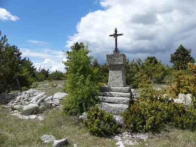
Croix - nathalie.thomas HistorySaint-Guilhem
In the Middle Ages, the spread of Christianity encouraged an enthusiasm for religion. This route was used by crowds of pilgrims heading for the Abbey of Gellone, via Sainte-Enimie to see the saint’s relics. The route is currently a long-distance hiking trail linking Aumont-Aubrac and Saint-Guilhem-le-Désert in the Hérault. It is 240 km long, crosses 4 departments and offers exceptionally diverse scenery.
Description
1) Leave the road by turning left onto the second track by the cross of Rocoplan.
2) Go round a bend and continue straight ahead on the path that descends alongside the fence.
3) At the bottom of the downhill slope, leave the track on the left.
4) By a fork near the road, turn left on the path that goes up on the ridge.
5) By the barrier, leave the path to take the track on the right. Cross the road and continue straight ahead.
6) At the crossroads, continue on the left, following the track uphill (former draille or drovers’ road).
7) Before you arrive at the top of the ridge, turn left onto a small path towards Pessades (waymarked yellow and red).
8) Cross the road and follow the path that runs alongside Pessades farm on the left.
9) 1 km after Pessades farm, turn right.
10) At the cross, go uphill to Champerboux, and, in the village, take the second road on the left to return to the car park.
- Departure : Champerboux: on the road to La Périgouse
- Arrival : Champerboux: on the road to La Périgouse
- Towns crossed : Gorges du Tarn Causses
Forecast
Altimetric profile
Recommandations
Information desks

Tourism office Cévennes Gorges du Tarn, Sainte-Enimie
village, 48210 Sainte-Enimie
This office is part of the National Park's associated tourist-information network, whose mission is to provide information on, and raise awareness of, the sites and events as well as the rules that must be observed in the National Park's central zone.

Tourism'house and national Parc at Florac
Place de l'ancienne gare, N106, 48400 Florac-trois-rivières
This office is part of the National Park's associated tourist-information network, whose mission is to provide information on, and raise awareness of, the sites and events as well as the rules that must be observed in the National Park's central zone.
On site: exhibitions, video projections, events and shop Open year-round
Access and parking
Parking :
Calculateur d'itinéraire Lio
Utilisez le calculateur liO pour organiser votre trajet en région Occitanie.
Autres régions
Calculez votre itinéraire en Auvergne Rhône Alpes sur Oùra
Biodiversité autour de l'itinéraire
Source


Report a problem or an error
If you have found an error on this page or if you have noticed any problems during your hike, please report them to us here: