
Domaine des Boissets
4 points of interest
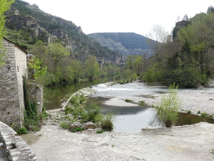
Ste-Enimie - N Thoams  History
Sainte-Enimie
The mediaeval village of Sainte-Enimie has been a tourist destination ever since pilgrims on the way to Santiago di Compostella were persuaded by locals to make a detour to pray at Ste-Enimie’s tomb. In 951, Benedictine monks from the abbey of Saint-Chaffre-en-Velay, led by the bishop of Mende, re-established the old priory, which had been founded in the 6th century by Bishop St-Lière. From the 12th century onwards, the village’s future was assured by the legend, which the Church in Gévaudan cleverly cultivated and exploited until it was carved into the collective unconscious. The Benedictines of Sainte-Enimie were thus able to revive faith, develop trade and enrich the village. Over time, they put in place a religious authority that ruled the region until the French Revolution.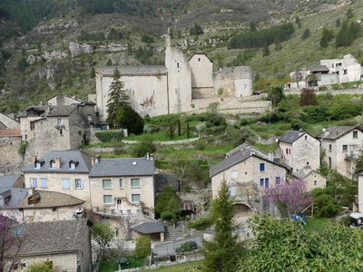
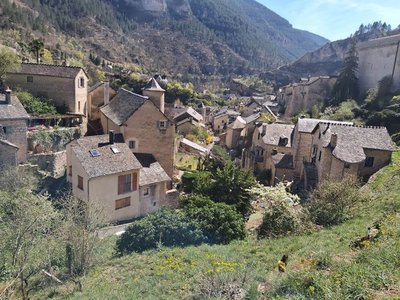
Vestiges de l'abbaye - nathalie.thomas HistoryThe vestiges of the abbey
During the Revolution, the monastery was destroyed and its furnishings burned alongside those of the church. The abbey was deconsecrated and used as a quarry. Only St-Madeline’s chapel, vestiges of the fortifications and the monk’s refectory (called the chapterhouse) remain.
The Tarn Gorge was on the official list of historical monuments, sites and furnishings from 1908 to 1950. Within the municipality of Sainte-Enimie, several buildings, including the abbey, the church and its furnishings, are listed. The monastery has been partly rebuilt and turned in a state secondary school.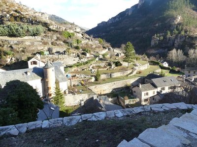
Les terrasses - nathalie.thomas AgricultureThe terraces
Locals have transformed the rocky slopes into hanging gardens by making use of the smallest of flat spaces. They carried the soil up in baskets or sacks on their backs. This is where they would have planted their vegetables and fruit trees (peach, walnut, almond). Until the early 20th century, almond trees were the “great resource” that made good use of soils too poor for other crops.
Until 1851, there were 54 hectares of grapevines for 850 inhabitants. The vineyards clung to 45-degree slopes, which made work difficult. The low yield, disease and mechanisation were all factors in the abandonment of this crop. The municipality of Ispagnac reintroduced vines in 2003 when a winemaker settled there; a second settled in Blajoux in 2006.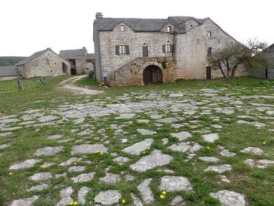
Domaine de Boisset - nathalie.thomas HistoryDomaine des Boissets
The stone framework of several windows suggests that the first buildings were built as early as the 15th. The farm was operational until 1960.The hamlet consists of six buildings, houses, outbuildings and sheepfolds, in the typical Caussenard style. The internal courtyard was closed off by walls that were much higher than they are today. A bread oven, cisterns and threshing floor complete the complex, showing that the inhabitants lived in autarky.
Description
From the car park on the banks of the Tarn, walk past the pharmacy and continue straight on Rue de la Combe. After 200 m, take the second lane on the right.
1) The lane (Chemin de Boissets) is tarred at first but quickly turns into a track that goes uphill through terraced gardens.
2) After the spring and the pine plantation, you get to a fork in the track. Continue straight ahead (steep climb) towards the plateau and Domaine des Boissets.
3) Once you are on the plateau, walk alongside the Domaine des Boissets on the left until you reach the road. Turn left onto this for about 360 m.
4) Fork left: the path soon comes out onto a track. Turn left onto it.
5) After 400 m, take on your right the path that goes downhill into the forest and joins up with a forest track.
6) Turn left onto the track, then turn right at the first bend.
7) Take the track on your left (NB: do not climb all the way to the road). This wide track, which is the former draille (drovers’ road) and road to Mende, takes you back down to Sainte-Enimie.
- Departure : Sainte-Enimie
- Arrival : Sainte-Enimie
- Towns crossed : Gorges du Tarn Causses
Forecast
Altimetric profile
Recommandations
Path with little shade. Make sure your equipment is appropriate for the day’s weather conditions. Remember that the weather changes quickly in the mountains. Take enough water, wear sturdy shoes and put on a hat. Please close all gates and barriers behind you.
Information desks

Tourism office Cévennes Gorges du Tarn, Sainte-Enimie
village, 48210 Sainte-Enimie
This office is part of the National Park's associated tourist-information network, whose mission is to provide information on, and raise awareness of, the sites and events as well as the rules that must be observed in the National Park's central zone.

Tourism'house and national Parc at Florac
Place de l'ancienne gare, N106, 48400 Florac-trois-rivières
This office is part of the National Park's associated tourist-information network, whose mission is to provide information on, and raise awareness of, the sites and events as well as the rules that must be observed in the National Park's central zone.
On site: exhibitions, video projections, events and shop Open year-round
Transport
Bus stop: Parking Gravière
- Bus line 258 “Florac – Sainte-Enimie – Le Rozier”, every day in July and August
- Bus line 259 "Mende – Saint Enimie – Meyrueis”
https://lio.laregion.fr/
Access and parking
From Ispagnac, take the D 907b down the Tarn Gorge to Sainte-Enimie.
Parking :
Calculateur d'itinéraire Lio
Utilisez le calculateur liO pour organiser votre trajet en région Occitanie.
Autres régions
Calculez votre itinéraire en Auvergne Rhône Alpes sur Oùra
Biodiversité autour de l'itinéraire
Source


Report a problem or an error
If you have found an error on this page or if you have noticed any problems during your hike, please report them to us here: