
The two farms of the Causse Noir
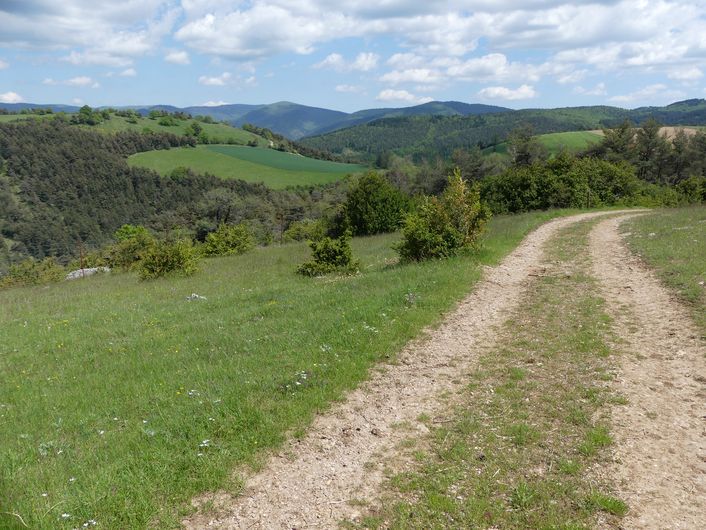
3 points of interest
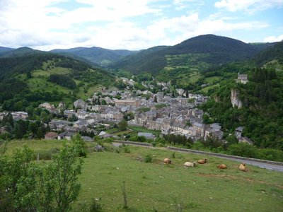
Meyrueis - ©Nathalie Thomas  History
Castle rock
According to a non-verifiable claim from the 17th century, the Roman general Caius Marius had a castrum built on the rock overlooking the village, in 101 BC. However, the first written sources to mention the village date from the 11th c. and refer to the castle, home to the Bermont family. The castle then passed successively into the hands of the Anduze, Roquefeuil and Armagnac families, before falling to Jeanne d’Albret, Queen of Navarre.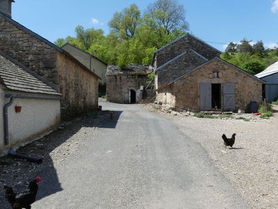
Le Marjoab - nathalie.thomas AgricultureSérigas, Marjoab
Here, local farms breed goats to produce milk for making Roquefort cheese. In the 17th and 18th century, farmers used their milk to make cheese for themselves. In 1842, following the collapse of wool rates, the “Société des Caves et Producteurs Réunis” was formed to centralise cheese-ripening in Roquefort. A large number of dairies were opened in Causse hamlets. It was not until 1929 that the “Confédération des Eleveurs de Brebis et des Industriels de Roquefort” was created to once again jointly manage Roquefort production.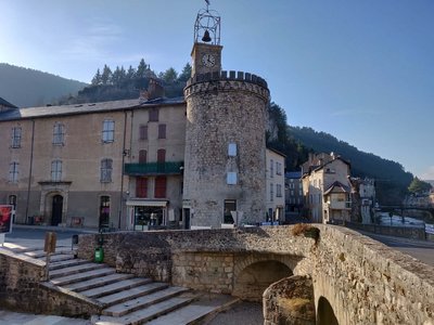
Le centre de Meyrueis et sa tour - Béatrice Galzin  Architecture
The village of Meyrueis
The geographical location of Meyrueis is remarkable, nestled between the Aigoual massif, the causse Noir and the causse Méjean. Here the Camin Ferrat crosses the Jonte river. Pilgrims and transhumant flocks of sheep stopped in the village before continuing their journey. Many merchants came to its large fairs. Stroll through the lanes and relive the flourishing past of the belle époque. From the prosperous bourgeois residences to the marketplaces, everything still speaks of the past! Sheep’s wool from the plateaux was woven here, silk was spun. There was intense economic activity. In the 17th century, Meyrueis became a centre for hat-making. By 1860, 17 milliners were busy making hats for Languedoc and Provence, beautiful and exceptionally high-quality hats made from felted wool and silk bourette. Discontinued as of about 1920, this activity left room for tourism, which today animates the village.
Description
From Jean-Séquier Square (in the village), take "chemin de la Vinade", a lane going uphill to the right of the Hôtel de l’Europe.
1) Then follow "Sérigas" on the GR® 62a hiking trail. The trail crosses the D39 twice.
2) In Sérigas, walk past the farm building, then turn left to reach the D39 once again. Turn right onto the road, walk for 200m and, having ignored two paths on the left, leave the road for a wide track on the left beyond a group of houses, towards "Le Marjoab".
3) Cross the hamlet of Le Marjoab and 150 m further on take the track on the left.
4) At the intersection of tracks, turn right towards "Meyrueis 4,6 km".
NB! Take a path on the left that goes downhill and around a field to join up with the old Meyrueis-Le Vigan road in a bend.
5) Turn left onto it and walk downhill to Meyrueis. Cross the D 986 and enter the forest opposite. At the crossroads, turn left towards Meyrueis, join up with the road and turn left onto it. Then turn left onto Rue de l’Airette to return to Meyrueis.
- Departure : Meyrueis: Place Jean-Séquier
- Arrival : Meyrueis: Place Jean-Séquier
- Towns crossed : Meyrueis
Forecast
Altimetric profile
Recommandations
Make sure your equipment is appropriate for the day’s weather conditions. Remember that the weather changes quickly in the mountains. Take enough water, wear sturdy shoes and put on a hat. Please close all gates and barriers behind you.
Information desks

Tourism'house and national Parc at Florac
Place de l'ancienne gare, N106, 48400 Florac-trois-rivières
This office is part of the National Park's associated tourist-information network, whose mission is to provide information on, and raise awareness of, the sites and events as well as the rules that must be observed in the National Park's central zone.
On site: exhibitions, video projections, events and shop Open year-round
Transport
Bus stop: Office de tourisme, place Sully
- Bus line 259 Mende - Sainte Enimie - Meyrueis
- Bus line 215 « Millau – Peyreleau - Meyrueis »
https://lio.laregion.fr/
Access and parking
From Florac or Le Rozier on the D 996.
Parking :
Calculateur d'itinéraire Lio
Utilisez le calculateur liO pour organiser votre trajet en région Occitanie.
Autres régions
Calculez votre itinéraire en Auvergne Rhône Alpes sur Oùra
Biodiversité autour de l'itinéraire
Source


Report a problem or an error
If you have found an error on this page or if you have noticed any problems during your hike, please report them to us here: