
Mill Trail
6 points of interest
Vimbouches - Nathalie Thomas  History
Vimbouches
In Vimbouches, the Catholic church and then the castle were burnt by the Protestant Camisards; the village was also pillaged by the King’s troops in 1703. As of 1943, like other hamlets in the valley, Vimbouches sheltered German antifascist refugees, who joined the French Resistance in 1944. These refugees were supported and supplied by the locals.
"My uncle told me, You have to go to Soubrelargue – there were Jews in Soubrelargue – and say this, and then he told me a sentence that made no sense at all. I said, What does that mean ? He said, Don’t worry, I’ll explain later, and so I went off, through Vimbouches all the way to Soubrelargue, I was 11 years old".
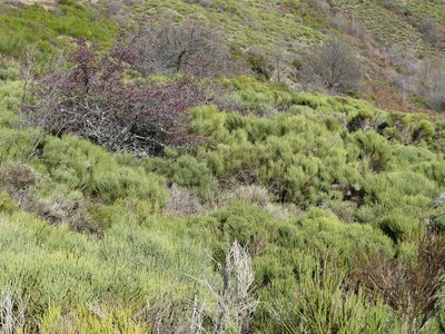
Lande à genêt - Nathalie Thomas HistoryThe broom
The heath of broom, heather and juniper that you are walking across is former pastureland, transformed by a decrease in grazing.
"My mother said there wasn’t any broom before, it was planted, probably for kindling and making broom. I used to sweep my house with a broom that I’d made from broom. My granddad had shown me how to make them and I knew exactly how to fetch broom in the mountains with my axe. I made the broom by attaching it with string.”
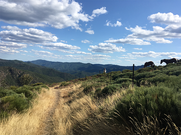
Limite de la végétation - nathalie.thomas  Flora
FloraThe road to Le Masmin
This lane represents the limit between the sweet chestnut zone and the broom and heather zone. This east-facing slope was once one of the largest pasture areas in the Cévennes, grazed by local and transhumant flocks of sheep. Higher up, callune, a type of heather which flowers earlier at altitude, covers the Bougès massif in mauve in August and provides its precious nectar to bees. This moor of heather and broom (common and Pyrenean or purging broom) is dotted with hawthorns, rose hips and blackthorns, and is slowly being taken over by the forest.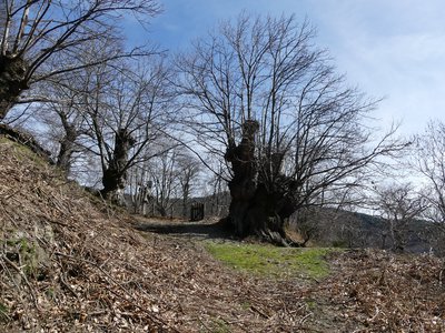
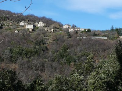
Un beau spécimen ! - nathalie.thomas AgricultureLe Tronc
This hamlet used to live the traditional Cévenol way. The chestnuts fed its human inhabitants and fattened the pigs. Sheep, goats and cows were raised. The crop terraces below the houses supplied the grains and garden vegetables. After a long period of abandonment, Le Tronc has come alive again. Today the ruins have become houses again, a sheep farmer maintains the open spaces, the chestnut orchard has been restored, and pélardon cheeses are waiting to be savoured.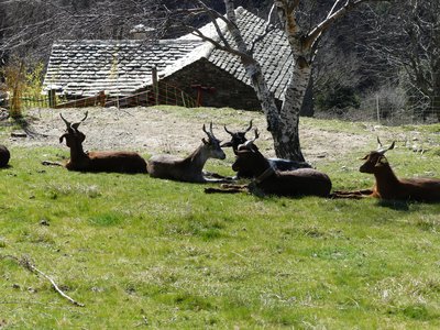
Le Salson - nathalie.thomas AgricultureLe Salson
(from: salaison, meaning “salting (meat)”)
This hamlet amidst meadows is very exposed to the winds but benefits from several springs, which are a crucial asset for farms. The diversity of the farm buildings (granges, sheepfolds, stables, clèdes or chestnut-drying buildings, etc.) bears witness to the size of these farms in the old days.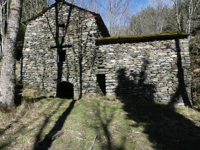
Le moulin - nathalie.thomas  Architecture
The mill
The mill, whose construction dates to 1790, was built and used by several landowners at Le Salson. It was the largest mill in the valley and had been cleverly designed. Its well-thought-out water course could activate several millstones at once. The mill was thus used to make groats while another millstone ground rye or wheat or buckwheat for flour and yet another crushed walnut kernels for oil.
In another building, pieces of caddis cloth were fulled. The water of the Gardon d'Alès was partially dammed and collected in a gourgue (basin) to activate the mill’s horizontal wheels. When the water re-emerged, it was channelled into béals (irrigation channels). A 2 km-long béal irrigated meadows and chestnut trees all the way to below Le Grenier.
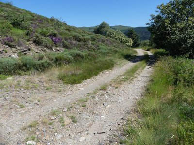
Description
Signposts will guide you all along this route, as well as yellow painted waymarks. In the description below, the signposted place names and/or directions are given in bold between quotation marks:
Starting at “Vimbouches”, walk towards “Draille de Vimbouches”. Continue towards “Poumeyrol” via Le Masmin and Le Tronc. At the “Poumeyrol” intersection, return to “Vimbouches” via “Le Salson-Nord”. The walk takes you right past the mill.
This hike is taken from the guidebook Mont Lozère - Pays des sources, Sommet des Cévennes, published by the Pôle de pleine nature du Mont Lozère.
- Departure : Hamlet of Vimbouches, Ventalon-en-Cévennes
- Arrival : Hamlet of Vimbouches, Ventalon-en-Cévennes
- Towns crossed : Ventalon en Cévennes and Pont de Montvert - Sud Mont Lozère
Forecast
Altimetric profile
Recommandations
Make sure your equipment is appropriate for the day’s weather conditions. Remember that the weather changes quickly in the mountains. Take enough water, wear sturdy shoes and put on a hat. Please close all gates and barriers behind you.
Information desks

Tourism'house and national Parc at Florac
Place de l'ancienne gare, N106, 48400 Florac-trois-rivières
This office is part of the National Park's associated tourist-information network, whose mission is to provide information on, and raise awareness of, the sites and events as well as the rules that must be observed in the National Park's central zone.
On site: exhibitions, video projections, events and shop Open year-round

Office de tourisme Des Cévennes au mont Lozère
le Quai, 48220 Le Pont de Montvert sud mont-Lozère
Access and parking
On the D35, 3km after Croix de Berthel, towards Le Masmin. Via the valley (main road N106), just before Saint-Privat-de-Vallongue, towards Saint-Frézal-de-Ventalon (D 29).
Parking :
Calculateur d'itinéraire Lio
Utilisez le calculateur liO pour organiser votre trajet en région Occitanie.
Autres régions
Calculez votre itinéraire en Auvergne Rhône Alpes sur Oùra
Biodiversité autour de l'itinéraire
Source


Report a problem or an error
If you have found an error on this page or if you have noticed any problems during your hike, please report them to us here: