
The fox trail
2 points of interest
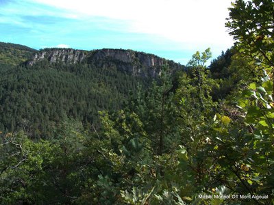
La barre rocheuse - Michel Monnot  Geology
Le Trévezel
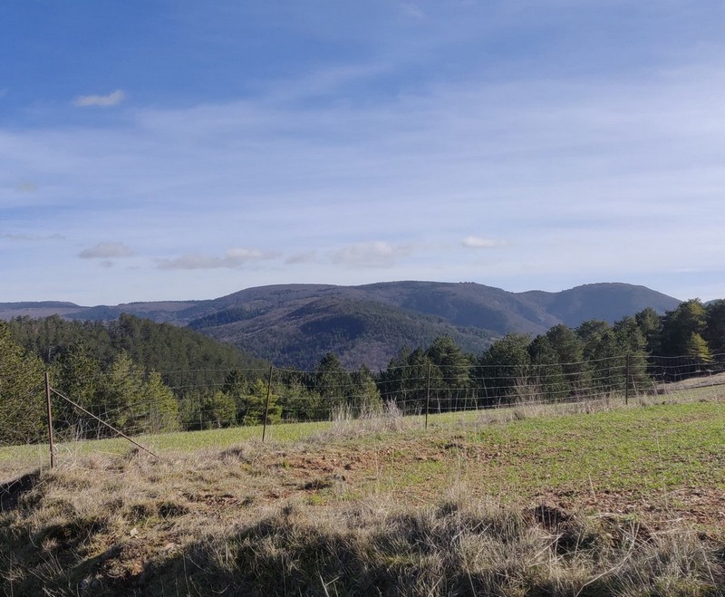
You are on the western border of the Aigoual massif, whose vast wooded slopes you can see. Southwest of you is a geological contact zone between the Causse Noir limestone plateau and the granite massif of Le Suquet. Between the two lies the deep groove created by the white waters of Le Trévezel. A small causse at the foot of Le Suquet is home to the hamlet of Comeiras, which is mentioned in Jean Carrière’s novel, La Caverne des pestiférés.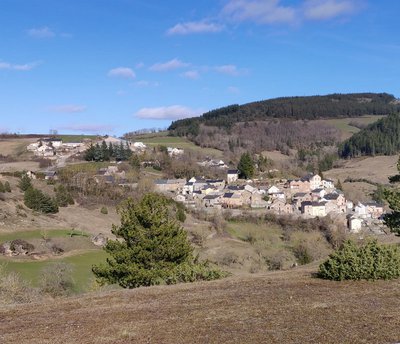
Montjardin, le hameau - Béatrice Galzin  History
The hamlet of Montjardin
The ground here is full of ores of all kinds, which have been mined at various times but without ever being abundant enough to make exploitation permanent.
Periodically, life in the village of Montjardin and its surroundings was dominated by lead, zinc, chalcopyrite and silver mining. In 1778 a shepherd discovered a silver vein at Montjardin. It was exploited for some time and then abandoned. In 1908 the Villemagne mining and metalworking company re-opened the mine, as well as others in the sector. The mine gallery at Montjardin was 450 m long. During this boom period, over 400 miners were employed across the concession. It definitively closed in 1932, and the former miners’ village near Montjardin is today a holiday centre.
Description
Signposts will guide you all along this route, as well as yellow painted waymarks. In the description below, the signposted place names and/or directions are given in bold italics between quotation marks:
From the starting-point in the hamlet of Montjardin, take the direction of La Foulquarié via GR®62.
- At “La Cambieyre”, direction "Le Roube".
- At "Le Roube" head for "Randavel” via “La Pousounyère”, walk along the camping-car area and go uphill into the coniferous forest.
- At “La Pousounyere” take the path on the left. Gentle downhill section to “Randavel”.
- At “Moulin de Randavel” stay below the houses and go uphill to
- "Randavel", then
- "Aven de Montjardin",
- “Le Roube”. Return to "Montjardin".
This walk is taken from the guidebook Massif de l’Aigoual, published by the Communauté de communes Causses Aigoual Cévennes as part of the collection Espaces Naturels Gardois and the label Gard Pleine Nature.
- Departure : Lanuéjols
- Arrival : lanuéjols
- Towns crossed : Lanuéjols
Forecast
Altimetric profile
Recommandations
Before committing yourself to a circuit, ensure that it is suitable for your activity level and ability. Remember that the weather changes quickly in the mountains. Take enough water. Please close all gates and barriers behind you.
Information desks

Tourism & national parc'house
Col de la Serreyrède, 30570 Val d'Aigoual
The Maison de l'Aigoual houses the tourism office Mont Aigoual Causses Cévennes and the Maison du Parc national. This visitor centre provides information on and raises awareness of the Cévennes National Park, its sites and events as well as the rules that must be observed in the National Park's central zone.
On site: changing exhibitions, video projections, Festival Nature events and shop Open year-round
Access and parking
From Meyrueis towards Lanuéjols on the D 986; Montjardin is 1km before the village of Lanuéjols. Park behind the petrol station.
Parking :
Calculateur d'itinéraire Lio
Utilisez le calculateur liO pour organiser votre trajet en région Occitanie.
Autres régions
Calculez votre itinéraire en Auvergne Rhône Alpes sur Oùra
Biodiversité autour de l'itinéraire
Source


Report a problem or an error
If you have found an error on this page or if you have noticed any problems during your hike, please report them to us here: