
Camprieu trail
6 points of interest
Le chemin des morts - nathalie.thomas  History
The Path of the Dead
In the Middle Ages and until 1870, the Catholic village of Camprieu had neither church nor cemetery. “Its inhabitants therefore went to the hamlet of Saint-Sauveur de Pourcils. To transport their dead to the remote cemetery, they had to take the ‘Path of the Dead’. They carried the coffins on their backs and, at every rest stop, recited the prayer De Profundis. Funeral processions stopped using the path in summer 1872. That year, the village of Camprieu finally obtained its own cemetery. But the name has stuck: “the Path of the Dead”.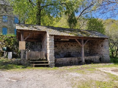
Le lavoir des Monts - Béatrice Galzin AgricultureLes Monts wash house
The wash house in Les Monts still has running water but the washerwomen have disappeared for good. The site is magical. The water is clear enough for dragonflies to lay their eggs in and for birds to drink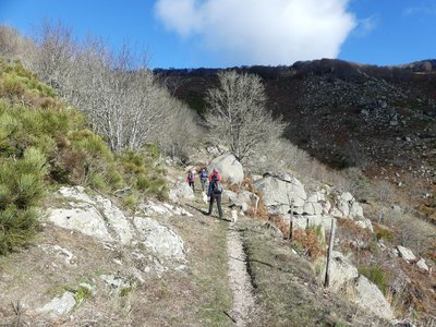
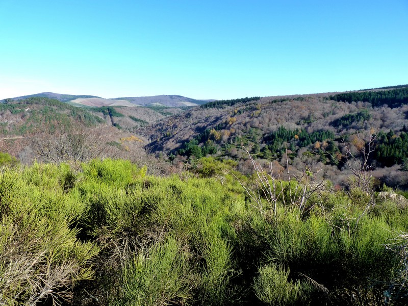
Montée au col du Suquet - nathalie.thomas  Landscape
Col du Suquet pass
You are at the highest point of the hike. On the right bank of the Dourbie, the path crosses a sheer slope that is alternatively made up of zones of solid granite and other zones where it has decomposed due to weathering into coarse granitic sand. To the south, the views encompass the entire Lingas massif, a high wooded plateau overlooking, further south, the region around Le Vigan and the Languedocian plain.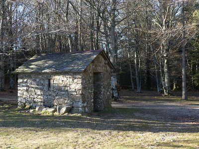
abris au col des Ubertes - Nathalie Thomas HistoryThe forestry labourers’ shelter
Deep inside the forest, you will soon see a little house. From the 19th to the early 20th century, it gave shelter to the forestry labourers in charge of reforesting the mountain. The work site was too far from a proper foresters’ house to get back there every evening, especially since the working day was long. There was no question then of working only 35 or even 40 hours a week! The trees were planted one by one using a pickaxe; the daily minimum agreed on was 100 trees per man per day. A total of 68 million were planted…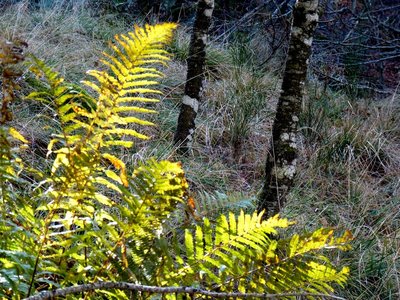
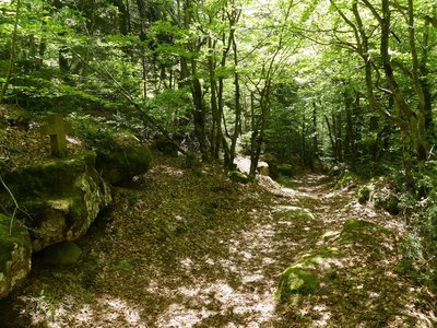
La fougère aigle - Béatrice Galzin  Natural environment
The hidden life of the forest
Trees grow upwards towards the light while mosses benefit from their shade on the ground and spread out. Like soft cushions or carpets, they hug everything that sticks out of the ground, such as old tree stumps. This soft felted surface is pleasing to see, and an undergrowth without mosses would not be worthy of the name. Legend has it that mosses show which way is north. Wrong!
Mosses indicate a degree of moisture; they protect the soil from drying out by retaining every last drop of dew. They prepare pockets of humus for the future occupants: grasses and herbaceous plants. They also love the damp of tree trunks and can grow there, on the side that is most exposed to the prevailing rains.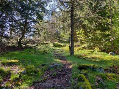
Sous bois du Trévezel - Béatrice Galzin Natural environmentThe Mont Aigoual forest
“Aigoual, Forêt d’Exception”
The French Forestry Office, which manages state forests, launched a programme in 2013 called “Aigoual, Forêt d’Exception” (Aigoual: An Exceptional Forest) with the aim of highlighting the massif’s natural and cultural heritage. The Forestry Office thus tries to foreground the different aspects of its multi-facetted management: production, protection and receiving visitors. One key aspect of this approach, which complements other initiatives by local actors, is to improve visitors’ experience in the forest.
Description
Start in Camprieu, from the car park at the gymnasium. Walk to “Camprieu – La croix Basse”, then “La Croix Haute”, “La Clédette”, “La passerelle de Bramabiau”.
- At “La passerelle de Bramabiau”, take the track on the left to “Conduite Forcées”.
- At “Conduite Forcées”, head for “Les Monts” via “La Matte” and “La Combelle”.
- Walk through the village of “Les Monts” and, as you leave, take the path opposite that goes uphill towards “Col du Suquet”, via “Valat de Malbosc“ and then the road to “La Roque”.
- At “La Roque”, take the path on the left that joins a track, to “Col du Suquet” via “Le Vieux Hêtre”.
- At “Col du Suquet”, take the track on the left towards “Camprieu” via “Col des Ubertes”, “Tédounès”, “Terondel”.
- At the signpost for “Terondel”, continue on the road to “Camprieu” via “Tailladette”, “Maison du Bois”, “Tabarde”, “Le Cros”.
- Departure : Gymnasium in Camprieu
- Arrival : Gymnasium in Camprieu
- Towns crossed : Saint-Sauveur-Camprieu and Dourbies
Forecast
Altimetric profile
Recommandations
Information desks

Tourism & national parc'house
Col de la Serreyrède, 30570 Val d'Aigoual
The Maison de l'Aigoual houses the tourism office Mont Aigoual Causses Cévennes and the Maison du Parc national. This visitor centre provides information on and raises awareness of the Cévennes National Park, its sites and events as well as the rules that must be observed in the National Park's central zone.
On site: changing exhibitions, video projections, Festival Nature events and shop Open year-round
Tourism office Mont Aigoual Causses Cévennes, Valleraugue
7 quartier des Horts, 30570 Valleraugue
This office is part of the National Park's associated tourist-information network, whose mission is to provide information on, and raise awareness of, the sites and events as well as the rules that must be observed in the National Park's central zone. : Open year-round
Transport
(in term time).
Access and parking
Parking :
Calculateur d'itinéraire Lio
Utilisez le calculateur liO pour organiser votre trajet en région Occitanie.
Autres régions
Calculez votre itinéraire en Auvergne Rhône Alpes sur Oùra
Biodiversité autour de l'itinéraire
Source


Report a problem or an error
If you have found an error on this page or if you have noticed any problems during your hike, please report them to us here: