
A steep climb
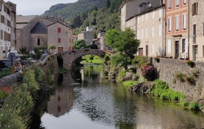
Explore the village of St-André de Valborgne with its 5 large silk spinning-mills, the dignified and understated Château de Nogaret (12th c.) overlooking the valley, and the ruins of the former foresters’ house of Rougeiresque. The downhill section is on the old track that used to connect the village with the King’s road (now the Corniche road).
5 points of interest
© Béatrice Galzin  History
The age of silk
From the 19th century onwards, the silk industry developed in the Cévennes: tanneries gave way to spinning mills. The mills used water not only to treat the silkworm cocoons (which were boiled to prepare the silk) but also for the steam-driven spinning machines. In the second half of the 19th century, diseases strongly reduced silk production, which was also subject to competition from foreign silks and then from artificial silk. The silk industry went under in 1965.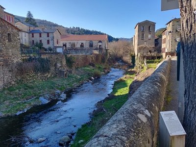
© Béatrice Galzin HistoryThe tanners’ district
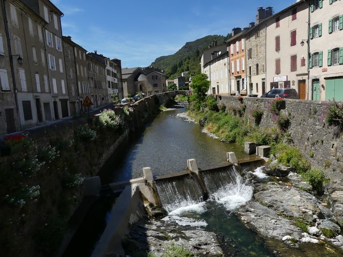
La Calquière district gets its name from that of the ditches in which the tanners soaked their animal skins with limestone, which is called cauç or calç in Occitan. All along the Gardon there were tanneries because its acidic water was good for rinsing the skins, which was indispensable for obtaining high quality products.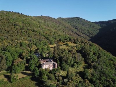
le château de Nogaret - Sabine Keller  Architecture
The Château de Nogaret
Built in the 11th century, the Château de Nogaret stood on the only road linking Saint-André de Valborgne with Le Pompidou. It is believed to have been constructed to serve as a stronghold and to defend the Vallée Borgne. It was set alight in 1628 during the war between the Duke of Rohan and Louis XIII, and again in 1704 by the Camisards, before being rebuilt in the 18th century. This private property still belongs to the Manoel de Nogaret family.
“This small château is one of the finest examples of the fortified manor houses built towards the end of the Middle Ages by minor local lords wanting to free themselves, at least symbolically, from domination by their feudal overlords.” (Isabelle Darnas - Les châteaux médiévaux en Cévennes).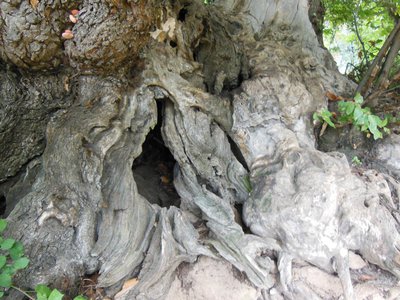
Tronc de châtaignier - Béatrice Galzin  Know-how
The sweet chestnut : a food tree
You are in a grafted chestnut orchard, which means that the trees were maintained and their nuts harvested by locals to be eaten in the family. The enormous trees around you are about 300 years old.
The chestnuts were dried in a clède, a small building on two levels that was located either close to the dwellings or right inside the forest. The clède would have been in use for an entire month in autumn to ensure that the whole, wood-dried chestnuts could be preserved for a year.
The chestnut tree was so vital in local subsistence farming that it was also called l'arbre à pain (the bread tree); it was also used to make beams, barrels, baskets, trunk-beehives and more, feed livestock and provide their bedding.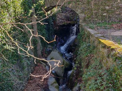
© Béatrice Galzin  Water
WaterThe gardonnades
The village benefits from the water that the Gardon brings – but it also has to put up with the river’s sporadic bad moods. Abundant rain can rapidly raise river levels. It is often in autumn that the torrent overflows its banks. The worst floods can have dramatic consequences in both material and human terms. Many can still remember the floods of September 1958 and 2002, which caused much damage.
Description
Signposts will guide you all along this route, as well as yellow painted waymarks. In the description below, the signposted place names and/or directions are given in bold between quotation marks :
Starting at “Au vieux pont”, cross the stream and turn left towards "Réservoir du Serre" via “Les vignes” and “Vignelongue”, first on the small tarred road to its very end and then on the small track on the left.
- At “Réservoir du Serre”, go right to walk along the basin, follow the path into the chestnut grove and to the footbridge over the stream, and then go uphill to the track above.
- Follow the track to “Chemin de Castanet” passing in front of the signpost to “Rougeiresque”.
- At “Chemin de Castanet” head to “Saint-André-de-Valborgne” via “Le valat de la Jasse”. Go downhill to the village via “Le Temple”.
- Departure : Saint-André-de-Valborgne
- Arrival : Saint-André-de-Valborgne
- Towns crossed : Saint-André-de-Valborgne
Forecast
Altimetric profile
Recommandations
Before committing yourself to a circuit, ensure that it is suitable for your activity level and ability. Remember that the weather changes quickly in the mountains. Take enough water. Please close all gates and barriers behind you.
Information desks

Tourism & national parc'house
Col de la Serreyrède, 30570 Val d'Aigoual
The Maison de l'Aigoual houses the tourism office Mont Aigoual Causses Cévennes and the Maison du Parc national. This visitor centre provides information on and raises awareness of the Cévennes National Park, its sites and events as well as the rules that must be observed in the National Park's central zone.
On site: changing exhibitions, video projections, Festival Nature events and shop Open year-round

Tourism office Mont Aigoual Causses Cévennes, Saint-André-de-Valborgne
les quais, 30940 Saint-André-de-Valborgne
This office is part of the National Park's associated tourist-information network, whose mission is to provide information on, and raise awareness of, the sites and events as well as the rules that must be observed in the National Park's central zone.
Transport
liO is the regional public transport service of the Occitanie/ Pyrénées – Méditerranée region. It facilitates everyone’s movements by prioritising public transport. For more information, call 08 10 33 42 73 or go to www.laregion.fr
(in term time).
Access and parking
From St-Jean-du-Gard, to St-André de Valborgne on the D907 via L’Estréchure and Saumane.
Parking :
Calculateur d'itinéraire Lio
Utilisez le calculateur liO pour organiser votre trajet en région Occitanie.
Autres régions
Calculez votre itinéraire en Auvergne Rhône Alpes sur Oùra
Biodiversité autour de l'itinéraire
Source


Report a problem or an error
If you have found an error on this page or if you have noticed any problems during your hike, please report them to us here: