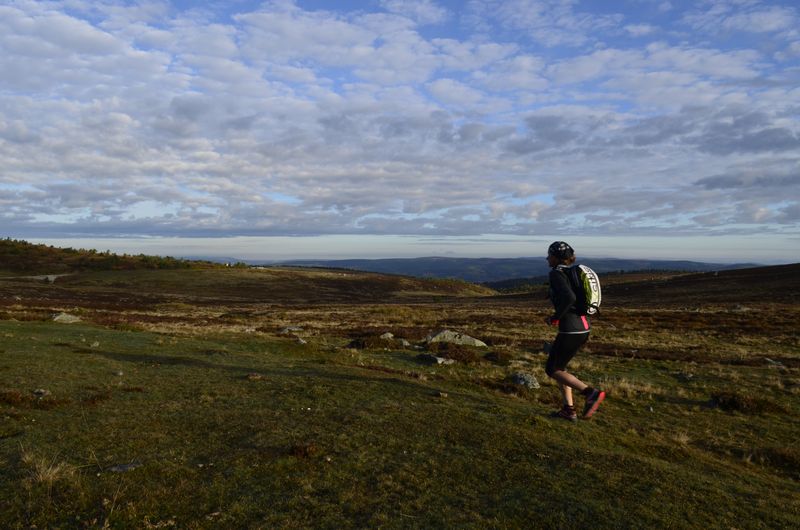
The panoramic Cévennes via Mont Lozère
Take the main draille (drovers’ road) from the Languedoc to the Gévaudan, which was once used to take livestock herds to their summer pastures. On ridges and passes, discover the granite landscape of Mont Lozère and the heath and chestnut groves of the Bougès massif before finishing on the prairies of the Can de Ferrières plateau.
19 points of interest
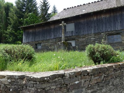
La croix des missions - Nathalie Thomas  History
The “mission” cross
In the municipality of Le Bleymard, there is a large number of crosses and other small religious heritage elements, which bear witness to inhabitants’ fervour in the old days. You will see them as you enter villages, on main squares and at crossroads, to protect the walker and ploughman. Offerings sometimes took the form of crosses, which were then called “mission” crosses.
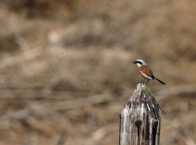
Pie-grièche écorcheur - Régis Descamps  Fauna
FaunaPasserine birds
Open spaces with a few trees and bushes favour passerine birds. Passerines are the largest and most varied order of birds, containing over half of all bird species. The red-backed shrike in particular likes this environment, which abounds in the large insects that constitute its main food source. The shrike is strictly migratory and hibernates in eastern Africa.
Paysage - © Brigitte Mathieu  Flora
FloraSubalpine short-grass prairie
Marker 1
Like garden or sports pitches, short-grass prairies are shaped by mankind. Grazing and controlled burns are the tools for their maintenance here. The main plants are nard and fescue, perennial grasses related to wheat. If you cut (graze) one of their stalks, five more will soon form; if you trample them, they multiply and become very dense. This kind of “torture” creates a thick plant cover that stabilises the sparse dark soil, which is derived from erosion of the ever-present granite. Here, then, are some clues for the appropriate management of this environment, which becomes weakened if neglected.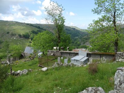
Frutgères - nathalie.thomas  Architecture
Frutgères
This village used to be the parish seat and developed long before Le-Pont-de-Montvert, a mere hamlet, turned into a small village of about 60 souls by 1631. In the 12th century, the important Commandery of the Knights of St-John of Jerusalem settled in the parish of Frutgères. This religious and military order later took the name of the Order of the Knights of Malta. The parish church was burned down by the Camisards (Protestant rebels), who were responsible for the assassination of the Frutgères parish priest, Reversat, in 1702, one day after the murder of the Abbot du Chaila in Le-Pont-de-Montvert. The church had been built after the unification of the parishes of Frutgères and Grizac. In the early 19th century, the municipality was densely populated (25 inhabitants/sq km). The large estates needed numerous labourers to harvest their hay, rye and buckwheat.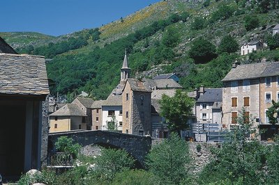
Le Pont-de-Montvert - © Guy Grégoire HistoryPont-de-Montvert
Marker 12
Le Pont-de-Montvert is at the confluence of the Tarn and two of its tributaries: the Rieumalet and the Martinet. The draille (drovers’ road) has today almost disappeared, but it was once used by flocks from the south of France to reach the summer pastures on the Mont Lozère. The first neighbourhoods were established along this axis. In 1630 the village was almost as extensive as in the early 19th century. Three stone bridges were built over the rivers, but the great floods of 1827 and 1900 seriously damaged or destroyed them. The grand Tarn Bridge is the only stone bridge still standing. New neighbourhoods developed on the village’s periphery, preserving the historic centre.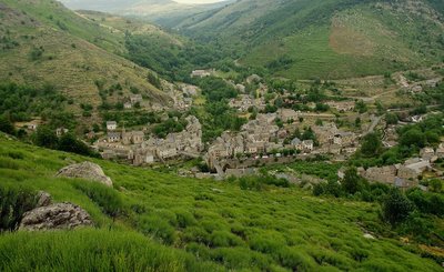
Chemin des camisards - © Brigitte Mathieu HistoryThe Camisards' path
Marker 11
This path used to be an important communication route linking Le Pont-de-Montvert with Barre-des-Cévennes. On 24 July 1702, it was used by a gathering of Huguenots coming from the Col des Trois Fayards, who intended to liberate their fellow Protestants being held by Abbot du Chayla in Le Pont-de-Montvert. These men thus used the path on which you stand. The tragic events that followed (including the Abbot’s violent death) triggered the Camisard War. The landscape surrounding the village is the result of intense agricultural activity. All neighbouring slopes were cultivated, especially with rye, on man-made terraces called bancels.
 Geology
A rolling stone...
Marker 10
On the plateau, the path has not always made a very distinct mark on the ground, evidence of little erosion. By contrast, the entire descent towards Le Pont-de-Montvert shows signs of more intense erosion, especially near the top where a large block has rolled into the middle of the path. It is the repeated passage of humans and animals that, combined with natural factors, eventually destabilised the rock. After the rock moved, the path was re-routed.- Architecture
Sheepfold with lauze-covered roof
Marker 9
Unlike the previous sheepfold, this one was built out of heavy, compact and solid materials. A granite vault instead of a timber roof suggests the rarity of wood. The roof was made watertight by schist lauzes (tilestones) on a bed of clay or coarse granite sand. This place is called La Jasse de Chanteloup (jasse/jas: resting place for animals; canteloube in popular etymology = place where the wolves howl, or, according to scholarly sources, luppe = stone, height, rounded mountain).  Landscape
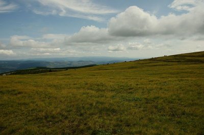
Panorama
Marker 8
Views of the southern slope of Mont Lozère- Architecture
A sheepfold in ruins
Marker 7
You need to leave the path on the left and walk for about 200 metres to see this former shelter for farm animals (ovines and bovines). The materials for its construction were found locally: granite for the walls, Scots pine or oak for the timber part of the roof, rye thatch for the roof. The variety of rye grown locally had fine long straw. It was cut by scythe at the end of July and put into swathes, then stored in stacks and threshed on threshing-floors. Finally it was made into small sheaves, which were soaked before use to make the last seeds germinate and make the straw less breakable during thatching. 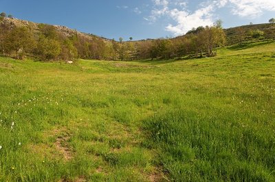
Prairie vers l'Hermet - © Guy Grégoire  Natural environment
Heath alternating with hay meadows
Marker 6
Callune has established itself on the knolls, meaning the convex areas which have poor and dry soils, whereas the meadows occupy the concave areas with their deeper and damper soils. All of these territories offer food sources for specific fauna. You may see hares, but also birds of prey (buzzards, hen and Montagu’s harriers, short-toed snake eagles, common kestrels) and red-legged partridges.- Fauna
Pine-forest fauna
Pine forests associated with blueberry zones are interesting environments for fauna: stags and roe deer come to browse the blueberry plants. Wild boar, foxes, martens and all birds eat their berries, including the Western capercaillie, which was reintroduced here by the National Park. You can also find coal tits, European crested tits, wrens, robins, mistle thrushes and black woodpeckers. Some birds of prey, such as the short-toed snake eagle, may come and build their nests at the highest point of a topped Scots pine.
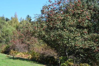
Sorbier des oiseleurs - © com com Florac Sud Lozère Natural environmentRowan or mountain ash (Sorbus aucuparia)
Sorbus allegedly derives from sorbitio (beverage, herbal tea) and aucuparia from auceps, bird-catcher. In the autumn, bird-catchers used rowan berries as bait in their tendelles or thrush traps. Some are said to have coated the branches of rowans with glue to capture birds. More simply, hunters lay in wait near rowans to catch blackbirds and thrushes. (P. Grime)
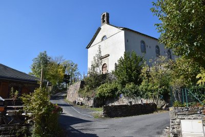
Temple de Cassagnas fraîchement rénové - © com com Florac Sud Lozère HistoryProtestant cemeteries
“Strange Cevennes, all paved with graves! You can see them right by each mas (farm).... Usually there is only a tilestone planted in the ground, with neither cross nor ornament, to indicate a grave,... If the family is well-off, the tombs are enhanced by a zinc contain er that keeps the wreaths dry... There are countless properties where the population laid in the ground is ten times greater than the population still standing!” (Roussel Romain, Almanach Cévenol, 1968).

Circaète Jean-le-Blanc - © Régis Descamps FaunaShort-toed snake eagle (Circaetus gallicus)
This bird of prey nests in the surrounding woodland. The best times of year for spotting it are March/April and July to September. It spends winters in sub-Saharan Africa, returning to France in early March. Along with its mate, it will spend five months incubating a single egg and bringing up the chick.
- History
Place de la Madeleine
Marker 5
The fountain dates from the 18th century. At the end of the 19th century, the bust of Marianne – the personification of the French Republic – was added. At the same time, a poplar was planted by republican youth as a symbol of freedom. From here, you can see several bourgeois houses, which mostly date from the 17th and 18th centuries. They bear witness to the village’s thriving past, when it had some 20 voituriers (merchant-carters), who would drive their carts down to the plains laden with wool and chestnuts and return with salt, wine and oil. Under the houses' large porches, harnesses and carts were kept. During fairs, the seed market took place in these vaults and those of the town hall. - History
The Château
Marker 6
Constructed in the 12th and 13th centuries, the Château was entirely rebuilt in the early 16th century. From 1710 to 1715, it was modified by the Lord of Barre, who had his coat of arms carved above the entrance. Two towers were also added at this time. During the 1789 Revolution, the coat of arms disappeared under vigorous hammer strokes. In the early 19th century, during an expansion, the main tower was removed. - History
Place de la loue (Hiring Square)
Marker 1
This little square, located at the north-eastern entrance to the village, was where the “loue” (hiring) used to be held during the great spring and autumn fairs: shepherds, domestics and chestnut gatherers would sit on the parapet and hope for an employer to take them on. The village hosted 12 to 15 fairs every year. The spring and autumn ones could attract up to ten thousand people from neighbouring departments, but also from the Var, Vaucluse and Bouches-du-Rhône. This village-rue (one-road village) was protected at each end by a fortified gate. One of them, called the Florac Gate, stood near the Place de la Loue. It was destroyed in the early 19th century. 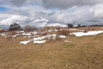
La Can de Ferrières - © Guy Grégoire AgricultureThe Can de Ferrières
This limestone plateau continues to be grazed by flocks of sheep. Note the piles of stones, called clapas. They are not there by chance! They are the result of locals clearing their fields and pastureland of stones. These piles shelter many species.
Description
Day 1 : La Bastide-Pyulaurent--Le Bleymard (between 5 and 6 ½ hrs), 850 m of climbs, 800 m of descents. GR®7.
Climb onto the ridges and Le Moure de la Gardille, where the Allier has its spring. Then go downhill to Belvezet and to the crossroads of the Pierre Plantée (standing stone). Go up to Le Plot de l'Aygue and then back down to Le Bleymard, which includes some short steep sections.
Day 2 : Le Bleymard--Pont-de-Montvert- Sud-Mont-Lozère (between 4 and 5 ½ hrs), 650 m of climbs, 850 m of descents. GR®7 puis GR®72.
From Le Bleymard, head uphill to the ski station of Le Bleymard-Mont-Lozère and then to the Col de Finiels pass. At the pass, go down to Salarial, L'Hôpital and Le Pont du Tarn. At Le Pont du Tarn, fork onto the GR®72 long-distance path to reach first Le Merlet and then Le Pont-de-Montvert-Sud-Mont-Lozère.
Day 3 : Pont-de-Montvert-Sud-Mont-Lozère--Barre-des-Cévennes, (4 ½ to 6 hrs), 900 m of climbs, 850 m of descents, GR®72
Head for the Col de la Planette pass via Champlong de Bougès. At the pass, go to Barre-des-Cévennes via Cassagnas, Relais de Stevenson, Le Crémadet, Les Quatre chemins, Barre-des-Cévennes.
Day 4 : Barre-des-Cévennes--Florac-Trois-Rivières (2 to 3 hrs), 220 m of climbs, 600 m of descents, GR®7 then GR®43
From Barre-des-Cévennes, take the GR®7 to the Col des Faïsses pass via the Can Noire plateau. At Col des Faïsses leave the GR®7 for the GR®43 towards Florac via Col du Rey, Tardonenche, La Rouvière, Pont de Barre.
- Departure : La Bastide-Puylaurent
- Arrival : Florac
- Towns crossed : La Bastide-Puylaurent, Mont Lozère et Goulet, Luc, Cheylard-l'Évêque, Saint-Frézal-d'Albuges, Cubières, Pont de Montvert - Sud Mont Lozère, Cassagnas, Barre-des-Cévennes, Cans et Cévennes, Vebron, and Florac Trois Rivières
Forecast
Altimetric profile
Recommandations
Before committing yourself to a circuit, ensure that it is suitable for your activity level and ability. Remember that the weather changes quickly in the mountains. Take enough water.
Information desks

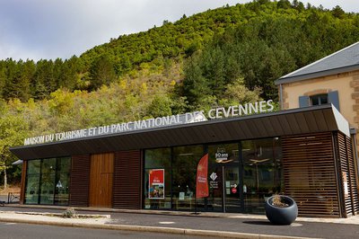
Tourism'house and national Parc at Florac
Place de l'ancienne gare, N106, 48400 Florac-trois-rivières
This office is part of the National Park's associated tourist-information network, whose mission is to provide information on, and raise awareness of, the sites and events as well as the rules that must be observed in the National Park's central zone.
On site: exhibitions, video projections, events and shop Open year-round
Transport
From Florac, return by bus to Mende (line 251) or Alès (line 252) :
From Mende or Alès, return to La Bastide-Puylaurent on the TER train / www.ter.sncf.com/occitanie
Passenger and luggage transport : www.lamallepostale.com/fr
Access and parking
From Mende, take the N88 towards Laubert, then the D6 via Les Chazeaux to La Bastide-Puylaurent. From Alès take the D906 via Villefort.
Parking :
Calculateur d'itinéraire Lio
Utilisez le calculateur liO pour organiser votre trajet en région Occitanie.
Autres régions
Calculez votre itinéraire en Auvergne Rhône Alpes sur Oùra
Biodiversité autour de l'itinéraire
Source


Report a problem or an error
If you have found an error on this page or if you have noticed any problems during your hike, please report them to us here: