
On the road to Rutènes
From Molière-Cavaillac, the path meanders over crop terraces and the Déroucades blockfield to reach Esparon. From the pass, you stay on a track lined with chestnut and wild cherry trees to Bréau-Salagosse with its picturesque lanes.
3 points of interest
Molières-Cavaillac - Nathalie Thomas  History
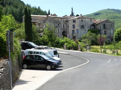
The origin of the villages’ names
Molières comes from the Occitan molièra, meaning “bog, wetland”. The valley below the village was a swamp. Known from 1162 onwards by the name of Eclésia Santi Johannes de Molieyrus, the village received its current name in 1435.
Esparon comes from the Occitan esparron, which means “echelon, banister”. A castle built against the rock surveyed the Esparon valley and pass; it was destroyed during the crusade against the Albigensians in the 13th century.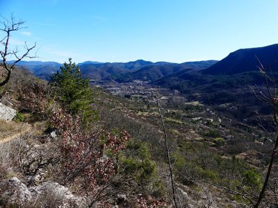
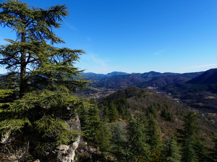
Vallée de l'Arre - Nathalie Thomas  Geology
The Arre valley
The path climbs steadily over fallow crop terraces. The higher you get, the wilder and more typical of dry limestone soils is the vegetation: white oaks, box trees, thyme, etc.
Opposite, the Causse de Blandas plateau overlooks the Arre. Following a geological incident, the river was diverted and dug its bed into the limestone, thus separating Esparon from the Causse. Halfway between Molières and Esparon, the Déroucades blockfield, created by an earthquake in 580, lies on a faultline.
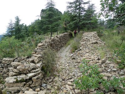
Route de Rutènes - Nathalie Thomas HistoryOn the road to Rutènes
Before Gaulle was conquered by Julius Cesar, this former track linked the territory of the Arecomici (whose capital was what is now Nîmes) and the land of the Rutènes (whose capital was first Albi, then Rodez). The Ruteni were the Gaulish people of the Aveyron department.
(see Molières-Cavaillac info sheet, available at the tourist office in Le Vigan).
Description
Signposts will guide you all along this route. In the description below, the signposted place names and/or directions are given in bold italics between quotation marks :
Starting from "MOLIÈRES-CAVAILLAC", walk to "ESPARON" via:
- "Place Bellevue",
- "Bois et Avans",
- "La Croix d’Esparon",
- "Chapelle d’Esparon".
- From "ESPARON", continue to "BRÉAU" via:
- "Col d’Esparon",
- "Courbières",
- "L’Ubac",
- "La Bernadelle Ouest". Go to “Bréau” on the right-hand track.
- On the square in front of the Protestant church in Bréau, take on your right the former Roman road to return straight to “MOLIÈRES-CAVAILLAC".
This walk is taken from the guidebook Les Vallées Cévenoles - En Pays Viganais, published by the Communauté de communes Pays Viganais-Cévennes as part of the collection Espaces Naturels Gardois and the label Gard Pleine Nature.
- Departure : Molières - Cavaillac
- Arrival : Molières - Cavaillac
- Towns crossed : Molières-Cavaillac, Bez-et-Esparon, and Bréau-Mars
Forecast
Altimetric profile
Recommandations
Make sure your equipment is appropriate for the day’s weather conditions. Take enough water, wear sturdy shoes and put on a hat. Please close any gates and barriers behind you.
Information desks

Tourism office Cévennes and Navacelles, Le Vigan
Maison de pays, place du Marché, BP 21, 30120 Le Vigan
This office is part of the National Park's associated tourist-information network, whose mission is to provide information on, and raise awareness of, the sites and events as well as the rules that must be observed in the National Park's central zone.
Open year-round
Transport
LiO is the regional public transport service of the Occitanie/ Pyrénées – Méditerranée region. It facilitates everyone’s movements by prioritising public transport. For more information, go to the lio Occitanie app or visit : https://www.mestrajets.lio.laregion.fr
Access and parking
From Le Vigan towards Bez-et-Espéron on the D999. At the roundabout in Cavaillac, turn right onto the D199 towards Aulas, then take the road uphill on the left to the village of Molières-Cavaillac
Parking :
Calculateur d'itinéraire Lio
Utilisez le calculateur liO pour organiser votre trajet en région Occitanie.
Autres régions
Calculez votre itinéraire en Auvergne Rhône Alpes sur Oùra
Biodiversité autour de l'itinéraire
Source


Report a problem or an error
If you have found an error on this page or if you have noticed any problems during your hike, please report them to us here: