
Le Briontet
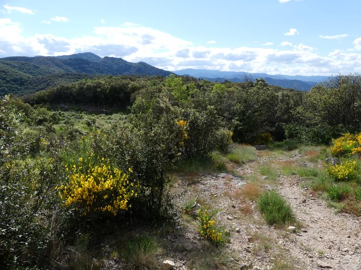
This is a pretty walk through the history of the Soudorgues area, a strategic point of passage to the continental Cévennes. Here, the freedom of religion and of the homeland were fervently defended in a natural environment that is both generous and protective.
5 points of interest
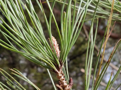
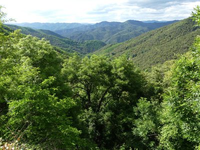
Aiguilles du pin parasol - Béatrice Galzin  Flora
FloraThe stone or umbrella pine
In the distance in the Lasalle valley there is dense, dark green vegetation. The stone or umbrella pine has a very characteristic opened-out shape, which resembles an umbrella from a distance. This conifer is at home especially in the Mediterranean basin. It prefers dry, deep and cool soils. Its bark is reddish and cracked. Its fruit, the pine nut, is often used in pastry cooking.
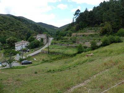
Les Horts et les bancels ou faïsses - Nathalie Thomas  History
Les Horts hamlet
The hamlet got its name from the Latin hortus, meaning garden. The presence of many springs and waterways contributed to the expansion of dry-stone terraces for growing crops (bancels or faïsses). Les Horts had a watermill.
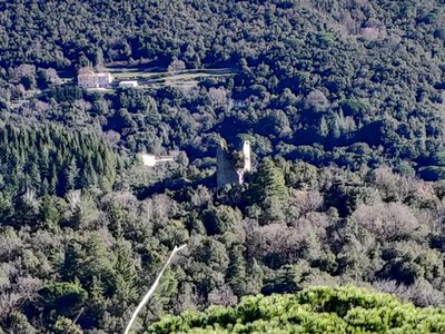
La tour de Peyre - Béatrice Galzin HistoryPeyre tower
The Peyre tower may have been built in the 10th century. It has long been considered a signal tower, where fires would have been lit to signal danger or any other event from valley to valley (66 towers or active posts have been listed in the Cévennes). It has also been identified as one of the eight watchtowers that guarded the northern route, also in the 10th c. A third hypothesis sees it as the defensive tower of a castle.
Built on a rectangular floor plan measuring 9 metres by 6 metres, it is 12 metres high. Its Romanesque style is typical of the 12th to 13th centuries.
Les cachettes huguenotes - Nathalie Thomas HistoryThe King’s dragoons and the dragonnade
Three-quarters of local Huguenots (Protestants) renounced their faith due to the “missionaries in boots”, meaning the dragoons. The dragonnade was the name given to Huguenots being forced to house these soldiers of the King, who then pillaged and mistreated them into renouncing their faith. The dragoons met with a unique resistance in the Camisard War (1702 to 1705), during which 3,000 Protestants in white shirts defied 30,000 red dragoons. The dragoons were on horseback, booted and armed with sabres a metre-and-a-half long, which was not very practical on small paths, during this guerilla war.
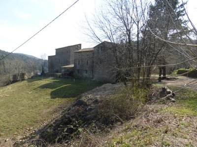
Le mas de Moina - © Nathalie Thomas HistoryLes caches des prédicants
From 1685, the so-called “wilderness period” began for Protestants, who were forced to follow their faith with clandestine preaching in isolated spots. In the Soudorgues area, these included Villeméjeanne (called Campan), Les Bousquets, Espaze, La Faux and Grevault du Bedos (a mas or farm near the pass of the same name). They took refuge in caves or with locals. The Mas du Moina had several hiding-places. One, in the stables of the residential building, had an arrowslit to be able to see the Dragoons arrive. Near Soudorgues, hiding-places have been identified at Mas Novis, Euzière and Viala (in the hamlet of Horts). Their good-hearted inhabitants risked having their farms destroyed and being sent to the galleys for life. A little further, beyond Mas Guiraud, there is still a flat-topped rock known as Le Templas, which has a very narrow entrance. About 20 people could fit into it for religious gatherings.
Description
Signposts will guide you all along this route, as well as yellow painted waymarks. In the description below, the signposted place names and/or directions are given in bold italics between quotation marks:
Start 50 metres before the mairie (town hall) of Soudorgues, at the “Soudorgues” car park.
- Walk to “Mairie de Soudorgues” and then to “Col de Briontet” via
- “Les quatres chemins” and
- “Caserne des Dragons”.
- At “Col de Briontet”, head to “Col de Mercou” on the GR®61 long-distance hiking path.
- At “Col de Mercou”, take the D39 road downhill on the left to Mercou then to “Soudorgues” via “Les quatre chemins” (2) and “Mairie de Soudorgues” (1).
NB. At “Mercou”, continue on the road for a few metres before turning right to walk past a building below the road, then turn left amidst the terraces onto a path that goes downhill to Soudorgues via La Moina.
- Departure : Soudorgues
- Arrival : Soudorgues
- Towns crossed : Soudorgues and Peyrolles
Forecast
Altimetric profile
Recommandations
Before committing yourself to a circuit, ensure that it is suitable for your activity level and ability. Remember that the weather changes quickly in the mountains. Take enough water. Please close all gates and barriers behind you.
Transport
LiO is the regional public transport service of the Occitanie/ Pyrénées – Méditerranée region. It facilitates everyone’s movements by prioritising public transport. For more information, go to the lio Occitanie app or visit. https://www.mestrajets.lio.laregion.fr
(in term time)
Access and parking
From Lasalle take the D39 towards L’Estréchure for about 4 km, then turn left onto the D271 to Soudorgues.
Parking :
Calculateur d'itinéraire Lio
Utilisez le calculateur liO pour organiser votre trajet en région Occitanie.
Autres régions
Calculez votre itinéraire en Auvergne Rhône Alpes sur Oùra
Biodiversité autour de l'itinéraire
Source


Report a problem or an error
If you have found an error on this page or if you have noticed any problems during your hike, please report them to us here: