The spine of Mont Aigoual (Trail)
7 points of interest
Village de l'Espérou - Béatrice Galzin  History
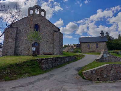
The village of L’Espérou
The village of L’Espérou lies on the border of Dourbies and Valleraugue local councils. A draille (track for livestock to migrate to summer pastures with their shepherds) crosses the village. As in many villages in the Gard, the two places of worship – one Catholic, the other Protestant – are opposite each other. The village is located in a varied environment that is suitable for outdoor activities and sports.
 History
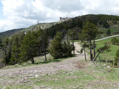
Multi-purpose forest
Marker 6
A draille is a path between winter and summer pastures, used by shepherds and their sheep. In the mid-19th century, this draille was the eastern border of the Miquel woods. At the time, forest covered 20 to 25% of the surface of Mont Aigoual. Following reforestation, that figure has risen to 80%. Foresters ascribe three purposes to forest: being a space the public can enjoy, providing protection and being productive. These objectives were already part of Georges Fabre's vision.- History
Georges Fabre
A graduate of the Ecole polytechnique, and top of his year at the Nancy forestry school, the forester Georges Fabre devoted 30 years of his energy to reforesting the mountains of the Lozère and Gard. His goal was to stabilise mountain soils, but also to provide work for a local population that would otherwise have been condemned, in its entirety, to leave the countryside. In 1894, he initiated the construction of the Mont Aigoual weather observatory. In association with the Club Cévenol and Club Alpin Français, he also laid the foundations of the local “heritage tourism” (creating the Grand Hotel de l'Aigoual, building a shelter and viewpoint indicator at the summit, etc.) that continues to this day.
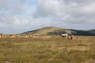
Troupeau au sommet de l'Aigoual - © Nathalie Thomas  Flora
FloraSummit of Mont Aigoual
At an altitude of 1,565 m, the climate is harsh: weather conditions are the same as they would be at 2,000 m elsewhere, with only four “frost-free” months a year. Winds of above 60 kph blow on 265 days a year, and the average annual temperature is 4.8°C. Trees do not have enough time to complete their life cycle. Local plant formations are those of the montane zone: subalpine short-grass prairies.
Observatoire de l'Aigoual - nathalie.thomas HistoryThe meteorological observatory
Inaugurated in 1824, the meteorological observatory was built on the initiative of Georges Fabre, one of the pioneers of the reforestation of Mont Aigoual. His work with the botanist Charles Flahault enabled the creation of the arboretum of L’Hort de Dieu. The first meteorological data were gathered by agents from the French National Water and Forestry Commission. Since 1943, the observatory has been managed by the National Meteorological Office. It is France’s last mountain weather station that is inhabited year-round.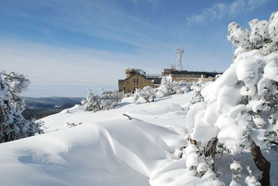
L'Aigoual sous la neige - © Météosite du Mont Aigoual HistoryMont Aigoual weather station
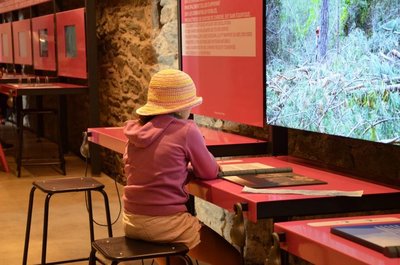
Inaugurated in 1894, this infrastructure is France’s last mountain weather station to be inhabited. Its history is closely linked to the reforestation of Mont Aigoual. It has become a high-performance weather station with an array of modern test instruments, measuring devices for extreme conditions, and a museum/exhibition on meteorology. The 800 sq m exhibition will tell you more about climatology on Mont Aigoual and about meteorology in general.
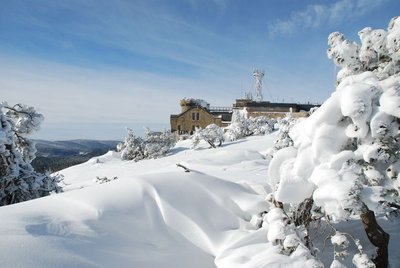
L'Aigoual sous la neige - © Météosite du Mont Aigoual HistoryMont Aigoual weather station
Inaugurated in 1894, this infrastructure is France’s last mountain weather station to be inhabited. Its history is closely linked to the reforestation of Mont Aigoual. It has become a high-performance weather station with an array of modern test instruments, measuring devices for extreme conditions, and a museum/exhibition on meteorology. The 800 sq m exhibition will tell you more about climatology on Mont Aigoual and about meteorology in general.
Description
Signposts will guide you all along this route. In the description below, the signposted place names and/or directions are given in bold italics between quotation marks :
There-and-back trail.
- From "Espérou-Halle", run to "Col de l'Espérou" via:
- "La halle",
- "Montlau",
- “Col de l'Espérou”, make for "Col de la Serreyrède" via:
- "Serre de Favatel".
- Au "Col de la Serreyrède", run to "Station de Prat Peyrot" via:
- "Le Fangas".
- At “Prat Peyrot”, go uphill to "Sommet du Mont Aigoual" via:
- "Draille du Calcadis",
- "La drailhe",
- "Les antennes",
- "Carrefour",
- "Sommet du mont Aigoual".
Go around the weather station.
Return to L'Espérou by retracing your steps: "Les Antennes", "La Drailhe", "Draille de Calcadis","Station de Prat Peyrot", "Le Fangas", "Col de la Serreyrède", "Serre de Pavatel", "Montlau", "la Halle", "Espérou-Halle".
This walk is taken from the guidebook Massif de l’Aigoual, published by the communauté de communes Causses Aigoual Cévennes as part of the collection Espaces naturels gardois and the label Gard Pleine.
- Departure : L’Espérou (Les Halles)
- Arrival : Summit of Mont Aigoual – L’Espérou
- Towns crossed : Dourbies, Saint-Sauveur-Camprieu, Val-d'Aigoual, Meyrueis, and Bassurels
Forecast
Altimetric profile
Recommandations
Before committing yourself to a circuit, ensure that it is suitable for your activity level and ability. Remember that the weather changes quickly in the mountains. Take enough water. Please close all gates and barriers behind you.
Information desks

Biosphera
18, rue vincent Faita, 30480 Cendras
Transport
LiO is the regional public transport service of the Occitanie/ Pyrénées – Méditerranée region. It facilitates everyone’s movements by prioritising public transport. For more information, go to the lio Occitanie app or visit https://www.mestrajets.lio.laregion.fr
Access and parking
From Valleraugue, take the D986 to the village of L’Espérou. At the roundabout, continue straight. Car park at La Halle/Les Halles.
Parking :
Calculateur d'itinéraire Lio
Utilisez le calculateur liO pour organiser votre trajet en région Occitanie.
Autres régions
Calculez votre itinéraire en Auvergne Rhône Alpes sur Oùra
Biodiversité autour de l'itinéraire
Source


Report a problem or an error
If you have found an error on this page or if you have noticed any problems during your hike, please report them to us here: