
A carpet of green (Trail)
7 points of interest
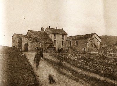
Maison forestière de la Serreyrède - © Jacques de Joly AgricultureLa Serreyrède
Before 1861, the house at the Col de la Serreyrède was inhabited by two families of farmers. They owned some livestock and had a vegetable garden, whose terraces you can still see above the La Caumette track. From 1861 on, the farm was inhabited by a forest ranger. It was only bought by the state body Eaux et Forêts in 1883, to be turned into a forester's house. It became one of Georges Fabre's headquarters during the reforestation of the Aigoual massif. The Cévennes National Park, tourism office and Terres d'Aigoual growers have now joined forces to revive La Serreyrède with the help of the Communauté de Communes Causses Aigoual Cévennes – Terres solidaires.
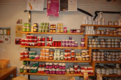
Boutique des producteurs - © Nathalie Thomas AgricultureThe association "Terres d'Aigoual"
The Cévennes National Park rents out part of the building to the association, enabling local farmers to sell their products directly to the public. The association brings together farmers who wish to promote what they produce and share their know-how. They also enjoy sharing their vision of farming- high quality produce and products,
- human-sized farms,
- mutual aid.
Come and discover their products!

 History
From beech copse to mature plantation
Marker 1
Around 1850, before reforestation began, the inhabitants of the Cevennes were using local wood resources on a massive scale for heating and in industry, especially spinning-mills. Gradually, only a few beech copses remained, which were cut every 25 to 40 years. Grazing by tens of thousands of sheep further reduced the herbaceous plant cover. Much weakened, the plant cover was then also subjected to heavy precipitation, the so-called Cevenol episodes. It is against this backdrop that the lengthy work of the foresters began. To reduce risks and establish a lasting forest cover, the first technique was to make use of what was already present by converting the disused copses into mature plantations.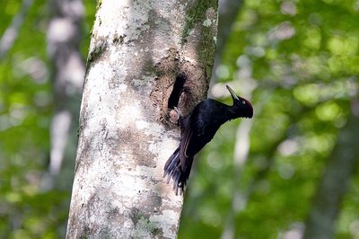
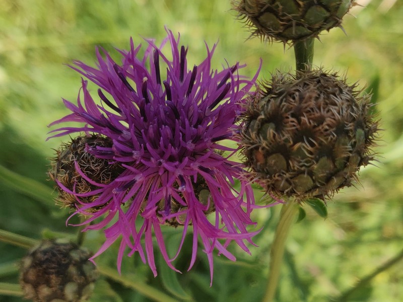
Pic noir mâle - © Jean-Pierre Malafosse HistoryPeat bog and acclimatisation garden
Marker 4
This peat bog was a site for experiments and research by Charles Flahault. Flahault, who studied the geographical distribution of species, was interested in what was then known as acclimatisation (adaptiaton to local environmental conditions). He attempted to introduce 200 plants from 40 non-indigenous species to Le Trévezel peat bog, echoing the way tree species were introduced into arboretums. The peat bog's history and the way it works are described in detail on the panel (in French only).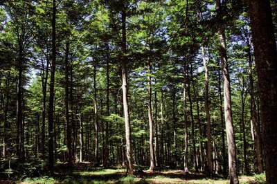
Hêtraie vers Camprieu, Aigoual - © Olivier Prohin  Natural environment
The Aigoual forest
In the 19th century, Mont Aigoual was almost totally bare of trees. Intensive use of the forest and the pressure of transhumant grazing together with the harsh local climate caused devastating floods. The rich vegetation of the grazing grounds was replaced by heather pastures and many gullies. In the valleys huddling at the foot of Mont Aigoual, terrible floods pushing tons of stones downstream carried off roads and pastureland. In response, a reforestation programme was launched in the second half of the 19th century, which created the forest you see today. Nowadays, the forested Aigoual massif protects the valleys while at the same time providing a space for economic production, biodiversity and leisure.
- Natural environment
Irregular forest
This tree population consists of trees of very different diameters, ages and heights. Species are mixed: mainly pine, but also beech, rowan and whitebeam. This is an irregular mature forest, a forestry dynamic that is interesting for several reasons: it creates permanent forest cover; resistance to soil erosion; better resilience against storms or parasite attacks; regular production, etc. In the small clearing to the left of the path, the sunlight now penetrating to the forest floor has made natural regeneration of beech and fir possible, ensuring the renewal of the forest.
 Know-how
Productive forest
Marker 2
Another method of creating a durable forest cover is to plant or sow. This work is carried out either on bare soil or among existing tree stands. The Aigoual reforestation programme was a gigantic effort, requiring 900,000 days of work, the planting of 60 million conifers and 7 million deciduous trees, and sowing of 38 tonnes of seeds. Spruces and pines, which can be planted in full sunlight and grow quite quickly, were widely used. Under the forest canopy, preference was given to firs.
Description
Signposts will guide you all along this route. In the description below, the signposted place names and/or directions are given in bold italics between quotation marks :
From “Col de La Serreyrède”, run to:
- “Le Trévezel” then
- “Col de la Pierre Plantée”. Turn left to
- “Tourbière du Trévezel”, head for
- “Bois de Miquel” and
- “La Pépinière”. (optional detour to “col de Faubel” and back). The walk to “Col de l’Espérou” via:
- “Montlau".
- At the “Col de l’Espérou”, return to “Col de La Serreyrède” via:
- “Serre de Favatel” and
- “Le Trévezel”.
This trail is taken from the guidebook Massif de l’Aigoual, published by the communauté de communes Causses Aigoual Cévennes as part of the collection Espaces naturels gardois and the label Gard Pleine nature.
- Departure : Col de La Serreyrède
- Arrival : Col de La Serreyrède
- Towns crossed : Val-d'Aigoual and Saint-Sauveur-Camprieu
Forecast
Altimetric profile
Recommandations
Before committing yourself to a circuit, ensure that it is suitable for your activity level and ability. Remember that the weather changes quickly in the mountains. Take enough water. Please close all gates and barriers behind you.
Information desks
Biosphera
18, rue vincent Faita, 30480 Cendras
Transport
LiO is the regional public transport service of the Occitanie/ Pyrénées – Méditerranée region. It facilitates everyone’s movements by prioritising public transport. For more information, go to the lio Occitanie app or visit https://www.mestrajets.lio.laregion.fr
Access and parking
From St-Sauveur-Camprieu, take the D986 towards L’Espérou to the Col de La Serreyrède pass.
From Valleraugue, take the D986 to L’Espérou. At the roundabout, turn right to go uphill to the Col de La Serreyrède pass.
Parking :
Calculateur d'itinéraire Lio
Utilisez le calculateur liO pour organiser votre trajet en région Occitanie.
Autres régions
Calculez votre itinéraire en Auvergne Rhône Alpes sur Oùra
Biodiversité autour de l'itinéraire
Source


Report a problem or an error
If you have found an error on this page or if you have noticed any problems during your hike, please report them to us here:
