
Around Le Mazel, #15
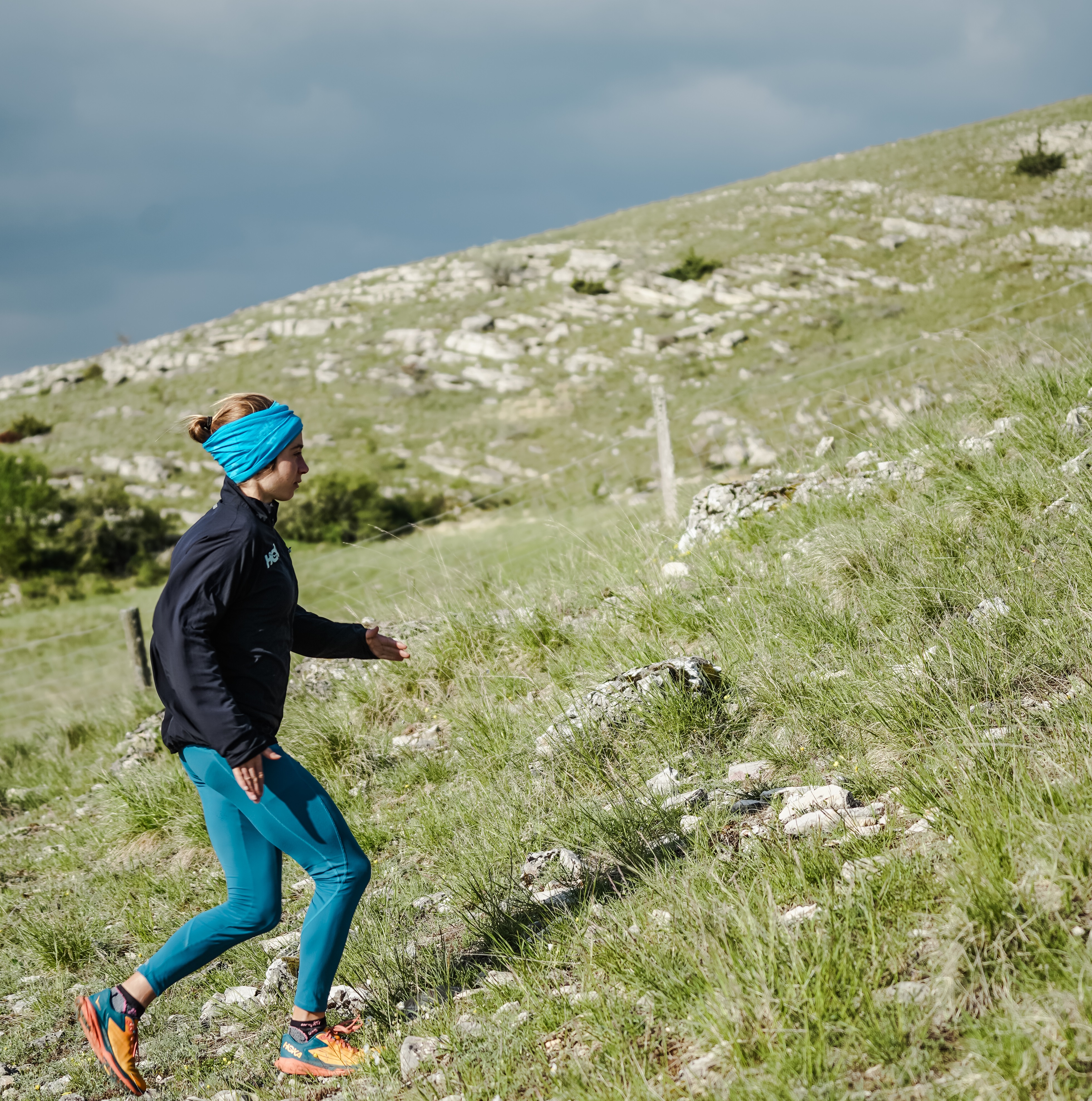
Plunge into the rural calm of the north slope of Mont Lozère and set foot on the famous Stevenson Trail.
2 points of interest
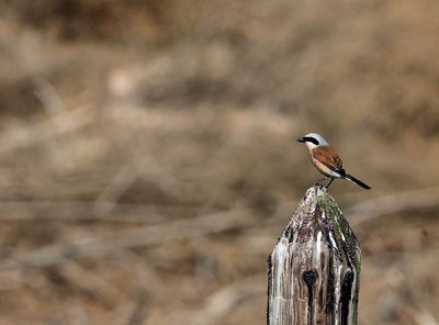
Pie-grièche écorcheur - Régis Descamps  Fauna
FaunaPasserine birds
Open spaces with a few trees and bushes favour passerine birds. Passerines are the largest and most varied order of birds, containing over half of all bird species. The red-backed shrike in particular likes this environment, which abounds in the large insects that constitute its main food source. The shrike is strictly migratory and hibernates in eastern Africa.
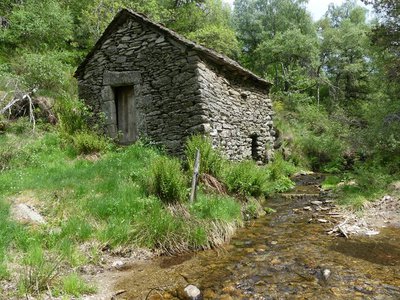
Le moulin de Malavieille - Nathalie Thomas  History
Malavieille mill
This mill with its vertical axle has a horizontal water wheel directly linked to the axle of the millstone, which is also horizontal. The water arrives on the wheel, known as coupo (spoon in Occitan), via the canélou or millrace (canelon in Occitan). The vertical axle transmits the motion, turning the runner stone (the upper millstone), which is supported by the bedstone, the immobile lower millstone. The grain falls through the hopper into the bucket. The centrifugal force pushes the grain from the centre towards the outside; it is gradually crushed, and the flour and bran are expelled into the mill chest.
Description
Signposts will guide you all along this route: follow the waymarks for trail #15
The trail starts with the descent to the village of Le Bleymard. The first stretch is on a narrow path in the forest, the second on the famous Stevenson Trail. You then take the GR® 44 and GR®68 long-distance hiking paths uphill to Le Cayre, before following the road for 1 kilometre to reach the charming hamlet of Le Mazel. There you fork onto a small path through the forest that leads you back to the Station, via Malavieille. The ascent is quite long but regular – no particular difficulty.
Follow the waymarks for trail #15.
Signposts will guide you all along this route, as well as yellow painted waymarks. In the description below, the signposted place names and/or directions are given in bold italics between quotation marks:
Depart from “Station du mont Lozère”, go down to “Eglise du Bleymard” via:
- “La Massola”,
- “le bois de Neyrac”,
- “Col Santel”.
- At "Eglise du Bleymard" we go back to "Station du mont Lozère" via
- "Le Cayre",
- "La Cham".
This hike is taken from the guidebook Mont Lozère – Pays des sources, de la montagne du Goulet aux gorges du Bramont, published by the Pôle de pleine nature du Mont Lozère.
- Departure : Station du Mont-Lozère (ski and outdoor resort)
- Arrival : Station du Mont-Lozère (ski and outdoor resort)
- Towns crossed : Cubières and Mont Lozère et Goulet
Forecast
Altimetric profile
Recommandations
The summit is often windy – don’t forget your windcheater. Do not attempt this trail during dense fog or strong winds. Be particularly vigilant when there is snow and/or fog.
Before committing yourself to a circuit, ensure that it is suitable for your activity level and ability. Remember that the weather changes quickly in the mountains. Please close all gates and barriers behind you. Stay on the marked path.
Information desks

Tourism office Coeur de Lozère, Mende
BP 83, place du Foirail, 48000 Mende
This office is part of the National Park's associated tourist-information network, whose mission is to provide information on, and raise awareness of, the sites and events as well as the rules that must be observed in the National Park's central zone.
Open year-round

Office de tourisme Des Cévennes au mont Lozère
le Quai, 48220 Le Pont de Montvert sud mont-Lozère

Tourism office Mont-Lozère, Bagnols-les-Bains
avenue de la gare, 48190 Bagnols-les-Bains Mont-Lozere et Goulet
This office is part of the National Park's associated tourist-information network, whose mission is to provide information on, and raise awareness of, the sites and events as well as the rules that must be observed in the National Park's central zone. Open from mid-April to late September
Access and parking
From Le Pont-de-Montvert, to Station du Mont-Lozère on the D 20 via the Col de Finiels pass.
From Le Bleymard, to Station du Mont-Lozère on the D 20.
Calculateur d'itinéraire Lio
Utilisez le calculateur liO pour organiser votre trajet en région Occitanie.
Autres régions
Calculez votre itinéraire en Auvergne Rhône Alpes sur Oùra
Biodiversité autour de l'itinéraire
Source


Report a problem or an error
If you have found an error on this page or if you have noticed any problems during your hike, please report them to us here: